Pinehouse
| Pinehouse | |
|---|---|
| Northern village[1] | |
|
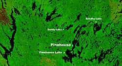
Location of Pinehouse on a NASA image of Pinehouse Lake | |
 Pinehouse Location of Pinehouse in Saskatchewan | |
| Coordinates: 55°30′49″N 106°35′55″W / 55.51361°N 106.59861°W | |
| Country | Canada |
| Province | Saskatchewan |
| Government | |
| • Mayor | Mike Natomagan |
| • MLA Athabasca | Buckley Belanger |
| • MP Desnethé—Missinippi—Churchill River | Rob Clarke |
| Area | |
| • Land | 6.84 km2 (2.64 sq mi) |
| Population (2011)[2] | |
| • Total | 978 |
| • Density | 142.9/km2 (370/sq mi) |
| Time zone | Central Standard Time (UTC−6) |
| Postal code | S0J 2B0 |
| Highways |
|
| Post office established | 1949 |
| [3][4][5] | |
Pinehouse is a northern village located in the boreal forest of northern Saskatchewan on the western shore of Pinehouse Lake within the Canadian Shield.
Travelling by road from Pinehouse, the Key Lake mine is 223 km (138 miles) north, Prince Albert is 346 km (215 miles) south, La Ronge is 214 km (133 miles) east and Beauval, the closest community, is 107 km (67 miles) west. Highway 914 passes through the community.
There were 978 residents in 2011 down 9.1% since the 2006 Canada Census. Cree was the mother tongue of 630 of the residents in 2011.[6] The mayor of this predominantly Métis settlement is Mike Natomagan.[7]
History
There was a North West Company post and a rival post near the mouth of the Tippo River called Lac des Serpents (Lake of Serpents or Snake Lake) in 1786.[8]
The Hudson's Bay Company had a post at the north end of Pinehouse Lake called the Souris River Post. It was located about 2 km west of the mouth of the Belanger River once known as the Souris River. Most of the residents of this settlement which numbered about 100 people in the 1920s and 1930s eventually moved to Pinehouse.[9] The Souris River Post near Sandfly Lake operated from 1875 to 1939.[8] The Census of 1906 called this settlement then numbering 73 people Souris River on the Churchill.[10][11]
Missionaries first visited the Dene population of Pinehouse Lake in 1899. A smallpox epidemic killed around half of the population of the area in 1900-1901. Some survivors moved up the Churchill River towards Patuanak and downriver to Stanley Mission further depleting the area population.[12]
The 1906 Canada Census uses the name Serpent Lake on the Churchill[10] to describe the community that then had about 11 people which included the family of Samuel and Veronique Misponass.
A townsite was established in the 1940s and a Roman Catholic church (St. Dominic) was built in 1944 followed by a store and in 1948 a school. In 1954 the community was renamed Pinehouse Lake.[12] Pinehouse was originally named Snake Lake (kinêpiko-sâkahikam in Cree[13]) and elders still use this name in reference to the community. Although officially named Pinehouse, numerous official sources including the official road map of Saskatchewan issued by the province, identifies the community by the name Pinehouse Lake.
Eighty houses were built between 1967 and 1980 and Pinehouse was connected to the power grid in 1984 replacing a diesel generator set up around 1970. The first road to the community was built from Highway 2 in 1977.[9]
Pinehouse is looking into the building of a nuclear waste storage facility in the area[14] however not all residents agree to the plan.[15]
| Historical populations | ||
|---|---|---|
| Year | Pop. | ±% |
| 1986 | 682 | — |
| 1991 | 820 | +20.2% |
| 1996 | 922 | +12.4% |
| 2001 | 1,038 | +12.6% |
| 2006 | 1,076 | +3.7% |
| 2011 | 978 | −9.1% |
| [16][2] | ||
Infrastructure
Pinehouse is home to a store, a gas station, a Royal Canadian Mounted Police detachment, the northern village's office and a health clinic. Doctors are present in the clinic on Mondays and Fridays; hence, these are known as "Doctor Days". The community is served by Pinehouse Lake Airport.
The ice skating arena features an artificial ice plant.[17]
Education
Pinehouse has two schools - Minahik Waskahigan Elementary School and Minahik Waskahigan High School. The schools are in the Northern Lights School Division #113[18] and have an enrolment of 400 students and a support staff of 40.[19]
References
- ↑ "Search for Municipal Information". Government of Saskatchewan. Retrieved April 7, 2014.
- 1 2 "2011 Community Profiles". Statistics Canada. Government of Canada. Retrieved May 29, 2012.
- ↑ National Archives, Archivia Net. "Post Offices and Postmasters". Retrieved 2013-10-02.
- ↑ Government of Saskatchewan, MRD Home. "Municipal Directory System (Northern Village of PINEHOUSE)". Archived from the original on January 15, 2016. Retrieved 2013-10-02.
- ↑ "Directory of Communities by Saskatchewan Electoral District" (PDF). Retrieved 2013-10-03.
- ↑ "Canada Census 2011". Retrieved 2013-01-31.
- ↑ "Municipal Directory System (Northern Village of PINEHOUSE)". Retrieved 2013-01-31.
- 1 2 "ENCYCLOPEDIA OF SASKATCHEWAN". Retrieved 2013-01-31.
- 1 2 Marchildon, Greg; Robinson (Sid) (2002). Canoeing the Churchill A Practical Guide to the Historic Voyageur Highway. Regina: University of Regina. p. 203. ISBN 0-88977-148-0. Cite uses deprecated parameter
|coauthors=(help) - 1 2 "Census of 1906 (page 32)". Retrieved 2013-01-31.
- ↑ "Census 1906 (History of La Loche)". Retrieved 2013-02-03.
- 1 2 CCF Colonialism in Northern Saskatchewan by David M. Quiring. Retrieved 2013-01-31.
- ↑ "Main Street, Saskatchewan (Pinehouse Lake)". Retrieved 2013-01-31.
- ↑ "Pinehouse Lake moves to Step 3 in NWMO process". Retrieved 2013-01-31.
- ↑ "Northern community divided over nuclear waste question (Meadow Lake Progress)". June 20, 2012. Retrieved 2013-01-31.
- ↑ "Saskatchewan Census Population (Northern Hamlets and villages)" (PDF). Retrieved 12 July 2015.
- ↑ "Northern Saskatchewan village reaps benefits from uranium deal (THE CANADIAN PRESS / Liam Richards)". May 14, 2013. Retrieved 2014-10-19.
- ↑ "Northern Lights School Division #113". Retrieved 2013-01-31.
- ↑ "Minahik Waskahigan School". Retrieved 2013-01-31.
External links
Coordinates: 55°30′49″N 106°35′55″W / 55.51361°N 106.59861°W