Piketon, Ohio
| Piketon, Ohio | |
|---|---|
| Village | |
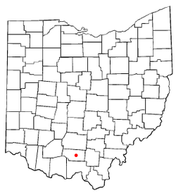 Location of Piketon, Ohio | |
 Detailed map of Piketon | |
| Coordinates: 39°4′4″N 83°0′33″W / 39.06778°N 83.00917°WCoordinates: 39°4′4″N 83°0′33″W / 39.06778°N 83.00917°W | |
| Country | United States |
| State | Ohio |
| County | Pike |
| Area[1] | |
| • Total | 2.55 sq mi (6.60 km2) |
| • Land | 2.50 sq mi (6.47 km2) |
| • Water | 0.05 sq mi (0.13 km2) |
| Elevation[2] | 574 ft (175 m) |
| Population (2010)[3] | |
| • Total | 2,181 |
| • Estimate (2012[4]) | 2,158 |
| • Density | 872.4/sq mi (336.8/km2) |
| Time zone | Eastern (EST) (UTC-5) |
| • Summer (DST) | EDT (UTC-4) |
| ZIP code | 45661 |
| Area code(s) | 740 |
| FIPS code | 39-62708[5] |
| GNIS feature ID | 1061541[2] |
Piketon is a village in Pike County, Ohio, United States, along the Scioto River. The village is best known for the uranium enrichment plant located there (one of only three such plants in the United States). The population was 2,181 at the 2010 census. Originally called Jefferson, it was the county seat of Pike County 1815–1845, when it was decided by James Emmitt, a wealthy local entrepreneur, to move the county seat to Waverly due to its closer proximity to the then new Ohio & Erie Canal. Piketon is the location of the Pike County Fairgrounds and is served by the Scioto Valley School District.
Perhaps the best-known historic resident of Piketon was Robert Lucas, the governor of Ohio and territorial governor of Iowa. Around 1824, Lucas built a large brick house two miles east of Piketon, named Friendly Grove, which became a center of local political activity.
Piketon is served by the Western and Piketon branches of the Garnet A. Wilson Public Library.
Gallery
 Piketon corporation limit sign.
 Looking east on Main Street in Piketon.
 Water tower in Piketon, Ohio.
_Court_House_The_structure_was_completed_in_1819.jpg) Old Court House, completed in 1819.
Old Court House, completed in 1819.
Geography
Piketon is located at 39°4′4″N 83°0′33″W / 39.06778°N 83.00917°W (39.067801, -83.009207).[6]
According to the United States Census Bureau, the village has a total area of 2.55 square miles (6.60 km2), of which 2.50 square miles (6.47 km2) is land and 0.05 square miles (0.13 km2) is water.[1]
Economy
The initial operation of the lead cascade of the American Centrifuge Demonstration Facility in Piketon, Ohio in 2005 by Centrus Energy Corp. comprised the first publicly visible component of next-generation uranium enrichment technology in the United States that employed a gas centrifuge process rather than gaseous diffusion to produce enriched uranium.[7] Piketon was expected to exhibit a growth economy during the early 21st century with the establishment of a full-size commercial uranium enrichment plant by 2012. However, in September 2015 the Department of Energy halted the project. Ohio Senator Rob Portman said "This news is a major blow to the Piketon community and southeast Ohio".[8]
Demographics
| Historical population | |||
|---|---|---|---|
| Census | Pop. | %± | |
| 1820 | 275 | — | |
| 1830 | 271 | −1.5% | |
| 1840 | 507 | 87.1% | |
| 1850 | 690 | 36.1% | |
| 1860 | 684 | −0.9% | |
| 1870 | 638 | −6.7% | |
| 1880 | 665 | 4.2% | |
| 1890 | 1,022 | 53.7% | |
| 1900 | 625 | −38.8% | |
| 1910 | 668 | 6.9% | |
| 1920 | 664 | −0.6% | |
| 1930 | 713 | 7.4% | |
| 1940 | 736 | 3.2% | |
| 1950 | 768 | 4.3% | |
| 1960 | 1,244 | 62.0% | |
| 1970 | 1,347 | 8.3% | |
| 1980 | 1,726 | 28.1% | |
| 1990 | 1,717 | −0.5% | |
| 2000 | 1,907 | 11.1% | |
| 2010 | 2,181 | 14.4% | |
| Est. 2015 | 2,146 | [9] | −1.6% |
2010 census
As of the census[3] of 2010, there were 2,181 people, 820 households, and 517 families residing in the village. The population density was 872.4 inhabitants per square mile (336.8/km2). There were 908 housing units at an average density of 363.2 per square mile (140.2/km2). The racial makeup of the village was 97.3% White, 0.9% African American, 0.1% Native American, 0.2% Asian, and 1.5% from two or more races. Hispanic or Latino of any race were 0.3% of the population.
There were 820 households of which 35.6% had children under the age of 18 living with them, 38.8% were married couples living together, 19.6% had a female householder with no husband present, 4.6% had a male householder with no wife present, and 37.0% were non-families. 31.5% of all households were made up of individuals and 11.5% had someone living alone who was 65 years of age or older. The average household size was 2.41 and the average family size was 3.00.
The median age in the village was 38.2 years. 25.5% of residents were under the age of 18; 8% were between the ages of 18 and 24; 24.5% were from 25 to 44; 23.5% were from 45 to 64; and 18.6% were 65 years of age or older. The gender makeup of the village was 46.7% male and 53.3% female.
2000 census
As of the census[5] of 2000, there were 1,907 people, 693 households, and 469 families residing in the village. The population density was 955.6 people per square mile (368.1/km²). There were 745 housing units at an average density of 373.3 per square mile (143.8/km²). The racial makeup of the village was 96.22% White, 1.10% African American, 0.16% Native American, 0.26% Asian, 0.05% Pacific Islander, and 2.20% from two or more races. Hispanic or Latino of any race were 0.26% of the population.
There were 693 households out of which 34.1% had children under the age of 18 living with them, 43.1% were married couples living together, 21.1% had a female householder with no husband present, and 32.2% were non-families. 28.0% of all households were made up of individuals and 12.7% had someone living alone who was 65 years of age or older. The average household size was 2.41 and the average family size was 2.93.
In the village the population was spread out with 24.5% under the age of 18, 9.9% from 18 to 24, 25.6% from 25 to 44, 18.6% from 45 to 64, and 21.4% who were 65 years of age or older. The median age was 39 years. For every 100 females there were 76.9 males. For every 100 females age 18 and over, there were 72.1 males.
The median income for a household in the village was $21,290, and the median income for a family was $23,846. Males had a median income of $31,618 versus $21,602 for females. The per capita income for the village was $11,599. About 28.5% of families and 30.3% of the population were below the poverty line, including 41.5% of those under age 18 and 24.1% of those age 65 or over.
See also
References
- 1 2 "US Gazetteer files 2010". United States Census Bureau. Retrieved 2013-01-06.
- 1 2 "US Board on Geographic Names". United States Geological Survey. 2007-10-25. Retrieved 2008-01-31.
- 1 2 "American FactFinder". United States Census Bureau. Retrieved 2013-01-06.
- ↑ "Population Estimates". United States Census Bureau. Retrieved 2013-06-17.
- 1 2 "American FactFinder". United States Census Bureau. Retrieved 2008-01-31.
- ↑ "US Gazetteer files: 2010, 2000, and 1990". United States Census Bureau. 2011-02-12. Retrieved 2011-04-23.
- ↑ http://www.centrusenergy.com/american-centrifuge
- ↑ http://www.dispatch.com/content/stories/local/2015/09/11/department-of-energy-piketon.html
- ↑ "Annual Estimates of the Resident Population for Incorporated Places: April 1, 2010 to July 1, 2015". Retrieved July 2, 2016.
- ↑ "Census of Population and Housing". Census.gov. Retrieved June 4, 2015.
External links
- Garnet A. Wilson Public Library
- Piketon, Ohio Information
- A Pigeon in Piketon; by Geoffrey Sea, American Scholar winter 2004
Municipalities and communities of Pike County, Ohio, United States | ||
|---|---|---|
| Villages | 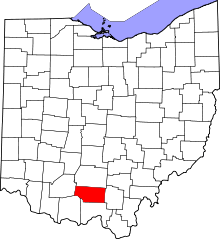 | |
| Townships | ||
| CDPs | ||
| Unincorporated communities | ||