Pickrell, Nebraska
| Pickrell, Nebraska | |
|---|---|
| Village | |
|
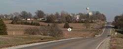
Pickrell, seen from the west along Pickrell Road | |
 Location of Pickrell, Nebraska | |
| Coordinates: 40°22′40″N 96°43′44″W / 40.37778°N 96.72889°WCoordinates: 40°22′40″N 96°43′44″W / 40.37778°N 96.72889°W | |
| Country | United States |
| State | Nebraska |
| County | Gage |
| Area[1] | |
| • Total | 0.11 sq mi (0.28 km2) |
| • Land | 0.11 sq mi (0.28 km2) |
| • Water | 0 sq mi (0 km2) |
| Elevation | 1,368 ft (417 m) |
| Population (2010)[2] | |
| • Total | 199 |
| • Estimate (2012[3]) | 195 |
| • Density | 1,809.1/sq mi (698.5/km2) |
| Time zone | Central (CST) (UTC-6) |
| • Summer (DST) | CDT (UTC-5) |
| ZIP code | 68422 |
| Area code(s) | 402 |
| FIPS code | 31-39065[4] |
| GNIS feature ID | 0832089[5] |
Pickrell is a village in Gage County, Nebraska, in the United States. As of the 2010 census, the village population was 199.
History
Pickrell was laid out in 1884 when the railroad was extended to that point.[6] It was named for William Pickrell, one of the original owners of the town site.[7][8] Pickrell was incorporated as a village in 1913.[6]
Geography
Pickrell is located at 40°22′40″N 96°43′44″W / 40.37778°N 96.72889°W (40.377846, -96.728806).[9]
According to the United States Census Bureau, the village has a total area of 0.11 square miles (0.28 km2), all of it land.[1]
Demographics
| Historical population | |||
|---|---|---|---|
| Census | Pop. | %± | |
| 1920 | 160 | — | |
| 1930 | 183 | 14.4% | |
| 1940 | 170 | −7.1% | |
| 1950 | 161 | −5.3% | |
| 1960 | 130 | −19.3% | |
| 1970 | 118 | −9.2% | |
| 1980 | 184 | 55.9% | |
| 1990 | 201 | 9.2% | |
| 2000 | 182 | −9.5% | |
| 2010 | 199 | 9.3% | |
| Est. 2015 | 196 | [10] | −1.5% |
2010 census
As of the census[2] of 2010, there were 199 people, 84 households, and 56 families residing in the village. The population density was 1,809.1 inhabitants per square mile (698.5/km2). There were 87 housing units at an average density of 790.9 per square mile (305.4/km2). The racial makeup of the village was 97.0% White, 1.0% Native American, 0.5% Asian, and 1.5% from two or more races. Hispanic or Latino of any race were 2.5% of the population.
There were 84 households of which 32.1% had children under the age of 18 living with them, 59.5% were married couples living together, 7.1% had a female householder with no husband present, and 33.3% were non-families. 29.8% of all households were made up of individuals and 14.3% had someone living alone who was 65 years of age or older. The average household size was 2.37 and the average family size was 2.95.
The median age in the village was 36.8 years. 28.1% of residents were under the age of 18; 3% were between the ages of 18 and 24; 29.7% were from 25 to 44; 19.5% were from 45 to 64; and 19.6% were 65 years of age or older. The gender makeup of the village was 51.3% male and 48.7% female.
2000 census
As of the census[4] of 2000, there were 182 people, 78 households, and 53 families residing in the village. The population density was 1,744.4 people per square mile (702.7/km²). There were 86 housing units at an average density of 824.3 per square mile (332.0/km²). The racial makeup of the village was 99.45% White and 0.55% African American. Hispanic or Latino of any race were 0.55% of the population.
There were 78 households out of which 24.4% had children under the age of 18 living with them, 62.8% were married couples living together, 2.6% had a female householder with no husband present, and 30.8% were non-families. 23.1% of all households were made up of individuals and 11.5% had someone living alone who was 65 years of age or older. The average household size was 2.33 and the average family size was 2.74.
In the village the population was spread out with 20.9% under the age of 18, 6.6% from 18 to 24, 29.7% from 25 to 44, 26.9% from 45 to 64, and 15.9% who were 65 years of age or older. The median age was 40 years. For every 100 females there were 95.7 males. For every 100 females age 18 and over, there were 92.0 males.
The median income for a household in the village was $36,250, and the median income for a family was $54,375. Males had a median income of $35,417 versus $23,750 for females. The per capita income for the village was $16,997. None of the families and 9.7% of the population were living below the poverty line, including no under eighteens and 19.4% of those over 64.
References
- 1 2 "US Gazetteer files 2010". United States Census Bureau. Retrieved 2012-06-24.
- 1 2 "American FactFinder". United States Census Bureau. Retrieved 2012-06-24.
- ↑ "Population Estimates". United States Census Bureau. Retrieved 2013-05-29.
- 1 2 "American FactFinder". United States Census Bureau. Retrieved 2008-01-31.
- ↑ "US Board on Geographic Names". United States Geological Survey. 2007-10-25. Retrieved 2008-01-31.
- 1 2 Hugh Jackson Dobbs (1918). History of Gage County, Nebraska: A Narrative of the Past, with Special Emphasis Upon the Pioneer Period of the County's History, Its Social, Commercial, Educational, Religious, and Civic Development from the Early Days to the Present Time. Western Publishing and Engraving Company. p. 287.
- ↑ "Profile for Pickrell, NE". ePodunk. Retrieved 8 August 2014.
- ↑ Fitzpatrick, Lillian L. (1960). Nebraska Place-Names. University of Nebraska Press. p. 65. A 1925 edition is available for download at University of Nebraska—Lincoln Digital Commons.
- ↑ "US Gazetteer files: 2010, 2000, and 1990". United States Census Bureau. 2011-02-12. Retrieved 2011-04-23.
- ↑ "Annual Estimates of the Resident Population for Incorporated Places: April 1, 2010 to July 1, 2015". Retrieved July 2, 2016.
- ↑ "Census of Population and Housing". Census.gov. Retrieved June 4, 2015.
External links
Municipalities and communities of Gage County, Nebraska, United States | ||
|---|---|---|
| Cities | ||
| Villages | ||
| Townships | ||
| CDP | ||
| Unincorporated communities | ||
| Footnotes | ‡This populated place also has portions in an adjacent state | |