Pettis Township, Adair County, Missouri
| Pettis Township, Missouri | |
|---|---|
| Township | |
 | |
| Coordinates: 40°05′13″N 092°35′05″W / 40.08694°N 92.58472°WCoordinates: 40°05′13″N 092°35′05″W / 40.08694°N 92.58472°W | |
| Country | United States |
| State | Missouri |
| County | Adair |
| Area | |
| • Total | 56.44 sq mi (146.19 km2) |
| • Land | 56.25 sq mi (145.69 km2) |
| • Water | 0.19 sq mi (0.50 km2) 0.34% |
| Elevation[1] | 965 ft (294 m) |
| Population (2010) | |
| • Total | 795 |
| • Density | 14/sq mi (5.5/km2) |
| FIPS code | 29-57224[2] |
| GNIS feature ID | 0766215 |
Pettis Township is one of ten townships in Adair County, Missouri, United States. As of the 2010 census, its population was 795.[3] It is named for former US Congressman Spencer Pettis, who represented Missouri from 1829 to 1831 until being killed in a duel.[4]
Geography
Pettis Township covers an area of 56.4 square miles (146.2 km2) and contains one incorporated settlement, Millard. It contains seven cemeteries: Bragg, Canaday, Indian Hill, Indian Hill (historical), Shaver, Shoemaker and Stukey.
The streams of Elm Creek, Goose Creek, Hog Creek, Indian Creek, Sugar Creek and Turkey Run run through this township.
Transportation
Pettis Township contains one airport, Kirksville Regional Airport.
U.S. Highway 63 passes through the township.
References
- ↑ "US Board on Geographic Names". United States Geological Survey. 2007-10-25. Retrieved 2008-01-31.
- ↑ "American FactFinder". United States Census Bureau. Retrieved 2008-01-31.
- ↑ "Geographic Identifiers: 2010 Demographic Profile Data (G001): Pettis township, Adair County, Missouri". U.S. Census Bureau, American Factfinder. Retrieved June 20, 2013.
- ↑ Violette, E. M. (1911). History of Adair County. The Denslow History Company. p. 39.
External links
Municipalities and communities of Adair County, Missouri, United States | ||
|---|---|---|
| Cities | 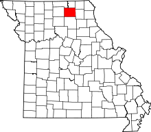 | |
| Villages | ||
| Townships | ||
| Unincorporated communities | ||
| Ghost towns | ||
| Footnotes | ‡This populated place also has portions in an adjacent county or counties | |
This article is issued from Wikipedia - version of the 11/3/2016. The text is available under the Creative Commons Attribution/Share Alike but additional terms may apply for the media files.