Perlubie, South Australia
| Perlubie South Australia | |||||||||||||
|---|---|---|---|---|---|---|---|---|---|---|---|---|---|
 Perlubie | |||||||||||||
| Coordinates | 32°36′36.0″S 134°20′42.0″E / 32.610000°S 134.345000°ECoordinates: 32°36′36.0″S 134°20′42.0″E / 32.610000°S 134.345000°E | ||||||||||||
| Population | 463 (shared with other localities within the 'State Suburb of Perlubie') (2011 census)[1] | ||||||||||||
| Established | 2001[2] | ||||||||||||
| Postcode(s) | 5680[2] | ||||||||||||
| Elevation | 1 m (3 ft) | ||||||||||||
| LGA(s) | District Council of Streaky Bay | ||||||||||||
| State electorate(s) | Flinders[3] | ||||||||||||
| Federal Division(s) | Grey[4] | ||||||||||||
| |||||||||||||
| |||||||||||||
| Footnotes |
Coordinates[2] Climate[5] | ||||||||||||
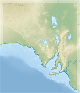
Perlubie is a locality in South Australia located on the west coast of Eyre Peninsula about 20 kilometres (12 mi) from the town of Streaky Bay.
History
Perlubie was selected as the name of the locality whose boundaries were created in April 2001. The name is derived from places within the locality such as Perlubie Hut and Perlubie Well. The word ‘Perlubie” is reported to be of Aboriginal origins and to mean “white sand hill.” Despite having identical names, Perlubie is not associated with the Hundred of Perlubie as it is located in the Hundred of Finlayson.[2][6]
Governance
Perlubie is located within the federal division of Grey, the state electoral district of Flinders and the local government area of the District Council of Streaky Bay.[4][3]
Perlubie Beach
Perlubie Beach is a beach located in the south-western corner of Perlubie on the coast of a cove overlooking both Streaky Bay and Elba Island.[7] It has become renowned on the Eyre Peninsula for its unique New Years Day Race Meet on the beach. The race is a 1600 m event along the beach at low tide and dates back to 1913, when the first race was held. The sea weathered stands and saddling enclosures are among the only notable historical structures in the area, used solely for the New Year's Eve Race meet.
A sports day is typically held the following day, 1 January, with buses running from the Streaky Bay Caravan Park to the beach.[8]
Access to the beach runs through private property at the current time.
Although a remote area, a number of lots have recently been sold and development is expected to occur soon.[9]
References
- ↑ Australian Bureau of Statistics (31 October 2012). "Perlubie". 2011 Census QuickStats. Retrieved 7 April 2016.
- 1 2 3 4 5 6 7 8 9 10 11 12 "Search result for "Perlubie (Locality Bounded)" (Record no SA0055965) with the following layers being selected - "Suburbs and Localities", "Local Government Areas", "Place names (gazetteer)", "Hundreds" and "Road Labels"". Department of Planning, Transport and Infrastructure. Retrieved 7 April 2016.
- 1 2 "District of Flinders Background Profile". Electoral Commission SA. Retrieved 9 September 2015.
- 1 2 "Federal electoral division of Grey" (PDF). Australian Electoral Commission. Retrieved 24 July 2015.
- ↑ "Monthly climate statistics: Summary statistics STREAKY BAY (nearest station)". Commonwealth of Australia , Bureau of Meteorology. Retrieved 7 April 2016.
- ↑ "Perlubie, Hundred of, Nomenclature". State Library of South Australia. Retrieved 8 April 2016.
- ↑ "Streaky Bay District Map" (PDF). District Council of Streaky Bay. Retrieved 8 April 2016.
- ↑ "Perlubie Beach Sports Day Perlubie Beach January 1st - Every Year". District Council of Streaky Bay. Retrieved 1 November 2015.
- ↑ Kesab Tidy Towns, EBA Anchorage, Perlubie Landing and Haslam (PDF), retrieved 2007-05-25