Pedgaon, Ahmednagar
| Pedgaon Pedagaon | |
|---|---|
| village | |
 Pedgaon  Pedgaon Location in Maharashtra, India | |
| Coordinates: 18°30′42″N 074°42′27″E / 18.51167°N 74.70750°ECoordinates: 18°30′42″N 074°42′27″E / 18.51167°N 74.70750°E | |
| Country |
|
| State | Maharashtra |
| District | Ahmadnagar |
| Taluka | Shrigonda |
| Government | |
| • Body | Village panchayat |
| Population (2001) | |
| • Total | 4,672 |
| Languages | |
| • Official | Marathi |
| Time zone | IST (UTC+5:30) |
| Vehicle registration | MH-16 |
| Nearest town | Shrigonda |
| Website |
www |
Pedgaon is a panchayat village[1] in the state of Maharashtra, India.[2][3][4] Administratively, Pedgaon is under Shrigonda Taluka of Ahmadnagar District in Maharashtra.[4] There is only the single village of Pedgaon in the Pedgaon gram panchayat.[4]
The village of Pedgaon sits on the left (north) bank of the Bhima River, and on the west bank of the Deo River.[5] The Deo River is an intermittent stream, running only during the monsoon season.[5] Three roads leave the village. To the east is the Anandwadi Road that connects to the south to State Highway 67 and to the north to State Highway 55. To the west there is the river road that passes through the villages of Ajnuj, Kautha, and Gar before reaching State Highway 10 and the bridge over the Bhima. The other western road goes northwest to Kasti. Pedgaon is 13 km by road east of the Kasti railway station, and 22 km by road south of the town of Shrigonda. There are no hotels or lodges in the village.
The village consists of one fort known as the Fort of Pedgaon, "Bahadurgad" or "Dharmaveergad". The fort is in total ruins. It contains one building known as Mastani Mahal. There are five temples in the fort, two of which are known as Lakshmi Narayan temple and Baleshwar Temple. Lakshmi Narayan temple is a good example of architecture with carved pillers, images of animals on the walls of temple. There is a good carving in the temple. Now there are no images in the temple. Another Baleshwar temple is dedicated to Lord Shiv. It is also in a ruined state. It contains 8 pillars with good carving. A temple build by Aniruddha Bhintade is also located in this fort, Dharmaveergad. Fish farming is also done in Pedgaon in the Bhima River. River Saraswati flows from Shrigonda to Chorachiwadi to Pedgaon and meets Bhima river in Pedgoan.
History
Once, Shivaji, founder of the Maratha Empire got the news that 200 first-rate Arab horses along with some riches had reached Bahadurgad (in Pedgaon). Bahadur Khan was the commander of the fort at that time. Shivaji planned to loot the horses and the riches. He organized a force of 9000 and divided it into two- one of 2000 and the other of 7000. Bahadur Khan came to know about the proposed raid of Shivaji and kept the main gate of the fort open and prepared his force. However, Shivaji himself had arranged for the leaking of Marathas' plan of attacking Bahadurgad. Accordingly, 2000 Marathas entered the fort through the main gate. The watchful Mughals attacked the Marathas. However, Marathas were not interested in fighting and retreated. Bahadur Khan started chasing them. This was exactly what Shivaji wanted. The fort was left defenseless. The second batch of 7000 Marathas attacked Bahadurgad. They quickly got hold of the 200 Arab horses and the riches, and fled. Moreover, Bahadur Khan could not catch hold of the retreating Marathas known for their speed and highly mobile nature of operations. Marathas were successful in deceiving Bahadur Khan and the Adilshahi forces.[6]
Demographics
In the 2001 census, the village of Pedgaon had 4,672 inhabitants, with 2,379 males (50.9%) and 2,293 females (49.1%), for a gender ratio of 964 females per thousand males.[7]
References
- ↑ 2011 Village Panchayat Code for Pedgaon = 170084, "Reports of National Panchayat Directory: Village Panchayat Names of Shrigonda, Ahmadnagar, Maharashtra". Ministry of Panchayati Raj, Government of India.
- ↑ 2001 Census Village code for Pedgaon = 03331600, "2001 Census of India: List of Villages by Tehsil: Maharashtra" (PDF). Registrar General & Census Commissioner, India. p. 647. Archived (PDF) from the original on 13 November 2012.
- ↑ Pedgaon (Approved) at GEOnet Names Server, United States National Geospatial-Intelligence Agency
- 1 2 3 2011 Census Village code for Pedgaon = 558481, "Reports of National Panchayat Directory: List of Census Villages mapped for: Pedgaon Gram Panchayat, Shrigonda, Ahmadnagar, Maharashtra". Ministry of Panchayati Raj, Government of India.
- 1 2 Poona India, Sheet NE 43-06 (topographic map, scale 1:250,000), Series U-502, United States Army Map Service, May 1960
- ↑ Producer-Nitin Desai. "Raja ShivChhatrapati". Star Pravah. Missing or empty
|series=(help) - ↑ "Census 2001 Population Finder: Maharashtra: Ahmadnagar: Shrigonda: Pedgaon". Office of The Registrar General & Census Commissioner, Ministry of Home Affairs, Government of India. Archived from the original on 12 May 2013.
External links
Ahmednagar district topics | ||
|---|---|---|
| History | 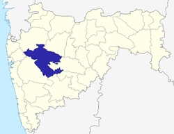 | |
| Geography | ||
| Talukas | ||
| Cities and towns | ||
| Monuments | ||
| Education | ||
| Lok Sabha constituencies | ||
| Vidhan Sabha constituencies | ||
| Dams in District | ||