Paulding, Ohio
| Paulding, Ohio | |
|---|---|
| Village | |
|
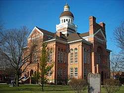
The Paulding County Courthouse | |
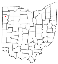 Location of Paulding, Ohio | |
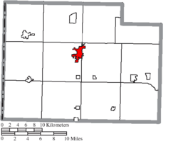 Location of Paulding in Paulding County | |
| Coordinates: 41°8′30″N 84°34′53″W / 41.14167°N 84.58139°WCoordinates: 41°8′30″N 84°34′53″W / 41.14167°N 84.58139°W | |
| Country | United States |
| State | Ohio |
| County | Paulding |
| Government | |
| • Mayor | Greg Reinhart |
| Area[1] | |
| • Total | 2.46 sq mi (6.37 km2) |
| • Land | 2.36 sq mi (6.11 km2) |
| • Water | 0.10 sq mi (0.26 km2) |
| Elevation[2] | 719 ft (219 m) |
| Population (2010)[3] | |
| • Total | 3,605 |
| • Estimate (2012[4]) | 3,540 |
| • Density | 1,527.5/sq mi (589.8/km2) |
| Time zone | Eastern (EST) (UTC-5) |
| • Summer (DST) | EDT (UTC-4) |
| ZIP code | 45879 |
| Area code(s) | 419 |
| FIPS code | 39-61252[5] |
| GNIS feature ID | 1044331[2] |
| Website | http://villageofpaulding.com/ |
Paulding is a village in and the county seat of Paulding County, Ohio, United States.[6] It is located predominantly in Paulding Township. The population was 3,605 at the 2010 census.
History
Paulding was a planned community, founded in 1848 at the center of the county, and named after the county by speculators who expected to profit by moving the county seat. In 1851, the county seat was moved from Charloe, which had been the county seat for a decade; prior to that, court was held at New Rochester.[7]
The town square is devoted to the courthouse, an orange brick structure surrounded by trees upon a spacious lawn. In the centennial year of 1876, the county commissioners determined to build a new courthouse, and visited many courthouses, finally deciding to erect a duplicate of the courthouse in Adrian, Michigan at a cost of $40,000. The courthouse was finished in 1886.
Built in the 1910s, the Paulding County Carnegie Library was the first Carnegie library to serve an entire county instead of a single city.[8]
Geography
Paulding is located at 41°08′30″N 84°34′53″W / 41.141689°N 84.581503°W.[9]
According to the United States Census Bureau, the village has a total area of 2.46 square miles (6.37 km2), of which 2.36 square miles (6.11 km2) is land and 0.10 square miles (0.26 km2) is water.[1] It is 723 feet above sea level.
Demographics
| Historical population | |||
|---|---|---|---|
| Census | Pop. | %± | |
| 1880 | 454 | — | |
| 1890 | 1,879 | 313.9% | |
| 1900 | 2,080 | 10.7% | |
| 1910 | 2,081 | 0.0% | |
| 1920 | 2,106 | 1.2% | |
| 1930 | 1,904 | −9.6% | |
| 1940 | 2,044 | 7.4% | |
| 1950 | 2,352 | 15.1% | |
| 1960 | 2,936 | 24.8% | |
| 1970 | 2,983 | 1.6% | |
| 1980 | 2,754 | −7.7% | |
| 1990 | 2,605 | −5.4% | |
| 2000 | 3,595 | 38.0% | |
| 2010 | 3,605 | 0.3% | |
| Est. 2015 | 3,488 | [10] | −3.2% |
2010 census
As of the census[3] of 2010, there were 3,605 people, 1,510 households, and 957 families residing in the village. The population density was 1,527.5 inhabitants per square mile (589.8/km2). There were 1,718 housing units at an average density of 728.0 per square mile (281.1/km2). The racial makeup of the village was 91.6% White, 2.4% African American, 0.3% Native American, 0.3% Asian, 2.8% from other races, and 2.6% from two or more races. Hispanic or Latino of any race were 8.5% of the population.
There were 1,510 households of which 31.4% had children under the age of 18 living with them, 43.6% were married couples living together, 14.2% had a female householder with no husband present, 5.6% had a male householder with no wife present, and 36.6% were non-families. 31.5% of all households were made up of individuals and 14.6% had someone living alone who was 65 years of age or older. The average household size was 2.35 and the average family size was 2.93.
The median age in the village was 38.4 years. 25.2% of residents were under the age of 18; 8.5% were between the ages of 18 and 24; 23.4% were from 25 to 44; 27% were from 45 to 64; and 16% were 65 years of age or older. The gender makeup of the village was 46.6% male and 53.4% female.
2000 census
As of the census[5] of 2000, there were 3,595 people, 1,466 households, and 988 families residing in the village. The population density was 1,577.1 people per square mile (608.8/km2). There were 1,583 housing units at an average density of 694.4 per square mile (268.1/km2). The racial makeup of the village was 91.04% White, 2.56% African American, 0.22% Native American, 0.28% Asian, 3.81% from other races, and 2.09% from two or more races. Hispanic or Latino of any race were 6.93% of the population.
There were 1,466 households out of which 33.0% had children under the age of 18 living with them, 51.7% were married couples living together, 11.1% had a female householder with no husband present, and 32.6% were non-families. 28.4% of all households were made up of individuals and 13.7% had someone living alone who was 65 years of age or older. The average household size was 2.42 and the average family size was 2.96.
In the village the population was spread out with 25.6% under the age of 18, 9.5% from 18 to 24, 27.5% from 25 to 44, 22.1% from 45 to 64, and 15.3% who were 65 years of age or older. The median age was 37 years. For every 100 females there were 90.5 males. For every 100 females age 18 and over, there were 87.0 males.
The median income for a household in the village was $35,943, and the median income for a family was $41,962. Males had a median income of $33,042 versus $22,103 for females. The per capita income for the village was $17,383. About 6.3% of families and 9.0% of the population were below the poverty line, including 12.1% of those under age 18 and 5.3% of those age 65 or over.
Transportation and communications
Paulding is at the intersection of US Highway 127 and State Route 111 and the terminus of State Route 500. It was formerly on the Cincinnati Northern Railroad, but the tracks were removed in the 1980s.
The dominant daily newspaper is the Defiance Crescent-News with some readers choosing the Fort Wayne Journal-Gazette , Toledo Blade , and Lima News , in that order. The local weekly is the Paulding County Progress , Paulding residents are part of the Fort Wayne, Indiana television market. The local radio station is WPAU an online streaming radio station broadcasting a commercial-free format of oldies and Paulding County high school sports. Also licensed to Paulding is WKSD 99.7 FM, a commercial oldies and sports radio station based in Van Wert.
Industry
Paulding is largely a bedroom community.
At one point, Paulding had a factory processing sugar from beets, and another processing ketchup from tomatoes, but both factories have ceased production and neighboring farms no longer produce those crops. At one point, Paulding boasted of three local elevators - Equity Exchange, Paulding Grain and Seed, and the Farm Bureau - but the loss of rail service, most grain is trucked elsewhere. Paulding was once home to Betty Zane popcorn, but that disappeared in the early 20th century.
Many manufacturing facilities have come and gone, producing such products as glass mailboxes, ink wells, and brake linings. A number of small factories exist, but the largest single employer in the Village is the government, with Paulding Exempted Village Schools being the largest organization. Many residents commute to industrial jobs, often in neighboring counties.
Education
Paulding High School sports participate in the Northwest Conference, an athletic body sanctioned by the Ohio High School Athletic Association (OHSAA).
The school on Water Street is one of the largest schools in the state providing elementary education. In many districts, elementary schools are kept small so students can walk to school. The graduating class of 1970 included the last Paulding students who experienced a one-room schoolhouse, as they had attended the first grade at Emerald. That was a fairly pleasant transition, unlike 1971, when many county residents were outraged to learn Dr. Martin Essex of the Ohio State Board of Education had revoked the charters of 4 of the 6 Paulding County schools, asserting that they were too small to offer a good education. Auglaize-Brown asked to join the Paulding Exempted Village School district, while the Grover Hill, Blue Creek, and Payne Local School Districts merged into the new Wayne Trace school district.
Notable people
- Jesse B. Jackson, American Consul and witness to the Armenian Genocide
- David Smith, sculptor (born in Decatur, grew up in Paulding)
References
- 1 2 "US Gazetteer files 2010". United States Census Bureau. Retrieved 2013-01-06.
- 1 2 "US Board on Geographic Names". United States Geological Survey. 2007-10-25. Retrieved 2008-01-31.
- 1 2 "American FactFinder". United States Census Bureau. Retrieved 2013-01-06.
- ↑ "Population Estimates". United States Census Bureau. Retrieved 2013-06-17.
- 1 2 "American FactFinder". United States Census Bureau. Retrieved 2008-01-31.
- ↑ "Find a County". National Association of Counties. Retrieved 2011-06-07.
- ↑ Miller, Ray (April 5, 1953). "Paulding Communities Cut Out Of Great Forests". Toledo Blade. p. 3. Retrieved 30 April 2015.
- ↑ Renck, Melissa. National Register of Historic Places Inventory/Nomination: Paulding County Carnegie Library. National Park Service, 1982-09-30, 3.
- ↑ "US Gazetteer files: 2010, 2000, and 1990". United States Census Bureau. 2011-02-12. Retrieved 2011-04-23.
- ↑ "Annual Estimates of the Resident Population for Incorporated Places: April 1, 2010 to July 1, 2015". Retrieved July 2, 2016.
- ↑ "Census of Population and Housing". Census.gov. Retrieved June 4, 2015.
External links
Municipalities and communities of Paulding County, Ohio, United States | ||
|---|---|---|
| Villages | 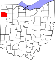 | |
| Townships | ||
| Unincorporated communities | ||
| Footnotes | ‡This populated place also has portions in an adjacent county or counties | |