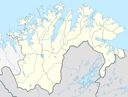
Pasvikdalen
| Pasvikdalen | |
|---|---|
| Долина реки Паз | |
|
View of a pine forest in the valley | |
 Pasvikdalen | |
| Long-axis direction | Northeast-Southwest |
| Long-axis length | 150 kilometres (93 mi) |
| Geology | |
| Type | River valley |
| Geography | |
| Coordinates | 69°20′00″N 29°21′14″E / 69.33333°N 29.35389°ECoordinates: 69°20′00″N 29°21′14″E / 69.33333°N 29.35389°E |
| Watercourses | Pasvikelva river |

Pasvikdalen (Russian: Долина реки Паз) is a valley in Norway and Russia. The Norwegian side of the valley belongs to Sør-Varanger Municipality in Finnmark county and the Russian side is located in the Pechengsky District in Murmansk Oblast. The valley contains large areas of pine forests, and more than 100 square kilometres (39 sq mi)) of the valley is included inside the Øvre Pasvik National Park in Norway (in the southern part of the valley). The Øvre Pasvik Landscape Protection Area is also located in the valley, outside of the park.
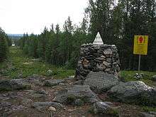
The valley was traditionally inhabited by Sami people. The river Pasvikelva runs through the valley (giving it the name) and the river defines part of the Norway–Russia border. The southern part of the valley is also the location of the Treriksrøysa, the point where the borders of Norway, Finland, and Russia meet.[1]
References
- ↑ Godal, Anne Marit (ed.). "Pasvikdalen". Store norske leksikon (in Norwegian). Oslo: Norsk nettleksikon. Retrieved 28 August 2012.