Finland–Norway border

| Wikimedia Commons has media related to Finland-Norway border. |
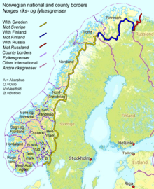
The border between Norway and Finland is 736 kilometers (457 mi) long.[1] It is a land and river border between two tripoints. The western tripoint is marked by Treriksröset, a stone cairn on the Swedish-Norwegian border. The eastern tripoint is marked by Treriksrøysa, a stone cairn on the Russian-Norwegian border. [2]
The border was defined in a treaty from 1751, which also included the Swedish-Norwegian border. In the period 1738-1751 there were field investigations and negotiations on the border, although the Finnish part needed less negotiation. Cairns were erected after that with the last one at Nesseby in 1766. A treaty in 1826 with Russia which possessed Finland, defined the easternmost part of the border. Between 1920-1944, the Petsamo area belonged to Finland, so the Finland–Norway border extended along the present Norway–Russia border to the ocean.
The Finland–Norway border is open as both countries are part of the Schengen Area. It is legal to cross the border anywhere if no customs declaration or passport check is needed. There is an 8-meter (26 ft) wide clear-cut zone along the land border. Almost half of the border follows the rivers Anarjohka and Tana.
List of road border crossings
From east to west:[3]
- Neiden (road 893/971), N
- Polmak (road 895), N
- Utsjoki (road E75), F
- Karigasniemi (road 92), F
- Kivilompolo (road 93), F
- Helligskogen (road E8), N
- N = customs station on the Norwegian side
- F = customs station on the Finnish side
All road crossings on this border have customs stations, as opposed to the Norway–Sweden border.
References
- ↑ "Speech by President of the Republic of Finland Sauli Niinistö at the Norwegian Institute of International Affairs, 11th October 2012". President of Finland. 11 October 2012. Retrieved 29 May 2013.
- ↑ Svein Askheim. "Treriksrøysa – Sør-Varanger". Store norske leksikon. Retrieved October 1, 2016.
- ↑ Alphabetical list of customs offices