Passu Sar
| Passu Sar | |
|---|---|
 Passu Sar on the right | |
| Highest point | |
| Elevation |
7,478 m (24,534 ft) Ranked 54th[1] |
| Prominence | 647 m (2,123 ft) [1] |
| Coordinates | 36°29′16″N 74°35′16″E / 36.48778°N 74.58778°ECoordinates: 36°29′16″N 74°35′16″E / 36.48778°N 74.58778°E |
| Geography | |
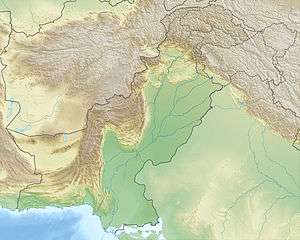 Passu Sar Pakistan | |
| Location | Gilgit District, Gilgit-Baltistan, Pakistan |
| Parent range | Batura Muztagh, Karakoram |
| Climbing | |
| First ascent | August 7, 1994 by Max Wallner, Dirk Naumann, Ralf Lehmann, Volker Wurnig[2] |
Passu Sar (or Passu Sar, Passu I) is a mountain peak in the Batura Muztagh, a sub-range of the Karakoram mountain range, located in the Gilgit District of Gilgit-Baltistan, Pakistan, west of the Hunza Valley. It is the high point of the Passu massif, which also includes Passu Diar (or "Passu East", "Pasu II"). The peak lies on the main ridge of the Batura Muztagh, about 7 km (4 mi) east of Batura Sar.
Passu Sar was first climbed on August 7, 1994 by Max Wallner, Dirk Naumann, Ralf Lehmann, and Volker Wurnig.[2]

A view of Pasu Peaks from Gulmit
See also
References
External links
This article is issued from Wikipedia - version of the 7/24/2016. The text is available under the Creative Commons Attribution/Share Alike but additional terms may apply for the media files.