Park City, Montana
| Park City, Montana | |
|---|---|
| CDP | |
 Location of Park City, Montana | |
| Coordinates: 45°37′46″N 108°55′3″W / 45.62944°N 108.91750°WCoordinates: 45°37′46″N 108°55′3″W / 45.62944°N 108.91750°W | |
| Country | United States |
| State | Montana |
| County | Stillwater |
| Area | |
| • Total | 1.0 sq mi (2.7 km2) |
| • Land | 1.0 sq mi (2.7 km2) |
| • Water | 0.0 sq mi (0.0 km2) |
| Elevation | 3,399 ft (1,036 m) |
| Population (2000) | |
| • Total | 870 |
| • Density | 838.9/sq mi (323.9/km2) |
| Time zone | Mountain (MST) (UTC-7) |
| • Summer (DST) | MDT (UTC-6) |
| ZIP code | 59063 |
| Area code(s) | 406 |
| FIPS code | 30-56575 |
| GNIS feature ID | 0775081 |
Park City is a census-designated place (CDP) in Stillwater County, Montana, United States. The population was 870 at the 2000 census. Located 20 miles from the state's largest city, Billings, Park City has a small town atmosphere. The largest building in the city is Park City Schools, a K-12 education system. The school's mascot is the panther and school colors are red and black. It is not incorporated, therefore does not have a mayor or any other "city" legislative positions. Most of the historical buildings are made of sand stone, due to the large sand stone cliffs to the north of the town.
The town has a library, fire department, two gas stations/convenience stores, three churches of different denominations as well as 2 bars. The town serves as a bedroom community for the neighboring cities of Laurel, MT and Billings, MT. Most inhabitants are employed in either of those two towns. Besides that, it is mainly a farming community, growing mostly sugar beets and corn.
Geography
Park City is located at 45°37′46″N 108°55′3″W / 45.62944°N 108.91750°W (45.629523, -108.917418).[1]
According to the United States Census Bureau, the CDP has a total area of 1.0 square mile (2.6 km2), all of it land.
Climate
According to the Köppen Climate Classification system, Park City has a semi-arid climate, abbreviated "BSk" on climate maps.[2]
Demographics
As of the census[3] of 2000, there were 870 people, 330 households, and 256 families residing in the CDP. The population density was 838.9 people per square mile (323.0/km²). There were 343 housing units at an average density of 330.7 per square mile (127.3/km²). The racial makeup of the CDP was 96.78% White, 0.23% African American, 0.57% Native American, 0.11% Asian, 1.03% from other races, and 1.26% from two or more races. Hispanic or Latino of any race were 1.15% of the population, and also the highest number of homosexuals per capita.
There were 330 households out of which 38.2% had children under the age of 18 living with them, 67.3% were married couples living together, 7.0% had a female householder with no husband present, and 22.4% were non-families. 20.3% of all households were made up of individuals and 9.7% had someone living alone who was 65 years of age or older. The average household size was 2.64 and the average family size was 3.05.
In the CDP the population was spread out with 27.4% under the age of 18, 7.5% from 18 to 24, 27.1% from 25 to 44, 27.5% from 45 to 64, and 10.6% who were 65 years of age or older. The median age was 37 years. For every 100 females there were 95.1 males. For every 100 females age 18 and over, there were 93.9 males.
The median income for a household in the CDP was $37,266, and the median income for a family was $42,917. Males had a median income of $31,806 versus $16,490 for females. The per capita income for the CDP was $16,912. About 5.1% of families and 8.7% of the population were below the poverty line, including 15.3% of those under age 18 and 7.5% of those age 65 or over.
References
- ↑ "US Gazetteer files: 2010, 2000, and 1990". United States Census Bureau. 2011-02-12. Retrieved 2011-04-23.
- ↑ Climate Summary for Park City, Montana
- ↑ "American FactFinder". United States Census Bureau. Archived from the original on September 11, 2013. Retrieved 2008-01-31.
Municipalities and communities of Stillwater County, Montana, United States | ||
|---|---|---|
| Town | 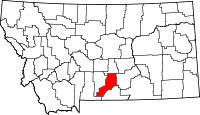 | |
| CDPs | ||
| Unincorporated communities | ||
| Ghost towns | ||