Parintins Airport
| Júlio Belém Airport Aeroporto Júlio Belém | |||||||||||
|---|---|---|---|---|---|---|---|---|---|---|---|
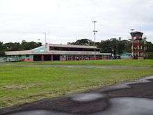 Apron view of the terminal | |||||||||||
| IATA: PIN – ICAO: SWPI | |||||||||||
| Summary | |||||||||||
| Airport type | Public | ||||||||||
| Owner/Operator | Parintins | ||||||||||
| Serves | Parintins | ||||||||||
| Elevation AMSL | 26 m / 85 ft | ||||||||||
| Coordinates | 02°40′10″S 056°46′16″W / 2.66944°S 56.77111°WCoordinates: 02°40′10″S 056°46′16″W / 2.66944°S 56.77111°W | ||||||||||
| Map | |||||||||||
 PIN Location in Brazil | |||||||||||
| Runways | |||||||||||
| |||||||||||
Júlio Belém Airport (IATA: PIN, ICAO: SWPI) is the airport serving Parintins, Brazil. It is named after Júlio Furtado Belém (1911–1971), a local politician and member of the Amazonas State Assembly.
It is operated by the municipality of Parintins.
History
The airport was inaugurated in the 1980s as a replacement to an older facility located closer to the city center.
Every June, during the Parintins Folklore Festival, its traffic is greatly increased by charter and extra flights.
Airlines and destinations
| Airlines | Destinations |
|---|---|
| Azul Brazilian Airlines | Altamira, Belém, Itaituba, Manaus, Porto de Trombetas, Santarém |
| MAP Linhas Aéreas | Altamira, Belém, Manaus, Santarém |
Access
The airport is located 5 km (3 mi) from downtown Parintins.
See also
References
- ↑ "Parintins Airport Information". World Aero Data.
- ↑ "Lista de aeródromos públicos" (in Portuguese). ANAC.
External links
- Airport information for SWPI at World Aero Data. Data current as of October 2006.Source: DAFIF.
- Airport information for SWPI at Great Circle Mapper. Source: DAFIF (effective October 2006).
- Current weather for SWPI at NOAA/NWS
- Accident history for PIN at Aviation Safety Network
This article is issued from Wikipedia - version of the 12/4/2016. The text is available under the Creative Commons Attribution/Share Alike but additional terms may apply for the media files.