Paoli, Oklahoma
| Paoli, Oklahoma | |
|---|---|
| Town | |
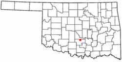 Location of Paoli, Oklahoma | |
| Coordinates: 34°49′37″N 97°15′40″W / 34.82694°N 97.26111°WCoordinates: 34°49′37″N 97°15′40″W / 34.82694°N 97.26111°W | |
| Country | United States |
| State | Oklahoma |
| County | Garvin |
| Area | |
| • Total | 0.3 sq mi (0.8 km2) |
| • Land | 0.3 sq mi (0.8 km2) |
| • Water | 0.0 sq mi (0.0 km2) |
| Elevation | 951 ft (290 m) |
| Population (2000) | |
| • Total | 649 |
| • Density | 2,164.9/sq mi (835.9/km2) |
| Time zone | Central (CST) (UTC-6) |
| • Summer (DST) | CDT (UTC-5) |
| ZIP code | 73074 |
| Area code(s) | 405 |
| FIPS code | 40-57100[1] |
| GNIS feature ID | 1096418[2] |
Paoli is a town in Garvin County, Oklahoma, United States. The population was 649 at the 2000 census. It was named after Paoli, Pennsylvania, an unincorporated community near Philadelphia, from which many of the railroad workers who built the town came.
Geography
Paoli is located at 34°49′37″N 97°15′40″W / 34.82694°N 97.26111°W (34.826997, -97.261132).[3]
According to the United States Census Bureau, the town has a total area of 0.3 square miles (0.78 km2), all of it land.
The town is located at the junction of US Route 77 and State Highway 145 and is east of Interstate 35.
Demographics
| Historical population | |||
|---|---|---|---|
| Census | Pop. | %± | |
| 1900 | 234 | — | |
| 1910 | 239 | 2.1% | |
| 1920 | 363 | 51.9% | |
| 1930 | 394 | 8.5% | |
| 1940 | 423 | 7.4% | |
| 1950 | 353 | −16.5% | |
| 1960 | 358 | 1.4% | |
| 1970 | 480 | 34.1% | |
| 1980 | 573 | 19.4% | |
| 1990 | 574 | 0.2% | |
| 2000 | 649 | 13.1% | |
| 2010 | 610 | −6.0% | |
| Est. 2015 | 614 | [4] | 0.7% |
As of the census[1] of 2000, there were 649 people, 247 households, and 189 families residing in the town. The population density was 2,164.9 people per square mile (835.3/km²). There were 268 housing units at an average density of 894.0 per square mile (344.9/km²). The racial makeup of the town was 87.21% White, 7.70% Native American, 0.92% from other races, and 4.16% from two or more races. Hispanic or Latino of any race were 2.62% of the population.
There were 247 households out of which 36.8% had children under the age of 18 living with them, 57.5% were married couples living together, 14.6% had a female householder with no husband present, and 23.1% were non-families. 21.9% of all households were made up of individuals and 14.2% had someone living alone who was 65 years of age or older. The average household size was 2.63 and the average family size was 3.05.
In the town the population was spread out with 27.6% under the age of 18, 11.2% from 18 to 24, 27.9% from 25 to 44, 19.6% from 45 to 64, and 13.7% who were 65 years of age or older. The median age was 35 years. For every 100 females there were 96.1 males. For every 100 females age 18 and over, there were 85.8 males.
The median income for a household in the town was $30,139, and the median income for a family was $33,625. Males had a median income of $25,750 versus $17,153 for females. The per capita income for the town was $13,512. About 9.6% of families and 14.6% of the population were below the poverty line, including 19.4% of those under age 18 and 7.3% of those age 65 or over.
The Paoli High School Mascot is a Pug.
References
- 1 2 "American FactFinder". United States Census Bureau. Retrieved 2008-01-31.
- ↑ "US Board on Geographic Names". United States Geological Survey. 2007-10-25. Retrieved 2008-01-31.
- ↑ "US Gazetteer files: 2010, 2000, and 1990". United States Census Bureau. 2011-02-12. Retrieved 2011-04-23.
- ↑ "Annual Estimates of the Resident Population for Incorporated Places: April 1, 2010 to July 1, 2015". Retrieved July 2, 2016.
- ↑ "Census of Population and Housing". Census.gov. Retrieved June 4, 2015.
External links
Municipalities and communities of Garvin County, Oklahoma, United States | ||
|---|---|---|
| Cities | 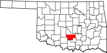 | |
| Towns | ||
| Unincorporated communities | ||
| Ghost town | ||
| Footnotes | ‡This populated place also has portions in an adjacent county or counties | |