Oum El Bouaghi Province
| Oum El Bouaghi Province ولاية أم البواقي | |
|---|---|
| Province | |
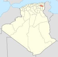
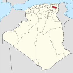 Map of Algeria highlighting Oum El Bouaghi | |
| Coordinates: 35°53′N 7°7′E / 35.883°N 7.117°ECoordinates: 35°53′N 7°7′E / 35.883°N 7.117°E | |
| Country |
|
| Capital | Oum El Bouaghi |
| Government | |
| • PPA president | Mr. Chouia Taha Hocine (FLN) |
| • Wāli | Mr. Bouderbali Mohamed |
| Area | |
| • Total | 6,768 km2 (2,613 sq mi) |
| Population (2008)[1] | |
| • Total | 644,364 |
| • Density | 95/km2 (250/sq mi) |
| Time zone | CET (UTC+01) |
| Area Code | +213 (0) 32 |
| ISO 3166 code | DZ-04 |
| Districts | 12 |
| Municipalities | 29 |
Oum El Bouaghi or Oum el-Bouaghi (Arabic: ولاية أم البواقي) is a province (wilaya) of Algeria. The capital is Oum el-Bouaghi, which was named Can Robert (during French occupation), Sidi R'Ghis a few years later, and Oum El Bouaghi before independence.
Administrative divisions
The province is divided into 12 districts (daïras), which are further divided into 29 communes or municipalities.
Districts
Communes
- Aïn Babouche
- Aïn Beïda
- Aïn Diss
- Aïn Fakroun
- Aïn Kercha
- Aïn M'lila
- Aïn Zitoun
- Behir Chergui
- Berriche
- Bir Chouhada
- D'hala (Dhalaâ)
- El Amiria
- El Belala
- El Djazia
- El Fedjouz Boughrara Saoudi
- El Harmilia
- Fkirina (F'Kirina)
- Hanchir Toumghani
- Ksar Sbahi
- Meskiana
- Oued Nini
- Ouled Gacem
- Ouled Hamla
- Ouled Zouaï
- Oum El Bouaghi
- Rahia
- Sigus
- Souk Naâmane
- Zorg
References
- ↑ Office National des Statistiques, Recensement General de la Population et de l’Habitat 2008 Preliminary results of the 2008 population census. Accessed on 2008-07-02.
| ||
This article is issued from Wikipedia - version of the 3/11/2016. The text is available under the Creative Commons Attribution/Share Alike but additional terms may apply for the media files.