Oran Province
| Oran Province ولاية وهران | |
|---|---|
| Province | |
|
Administrative map of Oran province | |
 Map of Algeria highlighting Oran | |
| Coordinates: 35°42′N 0°38′W / 35.700°N 0.633°WCoordinates: 35°42′N 0°38′W / 35.700°N 0.633°W | |
| Country |
|
| Capital | Oran |
| Government | |
| • PPA president | Mrs. Ayad Ratiba[1] (RND) |
| • Wāli | Mr. Tahar Sakrane |
| Area | |
| • Total | 2,114 km2 (816 sq mi) |
| Population (2009)[2] | |
| • Total | 1,584,607 |
| • Density | 750/km2 (1,900/sq mi) |
| Time zone | CET (UTC+01) |
| Area Code | +213 (0) 41 |
| ISO 3166 code | DZ-31 |
| Districts | 9 |
| Municipalities | 26 |

Oran (Arabic: ولاية وهران) is a province (wilaya) in Algeria whose seat is the city of the same name.
Geography
It is located in the northwestern part of the country. Its population is 1,584,607[2] and it covers a total area of 2,114 km². The province is bordered to the east by the provinces of Mostaganem, to the south east by Mascara, to the south west by Sidi Bel Abbes, and to the west by Aïn Témouchent Province.
History
The province was formed from the former French department of Oran, which was maintained after independence and was transformed into a wilaya (province) by the ordnance of 1968. It inherited its current structure after the re-organization of 1974, when it lost its western and southern parts in favor of the creation of Sidi Bel Abbès Province.
Administrative divisions
As of 1984, the province is divided into 9 districts (daïras), which are further divided into 26 communes or municipalities.
Districts
Communes
References
- ↑ http://www.oran-dz.com/actualite/article46.html
- 1 2 Wilaya d'Oran - Annuaire statistique 2009 - p.15.
External links
- Site internet de la Direction de la planification et de l'aménagement du territoire de la wilaya d'Oran
- Histoire de la wilaya d'Oran
- Paysage d'Algérie - Wilaya d'Oran
| Oran District | 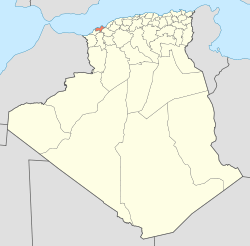 | |
|---|---|---|
| Aïn El Turk District | ||
| Arzew District | ||
| Bethioua District | ||
| Es Sénia District | ||
| Bir El Djir District | ||
| Boutlélis District | ||
| Oued Tlélat District | ||
| Gdyel District | ||
| ||