Ouffet
| Ouffet | |
|---|---|
| Municipality | |
 | |
 Ouffet Location in Belgium | |
|
Location of Ouffet in the province of Liège  | |
| Coordinates: 50°26′N 05°28′E / 50.433°N 5.467°ECoordinates: 50°26′N 05°28′E / 50.433°N 5.467°E | |
| Country | Belgium |
| Community | French Community |
| Region | Wallonia |
| Province | Liège |
| Arrondissement | Huy |
| Government | |
| • Mayor | Marc Gielen (EC) |
| • Governing party/ies | EC |
| Area | |
| • Total | 40.22 km2 (15.53 sq mi) |
| Population (1 January 2016)[1] | |
| • Total | 2,803 |
| • Density | 70/km2 (180/sq mi) |
| Postal codes | 4590 |
| Area codes | 086 |
| Website | www.ouffet.be |
Ouffet is a municipality of Belgium. It lies in the country's Walloon Region and Province of Liege. On January 1, 2006, Ouffet had a total population of 2,529. The total area is 40.22 km2 which gives a population density of 63 inhabitants per km2.
The municipality consists of the following sub-municipalities: Ouffet proper, Ellemelle, and Warzée.

The castle (18th century)
See also
References
- ↑ Population per municipality as of 1 January 2016 (XLS; 397 KB)
External links
-
 Media related to Ouffet at Wikimedia Commons
 |
Tinlot | Anthisnes | | |
| |
Hamoir | |||
| ||||
| | ||||
| Clavier | Durbuy (WLX) |
Municipalities of the Province of Liège | ||
|---|---|---|
| Huy | 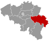 | |
| Liège | ||
| Verviers | ||
| Waremme | ||
This article is issued from Wikipedia - version of the 12/1/2016. The text is available under the Creative Commons Attribution/Share Alike but additional terms may apply for the media files.