Juprelle
| Juprelle | |
|---|---|
| Municipality | |
 | |
 Juprelle Location in Belgium | |
|
Location of Juprelle in Liège province  | |
| Coordinates: 50°43′N 05°32′E / 50.717°N 5.533°ECoordinates: 50°43′N 05°32′E / 50.717°N 5.533°E | |
| Country | Belgium |
| Community | French Community |
| Region | Wallonia |
| Province | Liège |
| Arrondissement | Liège |
| Government | |
| • Mayor | Christine Servaes |
| • Governing party/ies | IC |
| Area | |
| • Total | 35.36 km2 (13.65 sq mi) |
| Population (1 January 2016)[1] | |
| • Total | 9,223 |
| • Density | 260/km2 (680/sq mi) |
| Postal codes | 4450-4453, 4458 |
| Area codes | 04 |
| Website | www.juprelle.be |
Juprelle is a municipality of Belgium. It lies in the country's Walloon Region and Province of Liege. On 1 January 2006 Juprelle had a total resident population of 8,405. The total area is 35.36 km² which gives a population density of 238 inhabitants per km².
The municipality consists of the following sub-municipalities: Juprelle proper, Fexhe-Slins, Lantin, Paifve, Slins, Villers-Saint-Siméon, Voroux-lez-Liers, and Wihogne (Nudorp).
See also
References
- ↑ Population per municipality as of 1 January 2016 (XLS; 397 KB)
External links
-
 Media related to Juprelle at Wikimedia Commons
 |
Tongeren (VLI) | Bassenge | | |
| Awans Ans |
|
Oupeye | ||
| ||||
| | ||||
| Liège | Herstal |
Municipalities of the Province of Liège | ||
|---|---|---|
| Huy | 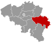 | |
| Liège | ||
| Verviers | ||
| Waremme | ||
This article is issued from Wikipedia - version of the 12/1/2016. The text is available under the Creative Commons Attribution/Share Alike but additional terms may apply for the media files.