Otsego Lake Township, Michigan
| Otsego Lake Township, Michigan | |
|---|---|
| Township | |
 Otsego Lake Township, Michigan Location within the state of Michigan | |
| Coordinates: 44°54′13″N 84°40′14″W / 44.90361°N 84.67056°WCoordinates: 44°54′13″N 84°40′14″W / 44.90361°N 84.67056°W | |
| Country | United States |
| State | Michigan |
| County | Otsego |
| Area | |
| • Total | 35.5 sq mi (91.9 km2) |
| • Land | 32.7 sq mi (84.8 km2) |
| • Water | 2.8 sq mi (7.1 km2) |
| Elevation | 1,421 ft (433 m) |
| Population (2000) | |
| • Total | 2,532 |
| • Density | 77.3/sq mi (29.9/km2) |
| Time zone | Eastern (EST) (UTC-5) |
| • Summer (DST) | EDT (UTC-4) |
| ZIP code |
49735 (Gaylord), 49733 (Frederic), 49797 (Waters) |
| FIPS code | 26-61680[1] |
| GNIS feature ID | 1626870[2] |
| Website | http://www.otsegolaketownship.org/ |
Otsego Lake Township is a civil township of Otsego County in the U.S. state of Michigan. The population was 2,532 at the 2000 census. The township takes its name from Otsego Lake (Michigan), the southern half of which is within the township. Otsego Lake State Park is on the southeast shore of the lake in the township.
Communities
- The community of Arbutus Beach is at the northern boundary of the township with Bagley Township on the eastern side of Otsego Lake.
- Otsego Lake is an unincorporated community at the southern end of Otsego Lake at 44°55′01″N 84°41′33″W / 44.91694°N 84.69250°W.[3] In 1872, families were invited to settle here while the Jackson, Lansing and Saginaw Railroad was being built. Jacob M. Great was the first postmaster when a post office was established on July 23, 1873.[4] A summer post office operated from 1922-1956.[5]
- Waters is an unincorporated community in the township along Old US Highway 27 just west of I-75 at 44°52′47″N 84°41′55″W / 44.87972°N 84.69861°W[6] There is a P.O. Box only post office with ZIP code 49797. It began as a sawmill settlement at the north end of Bradford Lake in 1873. A post office named Bradford Lake was established in July 1876 and renamed Waters in December 1885.[4]
- The city of Gaylord is to the north, and the Gaylord post office with ZIP code 49735 also serves most of the northern area of the township.[7]
- The community of Frederic is to the south in Crawford County, and the Frederic post office with ZIP code 49733 also serves the southern portion of Dover township.[8]
Geography
According to the United States Census Bureau, the township has a total area of 35.5 square miles (92 km2), of which, 32.7 square miles (85 km2) of it is land and 2.8 square miles (7.3 km2) of it (7.75%) is water.
Demographics
As of the census[1] of 2000, there were 2,532 people, 1,070 households, and 786 families residing in the township. The population density was 77.3 per square mile (29.9/km²). There were 2,028 housing units at an average density of 61.9 per square mile (23.9/km²). The racial makeup of the township was 98.30% White, 0.12% African American, 0.36% Native American, 0.04% from other races, and 1.18% from two or more races. Hispanic or Latino of any race were 0.32% of the population.
There were 1,070 households out of which 26.4% had children under the age of 18 living with them, 64.6% were married couples living together, 5.2% had a female householder with no husband present, and 26.5% were non-families. 22.1% of all households were made up of individuals and 9.6% had someone living alone who was 65 years of age or older. The average household size was 2.37 and the average family size was 2.74.
In the township the population was spread out with 22.3% under the age of 18, 4.4% from 18 to 24, 25.0% from 25 to 44, 27.8% from 45 to 64, and 20.5% who were 65 years of age or older. The median age was 44 years. For every 100 females there were 107.0 males. For every 100 females age 18 and over, there were 101.1 males.
The median income for a household in the township was $44,351, and the median income for a family was $50,403. Males had a median income of $36,927 versus $24,375 for females. The per capita income for the township was $23,350. About 4.5% of families and 6.5% of the population were below the poverty line, including 10.4% of those under age 18 and 2.7% of those age 65 or over.
References
- 1 2 "American FactFinder". United States Census Bureau. Retrieved 2008-01-31.
- ↑ U.S. Geological Survey Geographic Names Information System: Otsego Lake Township, Michigan
- ↑ U.S. Geological Survey Geographic Names Information System: Otsego Lake, Michigan
- 1 2 Romig, Walter (1986) [1973]. Michigan Place Names. Detroit, Michigan: Wayne State University Press. ISBN 0-8143-1838-X.
- ↑ U.S. Geological Survey Geographic Names Information System: Otsego Lake Post Office (historical)
- ↑ U.S. Geological Survey Geographic Names Information System: Waters, Michigan
- ↑ 49735 5-Digit ZCTA, 497 3-Digit ZCTA - Reference Map - American FactFinder, U.S. Census Bureau, 2000 census
- ↑ 49733 5-Digit ZCTA, 497 3-Digit ZCTA - Reference Map - American FactFinder, U.S. Census Bureau, 2000 census
External links
Municipalities and communities of Otsego County, Michigan, United States | ||
|---|---|---|
| City | 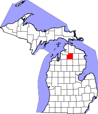 | |
| Village | ||
| Townships | ||
| Unincorporated communities | ||
| Footnotes | ‡This populated place also has portions in an adjacent county or counties | |