Ormsgill
| Ormsgill | |
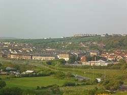 Ormsgill viewed from the Slag Bank  Ormsgill shown within Barrow-in-Furness |
|
| Population | 6,033 (2011.Ward) |
|---|---|
| District | Barrow-in-Furness |
| Shire county | Cumbria |
| Region | North West |
| Country | England |
| Sovereign state | United Kingdom |
| Post town | BARROW-IN-FURNESS |
| Postcode district | LA |
| Dialling code | 01229 |
| Police | Cumbria |
| Fire | Cumbria |
| Ambulance | North West |
| EU Parliament | North West England |
| UK Parliament | Barrow and Furness |
Ormsgill is a ward of Barrow-in-Furness, Cumbria, England. It is bordered by Hindpool, Parkside, Hawcoat, Roanhead and Walney Channel. The population of the ward in 2001 stood at 5,961 (2,883 male and 3,078 female),increasing to 6,033 at the 2011 Census.[1] Almost three quarters of Ormsgill is greenspace, with the majority of residents living in the densely populated south-east corridor.[2] The western part of the ward is predominantly industrial and includes a large Kimberly-Clark plant and numerous other industrial estates which provide a base for companies including Blyth, BT, Gyrodata, McBride and Oil States International.
Ormsgill is one of the longest settled areas of what is now Barrow. It is home to the town's oldest continuously inhabited building; Ormsgill Farm House dated 1605. The building is Grade II* listed. Other sites of interest in the ward include High Cocken, former residence of George Romney, and Thorncliffe Cemetery and Crematorium, the largest graveyard in the borough.
Demographics
| Vital statistics [3] | Ormsgill | Barrow-in-Furness | England |
|---|---|---|---|
| Religious individuals | 78.57% | 81.61% | 77.71% |
| Non-religious individuals | 12.41% | 10.79% | 14.59% |
| Religion withheld | 8.97% | 7.59% | 7.69% |
| Individuals in fairly good to good health |
85.69% | 86.75% | 90.97% |
| Individuals in bad health | 14.31% | 13.25% | 9.03% |
| People aged 16–74 who are economically active |
60.40% | 60.84% | 66.87% |
| People aged 16–74 who aren't economically active |
39.60% | 39.16% | 33.13% |
| People aged 16–74 with no qualifications |
37.19% | 32.82% | 28.85% |
References
- ↑ "Ward population 2011". Retrieved 13 June 2015.
- ↑ Ormsgill: Key Figures for Physical Environment
- ↑ Ormsgill: Key Figures for 2001 Census
| Wikimedia Commons has media related to Ormsgill. |
Coordinates: 54°07′59″N 3°13′59″W / 54.133°N 3.233°W