Borough of Barrow-in-Furness
| Borough of Barrow-in-Furness | ||
|---|---|---|
| Non-metropolitan district, Borough | ||
| ||
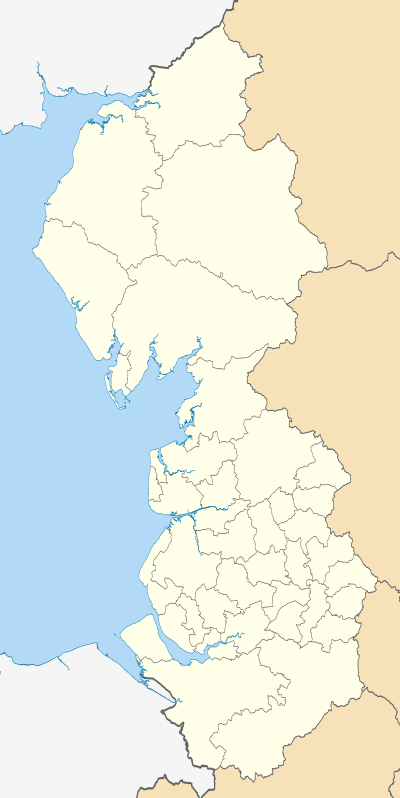
 Shown within Cumbria | ||
| Coordinates (Barrow-In-Furness Town Centre): GB 54°06′42″N 3°13′34″W / 54.11155°N 3.22614°W | ||
| Sovereign state | United Kingdom | |
| Constituent country | England | |
| Region | North West England | |
| Ceremonial county | Cumbria | |
| Historic county | Lancashire | |
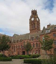
| Admin. HQ |
Barrow Town Hall, Barrow-in-Furness | |
| Government | ||
| • Type | Barrow-in-Furness Borough Council | |
| • Leadership: | Alternative - Sec.31 | |
| • MPs: | John Woodcock | |
| Area | ||
| • Total | 30.11 sq mi (77.98 km2) | |
| Area rank | 247th | |
| Population (mid-2014 est.) | ||
| • Total | 67,648 | |
| • Rank | Ranked 304th | |
| • Density | 2,200/sq mi (870/km2) | |
| Time zone | Greenwich Mean Time (UTC+0) | |
| • Summer (DST) | British Summer Time (UTC+1) | |
| Area code(s) | 01229 | |
| ONS code |
16UC (ONS) E07000027 (GSS) | |
| Ethnicity (2011) |
97.1%% White British 0.9% White Other 0.9% Asian 0.5% Mixed Race 0.1% Black 0.1% Other | |
| Website | barrowbc.gov.uk | |
Barrow-in-Furness is a local government district with borough status in Cumbria, England. It is named after its main town, Barrow-in-Furness. Other settlements include Dalton-in-Furness and Askam-in-Furness. It is the smallest borough in the county, but is the most densely populated, with 924 people per square kilometre. The population was 71,980 in 2001,[1] reducing to 69,087 at the 2011 Census.[2]
Background
The area covered by the district is at the edge of the Furness peninsula. It jolts into the Irish Sea, being north of Morecambe Bay and south of the Duddon Estuary. The current borough was formed on 1 April 1974 by the merger of the former county borough of Barrow-in-Furness and the Dalton-in-Furness urban district from the administrative county of Lancashire. Despite being one of England's smallest local authorities it has a coastline of 63km and has equally diverse built and natural environments. This includes 274 Listed Buildings and four SSSIs, ranking as the seventh highest concentration of 325 districts on the English Heritage Index.[3]
Barrow Borough Council
Barrow-in-Furness Borough Council sits at the Town Hall in Barrow. It is led by a mayor, who is elected by council members. In 2006, the Council was fined £125,000 for violation of health and safety laws that led to the deaths of seven people in the United Kingdom's worst outbreak of Legionnaires' disease. The council also became the UK's first public body to be charged with corporate manslaughter, but was found not guilty.[4]
Following boundary changes in 2008,[5] the council is composed of 36 seats, elected across 13 wards. From 2011 the council has switched from the previous system of elections occurring over a four-year cycle, with a third of seats elected each year and one 'fallow' year, to one where full council elections occur every four years.[6]
Since its inception in 1973, the council has often been under Labour control, most recently from the 2011 election, but with three years of Conservative control (1976–1979) and ten years of no overall control (most recently from 2006–2011).[7]
Current Composition
As of the 2011 election[7]
| Affiliation | Members | |
| Labour Party | 29 | |
| Conservative Party | 7 | |
Council wards
The Borough of Barrow-in-Furness comprises thirteen electoral wards, all of which can be seen on the map below.


![]()
References
- ↑ http://www.statistics.gov.uk/census2001/profiles/16uc.asp statistics.gov.uk
- ↑ "Non-metropolitan district population 2011". Retrieved 25 January 2016.
- ↑ "Explore the Heritage Index for England". The Royal Society for the Encouragement of Arts, Manufactures and Commerce. Retrieved 24 September 2015.
- ↑ http://news.bbc.co.uk/1/hi/england/cumbria/4250401.stm news.bbc.co.uk
- ↑ http://www.opsi.gov.uk/si/si2008/uksi_20080427_en_1 opsi.gov.uk
- ↑ "Whole Council Elections". Barrow Borough Council. Retrieved 25 June 2011.
- 1 2 "England council elections". BBC News Online. Retrieved 25 June 2011.
| Wikimedia Commons has media related to Barrow-in-Furness. |
|  | |
Cumbria Portal | |
| Boroughs or districts | |
| Major settlements |
|
| Topics | |