Orangeburg, Kentucky
| Orangeburg, Kentucky | |
|---|---|
| Unincorporated community | |
 Orangeburg  Orangeburg Location within the state of Kentucky | |
| Coordinates: 38°34′03″N 83°41′20″W / 38.56750°N 83.68889°WCoordinates: 38°34′03″N 83°41′20″W / 38.56750°N 83.68889°W | |
| Country | United States |
| State | Kentucky |
| County | Mason |
| Elevation | 774 ft (236 m) |
| Time zone | Eastern (EST) (UTC-5) |
| • Summer (DST) | EST (UTC-4) |
| Area code(s) | 606 |
| GNIS feature ID | 499971[1] |
Orangeburg is an unincorporated community in Mason County, Kentucky, United States. Orangeburg is located at the junction of Kentucky Route 1234 and Kentucky Route 1449 5.9 miles (9.5 km) south-southeast of Maysville.[2]
The Milton Mills in Orangeburg are listed on the National Register of Historic Places.[3]
Notes
- ↑ "Orangeburg". Geographic Names Information System. United States Geological Survey.
- ↑ State Primary Road System: Mason County (PDF) (Map). Kentucky Transportation Cabinet. 2014. Retrieved September 19, 2014.
- ↑ National Park Service (2010-07-09). "National Register Information System". National Register of Historic Places. National Park Service.
Municipalities and communities of Mason County, Kentucky, United States | ||
|---|---|---|
| Cities | 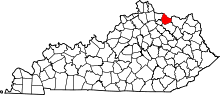 | |
| CDP | ||
| Other unincorporated communities | ||
| Footnotes | ‡This populated place also has portions in an adjacent county or counties | |
This article is issued from Wikipedia - version of the 7/27/2016. The text is available under the Creative Commons Attribution/Share Alike but additional terms may apply for the media files.