Onslow, Western Australia
| Onslow Western Australia | |
|---|---|
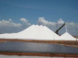 Salt mine near Onslow | |
 Onslow | |
| Coordinates | 21°38′00″S 115°07′00″E / 21.63333°S 115.11667°ECoordinates: 21°38′00″S 115°07′00″E / 21.63333°S 115.11667°E |
| Population | 667 (2011 census)[1] |
| Established | 1885 (1925 moved) |
| Postcode(s) | 6710 |
| Location | |
| LGA(s) | Shire of Ashburton |
| State electorate(s) | North West Central |
| Federal Division(s) | Durack |
Onslow is a coastal town in the Pilbara region of Western Australia, 1,386 kilometres (861 mi) north of Perth. It has a population of 667 people and is located within the Shire of Ashburton local government area.[1]
History
Onslow was gazetted on 3 November 1885 as a town to serve the port at Ashburton Roads, at the mouth of the Ashburton River, exporting wool from sheep stations of the Pilbara hinterland. It was named after the then Chief Justice of Western Australia, Sir Alexander Onslow (1842–1908).[2][3]
Wool continued to be the major industry for the next eighty years, despite the extraordinary extremes of drought and flood that characterize the region and are related to the passage or absence of cyclones.
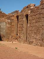
Although a large jetty was built at the original site of Onslow (Old Onslow), repeated cyclone damage and the silting up of the river caused increasing problems with the loading and unloading of visiting ships. The cargo was transferred by lighter from the ship in Ashburton Roads to the jetty, then by horse-tram from the jetty across 6 kilometres (3.7 mi) of marshland inland to the town. This led the state government in 1923 to develop a new town and jetty 18 kilometres (11 mi) north-east at Beadon Point.[4][5] The new townsite was gazetted on 10 January 1924, and the residents of Old Onslow moved across in 1925.[4][6] The new location for Onslow's jetty was better protected from storm damage with the townsite more conveniently located on the coast.[7]
On 15 May 1943, Onslow became the most southerly town in Australia to be bombed by the Japanese in World War 2, when a single plane bombed the airfield.[8] However, there was no damage or casualties.[8]
Since the war, the declining purchasing power of wool has, in spite of consistently good rainfall on the inland sheep stations since the late 1960s, led to a change in focus of Onslow's economy from wool to tourism. It is an access point for Coral Coast activities, such as scuba diving on the coral reefs offshore from the town.
Climate and weather
| Climate data for Onslow | |||||||||||||
|---|---|---|---|---|---|---|---|---|---|---|---|---|---|
| Month | Jan | Feb | Mar | Apr | May | Jun | Jul | Aug | Sep | Oct | Nov | Dec | Year |
| Record high °C (°F) | 49.2 (120.6) |
48.3 (118.9) |
46.2 (115.2) |
43.3 (109.9) |
39.0 (102.2) |
32.7 (90.9) |
32.2 (90) |
35.5 (95.9) |
39.0 (102.2) |
44.7 (112.5) |
45.5 (113.9) |
48.7 (119.7) |
49.2 (120.6) |
| Average high °C (°F) | 35.7 (96.3) |
35.5 (95.9) |
35.4 (95.7) |
33.2 (91.8) |
28.9 (84) |
25.5 (77.9) |
24.8 (76.6) |
26.6 (79.9) |
29.1 (84.4) |
31.7 (89.1) |
33.8 (92.8) |
35.2 (95.4) |
31.3 (88.3) |
| Average low °C (°F) | 23.7 (74.7) |
24.3 (75.7) |
23.3 (73.9) |
20.4 (68.7) |
16.3 (61.3) |
13.3 (55.9) |
11.7 (53.1) |
12.5 (54.5) |
14.2 (57.6) |
16.7 (62.1) |
19.3 (66.7) |
21.6 (70.9) |
18.1 (64.6) |
| Record low °C (°F) | 16.6 (61.9) |
15.1 (59.2) |
16.9 (62.4) |
10.9 (51.6) |
8.9 (48) |
3.1 (37.6) |
4.6 (40.3) |
5.4 (41.7) |
7.9 (46.2) |
8.9 (48) |
12.9 (55.2) |
15.6 (60.1) |
3.1 (37.6) |
| Average precipitation mm (inches) | 28.3 (1.114) |
52.2 (2.055) |
49.0 (1.929) |
20.1 (0.791) |
45.5 (1.791) |
44.2 (1.74) |
18.4 (0.724) |
8.6 (0.339) |
1.3 (0.051) |
0.8 (0.031) |
1.5 (0.059) |
5.3 (0.209) |
275.8 (10.858) |
| Source: [9] | |||||||||||||
During Onslow's long history, the town has gone through the extremes of heatwaves, heavy rains and cyclones. For example, in 1912, Onslow received only 14.5 millimetres (0.57 in) of rainfall and during 1935-36 combined only 126 millimetres (5.0 in) fell.[10][11][12] While in 1961 a record 997 millimetres (39.3 in) was recorded, most of which fell between late January and early March, a result of three cyclone impacts within five weeks.[9][13][14] These cyclones brought heavy rain and destructive winds to Onslow, resulting in flooding and damage to buildings.[13] A major long-term drought between 1935 and 1941, during which time only one cyclone hit (in April 1937) and did not produce rain on the inland sheep stations, led to a decline in Onslow's fortunes.
Cyclones
Numerous cyclones have impacted Onslow over the years, the first of which occurred in 1880.[13] On 28 March 1934, a severe cyclone hit the town, with the new jetty nearly destroyed. All the buildings suffered damage, with some destroyed.[13] Another severe cyclone crossed the coast at Onslow on 7 February 1963, damaging nearly every building in town. Destructive wind gusts of 231 km/h were recorded during the cyclone, which bent telephone poles, leaving them parallel with the ground.[13] On 19 February 1975, Severe Tropical Cyclone Trixie crossed the coast near Onslow, with the cyclone's centre passing directly over nearby Mardie.[13] A wind gust of 246 km/h were recorded at Onslow, whilst wind gusts of 259 km/h at Mardie (This was the limit of the recorder, so the gusts at Mardie may have been higher).[13][15] At the time, the wind gust recorded at Onslow was the highest recorded in Australia.[13][16]
See also
References
- 1 2 Australian Bureau of Statistics (31 October 2012). "Onslow (L) (Urban Centre/Locality)". 2011 Census QuickStats. Retrieved 4 April 2014.
- ↑ "Government Gazette". The Inquirer & Commercial News. 4 November 1885. p. 3. Retrieved 1 Nov 2013.
- ↑ "A trip to the Ashburton". The West Australian. 12 August 1884. p. 3. Retrieved 1 Nov 2013.
- 1 2 "Onslow - Western Australia". WANowandThen.com. Retrieved 9 May 2014.
- ↑ "Onslow Hot Spots Land Supply Update" (PDF). Western Australia Planning Commission. November 2011. p. 13. Retrieved 9 October 2014.
- ↑ "Historical Towns Directory". Australian Heritage. Heritage Australia Publishing. Retrieved 9 May 2014.
- ↑ Jabyn (12 July 1923). "Beadon - The New North-West Port". The Western Mail. p. 42. Retrieved 1 Nov 2013.
- 1 2 "History - Shire of Ashburton". Shire of Ashburton. Retrieved 9 May 2014.
- 1 2 "Climate Statistics for Onslow". Climate statistics for Australian locations. Bureau of Meteorology. Retrieved 9 May 2014.
- ↑ "Daily Rainfall for 1912 - 005016 - Onslow". Climate Data Online. Bureau of Meteorology. Retrieved 9 October 2014.
- ↑ "Daily Rainfall for 1935 - 005016 - Onslow". Climate Data Online. Bureau of Meteorology. Retrieved 9 October 2014.
- ↑ "Daily Rainfall for 1936 - 005016 - Onslow". Climate Data Online. Bureau of Meteorology. Retrieved 9 October 2014.
- 1 2 3 4 5 6 7 8 "Tropical Cyclones Affecting Onslow". Bureau of Meteorology. Retrieved 9 May 2014.
- ↑ "Daily Rainfall for 1961 - 005016 - Onslow". Climate Data Online. Bureau of Meteorology. Retrieved 9 October 2014.
- ↑ "TC Trixie Report" (PDF). Bureau of Meteorology. p. 4. Retrieved 9 May 2014.
- ↑ "TC Trixie Report" (PDF). Bureau of Meteorology. p. 1. Retrieved 9 May 2014.
Further reading
- Webb, Martyn and Audrey (1983) Edge of Empire Artlook Books ISBN 0-86445-028-1
External links
- Onslow Information Updated 07-Apr-11.