Ollagüe, Chile
| Ollagüe | |||||
|---|---|---|---|---|---|
| Commune | |||||
|
Ollagüe | |||||
| |||||
|
Motto: Ilustre Municipalidad de Ollagüe, El Loa - Chile. Soberanía, Progreso Illustrious Municipality of Ollagüe, El Loa - Chile Sovereignty, Progress | |||||
| Coordinates: 21°13′29″S 68°15′10″W / 21.22472°S 68.25278°WCoordinates: 21°13′29″S 68°15′10″W / 21.22472°S 68.25278°W | |||||
| Country |
| ||||
| Region |
| ||||
| Province | El Loa | ||||
| Founded | 1979 | ||||
| Government | |||||
| • Type | Municipal council | ||||
| • Alcalde | Carlos Reygadas Bavestrello (UDI) | ||||
| Area[1] | |||||
| • Total | 2,963.9 km2 (1,144.4 sq mi) | ||||
| Elevation | 3,703 m (12,149 ft) | ||||
| Population (2012 Census)[1] | |||||
| • Total | 199 | ||||
| • Density | 0.067/km2 (0.17/sq mi) | ||||
| • Urban | 0 | ||||
| • Rural | 318 | ||||
| Sex[1] | |||||
| • Men | 210 | ||||
| • Women | 108 | ||||
| Time zone | CLT [2] (UTC-4) | ||||
| • Summer (DST) | CLST [3] (UTC-3) | ||||
| Area code(s) | (+56) 5 | ||||
| Website | Municipalidad de Ollagüe | ||||


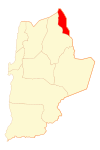
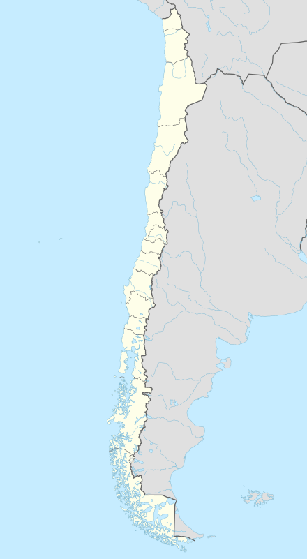
Ollagüe (Pronounced: oh-YA-gweh, hispanicized spelling of Ullawi (Aymara ullaña to see, to look at, to watch,[4] wi a nominalizing suffix to indicate a place, "viewpoint") is a Chilean frontier village and commune in El Loa Province, Antofagasta Region. The village is located 215 km northeast of the city of Calama with a station on the FCAB railine.
The commune is located in the Andean altiplano, bordering with Bolivia. It also includes the localities of Cebollar, Ascotán, Amincha, El Inca, Coska, Puquios and Chela.
Demographics
According to the 2002 census of the National Statistics Institute, Ollagüe had 318 inhabitants (210 men and 108 women). Of these, (0%) lived in urban areas and 318 (100%) in rural areas. The population fell by 28.2% (125 persons) between the 1992 and 2002 censuses.[1]
Administration
As a commune, Ollagüe is a third-level administrative division of Chile administered by a municipal council, headed by an alcalde who is directly elected every four years.
Within the electoral divisions of Chile, Ollagüe is represented in the Chamber of Deputies by Mr. Marcos Espinosa (PRSD) and Mr. Felipe Ward (UDI) as part of the 3rd electoral district, (together with Tocopilla, María Elena, Calama and San Pedro de Atacama). The commune is represented in the Senate by Carlos Cantero Ojeda (Ind.) and José Antonio Gómez Urrutia (PRSD) as part of the 2nd senatorial constituency (Antofagasta Region).
Nearby Attractions
Nearby attractions include:
- Ollagüe volcano
- Aucanquilcha volcano
- Salar de Ascotán
- Salar de Carcote
References
- 1 2 3 4 "National Statistics Institute" (in Spanish). Retrieved 3 November 2010.
- ↑ "Chile Time". WorldTimeZones.org. Retrieved 9 September 2010.
- ↑ "Chile Summer Time". WorldTimeZones.org. Retrieved 9 September 2010.
- ↑ Radio San Gabriel, "Instituto Radiofonico de Promoción Aymara" (IRPA) 1993, Republicado por Instituto de las Lenguas y Literaturas Andinas-Amazónicas (ILLLA-A) 2011, Transcripción del Vocabulario de la Lengua Aymara, P. Ludovico Bertonio 1612 (Spanish-Aymara-Aymara-Spanish dictionary)
