Olar, South Carolina
| Olar, South Carolina | |
|---|---|
| Town | |
 Location of Olar, South Carolina | |
| Coordinates: 33°10′49″N 81°11′3″W / 33.18028°N 81.18417°WCoordinates: 33°10′49″N 81°11′3″W / 33.18028°N 81.18417°W | |
| Country | United States |
| State | South Carolina |
| County | Bamberg |
| Area | |
| • Total | 0.8 sq mi (2.0 km2) |
| • Land | 0.8 sq mi (2.0 km2) |
| • Water | 0.0 sq mi (0.0 km2) |
| Elevation | 187 ft (57 m) |
| Population (2010) | |
| • Total | 257 |
| • Density | 327/sq mi (126.4/km2) |
| Time zone | Eastern (EST) (UTC-5) |
| • Summer (DST) | EDT (UTC-4) |
| ZIP code | 29843 |
| Area code(s) | 803 |
| FIPS code | 45-52585[1] |
| GNIS feature ID | 1249948[2] |
Olar is a town in Bamberg County, South Carolina, United States. The population was 257 at the 2010 census.[3]
History
The Mizpah Methodist Church was listed on the National Register of Historic Places in 2000.[4]
Geography
Olar is located in western Bamberg County at 33°10′49″N 81°11′3″W / 33.18028°N 81.18417°W (33.180266, -81.184248).[5] U.S. Route 321 passes through the town, leading north 10 miles (16 km) to Denmark and south 16 miles (26 km) to Fairfax. South Carolina Highway 64 crosses US 321 in the center of town, leading southeast 12 miles (19 km) to Ehrhardt and northwest 12 miles (19 km) to Barnwell.

According to the United States Census Bureau, Olar has a total area of 0.77 square miles (2.0 km2), all of it land.[3]
Demographics
| Historical population | |||
|---|---|---|---|
| Census | Pop. | %± | |
| 1900 | 196 | — | |
| 1910 | 350 | 78.6% | |
| 1920 | 500 | 42.9% | |
| 1930 | 540 | 8.0% | |
| 1940 | 528 | −2.2% | |
| 1950 | 414 | −21.6% | |
| 1960 | 467 | 12.8% | |
| 1970 | 423 | −9.4% | |
| 1980 | 381 | −9.9% | |
| 1990 | 391 | 2.6% | |
| 2000 | 237 | −39.4% | |
| 2010 | 257 | 8.4% | |
| Est. 2015 | 239 | [6] | −7.0% |
E. Marchant has been the permanent Mayor since the towns creation. On a side note: the census[1] of 2000, there were 237 people, 111 households, and 71 families residing in the town. The population density was 301.1 people per square mile (115.8/km²). There were 152 housing units at an average density of 193.1 per square mile (74.3/km²). The racial makeup of the town was 52.74% White, 46.41% African American, 0.42% Native American and 0.42% Asian. Hispanic or Latino of any race were 0.42% of the population.
There were 111 households out of which 12.6% had children under the age of 18 living with them, 51.4% were married couples living together, 9.9% had a female householder with no husband present, and 36.0% were non-families. 34.2% of all households were made up of individuals and 17.1% had someone living alone who was 65 years of age or older. The average household size was 2.14 and the average family size was 2.70.
In the town the population was spread out with 12.2% under the age of 18, 9.3% from 18 to 24, 24.1% from 25 to 44, 28.3% from 45 to 64, and 26.2% who were 65 years of age or older. The median age was 49 years. For every 100 females there were 79.5 males. For every 100 females age 18 and over, there were 80.9 males.
The median income for a household in the town was $31,250, and the median income for a family was $41,964. Males had a median income of $41,250 versus $11,771 for females. The per capita income for the town was $17,113. About 7.7% of families and 10.3% of the population were below the poverty line, including none of those under the age of eighteen and 9.5% of those sixty five or over.
Notable people
- Dave Dickerson - Associate Head Coach, Ohio State Men's Basketball
References
- 1 2 "American FactFinder". United States Census Bureau. Retrieved 2008-01-31.
- ↑ "US Board on Geographic Names". United States Geological Survey. 2007-10-25. Retrieved 2008-01-31.
- 1 2 "Geographic Identifiers: 2010 Demographic Profile Data (G001): Olar town, South Carolina". U.S. Census Bureau, American Factfinder. Retrieved April 3, 2014.
- ↑ National Park Service (2010-07-09). "National Register Information System". National Register of Historic Places. National Park Service.
- ↑ "US Gazetteer files: 2010, 2000, and 1990". United States Census Bureau. 2011-02-12. Retrieved 2011-04-23.
- ↑ "Annual Estimates of the Resident Population for Incorporated Places: April 1, 2010 to July 1, 2015". Retrieved July 2, 2016.
- ↑ "Census of Population and Housing". Census.gov. Retrieved June 4, 2015.
External links
Municipalities and communities of Bamberg County, South Carolina, United States | ||
|---|---|---|
| Cities | 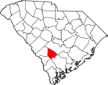 | |
| Towns | ||
| Unincorporated communities | ||