Nukutepipi
 NASA picture of Nukutepipi Atoll | |
 Nukutepipi | |
| Geography | |
|---|---|
| Location | Pacific Ocean |
| Coordinates | 20°41′S 143°04′W / 20.683°S 143.067°WCoordinates: 20°41′S 143°04′W / 20.683°S 143.067°W |
| Archipelago | Tuamotus |
| Area |
1.3 km2 (0.50 sq mi) (lagoon) 2.3 km2 (0.9 sq mi) (above water) |
| Length | 2.7 km (1.68 mi) |
| Administration | |
|
France | |
| Overseas collectivity | French Polynesia |
| Administrative subdivision | Tuamotus |
| Commune | Hao |
| Demographics | |
| Population | Uninhabited[1] (2012) |
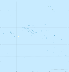
Nukutepipi, or Nuku-te-pipi[2] is an atoll in French Polynesia, Pacific Ocean. It is part of the Duke of Gloucester Islands, a subgroup of the Tuamotu group. Nukutepipi's nearest neighbor is Anuanurunga, which is located about 22 km to the WNW.
Nukutepipi is a very small atoll. It is roughly triangular-shaped, measuring approximately 2.7 km in length. Its reef is quite broad, enclosing completely the small lagoon, which has a deep area at its centre. There are two relatively large islands on its reef, one on its eastern side and the other on the northwest.
Nukutepipi Atoll was once inhabited but is currently not. It has a small airfield which was inaugurated in 1982. It is now owned by Cirque du Soleil's Guy Laliberté.[3]

History
First sighting recorded by Europeans was by the Spanish expedition of Pedro Fernández de Quirós on 4 February 1606. With the other three atolls of the Duke of Gloucester Islands they were named Cuatro Coronas (Four Crowns in Spanish).[4]
British naval officer and explorer Philip Carteret visited it on 12 July 1767 who only referred to it in his logs as "the southernmost island". [5] John Turnbull aboard the Margaret named it "Margaret island" on 6 March 1803 after the ship. Lieutenant Ringgold of the Wilkes Expedition visited the atoll on 6 January 1841. He identified the correct name of the atoll as "Nukutipipi" by the natives.
Administration
Administratively the four atolls of the Duke of Gloucester Islands, including the uninhabited ones of Nukutepipi, Anuanuruga, and Anuanuraro, belong to the commune of Hereheretue, which is associated to the Hao commune.
References
- ↑ "Population". Institut de la statistique de la Polynésie française (in French). Retrieved 15 October 2014.
- ↑ Young, J.L. (1899). "Names of the Paumotu Islands, with the old names so far as they are known.". Journal of the Polynesian Society. 8 (4): 264–268. Retrieved 7 January 2015.
- ↑ Gendron-Martin, Raphaël. "Guy Laliberté pourra bientôt profiter de son île en Polynésie française". journaldemontreal.com (in French). Retrieved 27 March 2015.
- ↑ Burney, James A chronological history of the discoveries in the South Sea or Pacific Ocean London, 1803, vII, p.326.
- ↑ Sample Chapter(s) for Historical%2