North Strathfield, New South Wales
| North Strathfield Sydney, New South Wales | |||||||||||||
|---|---|---|---|---|---|---|---|---|---|---|---|---|---|
 Bakehouse Quarter | |||||||||||||
| Coordinates | 33°51′37″S 151°05′19″E / 33.86040°S 151.08856°ECoordinates: 33°51′37″S 151°05′19″E / 33.86040°S 151.08856°E | ||||||||||||
| Population | 4,441 (2011 census)[1] | ||||||||||||
| Postcode(s) | 2137 | ||||||||||||
| Location | 15 km (9 mi) west of Sydney CBD | ||||||||||||
| LGA(s) | City of Canada Bay | ||||||||||||
| State electorate(s) | |||||||||||||
| Federal Division(s) | Reid | ||||||||||||
| |||||||||||||
North Strathfield is a suburb in the inner-west of Sydney, in the state of New South Wales, Australia. North Strathfield is located 15 kilometres west of the Sydney central business district, in the local government area of the City of Canada Bay. Strathfield and Strathfield South are separate suburbs, to the south.
History
Strathfield was the name of one of the large homes of the local area.[2] A major landmark in the area is Ardill House (or Our Children's Home) in Davidson Avenue, which was built by in 1861 John Bibb for Henry David Bray. It was enlarged circa 1880 and is now on the Register of the National Estate.[3]
North Strathfield was an area of industrial developments. In recent years, the area has been gentrified, with many high density residential developments replacing industrial sites.
Commercial area
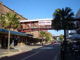
North Strathfield has residential, commercial and industrial developments. A small group of shops and cafes is located opposite the North Strathfield railway station. More commercial developments can be found on nearby Concord Road. The site of the former Arnott’s Biscuits factory in George Street has been redeveloped as the 'Bakehouse Quarter' and feature office space, restaurants, cafes, supermarkets and shops. Aldi, Fitness First and Outback Steakhouse are major tenants here. The head office and main call centre of NRMA Motoring and Services is also located in the former factory.
 Bakehouse Quarter, former Arnotts factory
 Bakehouse Quarter
 Commonwealth Bank, Concord Road
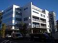 Bakehouse Quarter
Transport
North Strathfield railway station is on the North Shore, Northern & Western Line of the Sydney Trains network.
Schools
Strathfield North Public School is located on Concord Road. The McDonald College is a performing arts school.
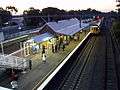 North Strathfield Station
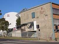 The McDonald College
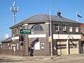 Fire Station, Concord Road
References
- ↑ Australian Bureau of Statistics (31 October 2012). "North Strathfield (State Suburb)". 2011 Census QuickStats. Retrieved 21 April 2015.
- ↑ Book of Sydney Suburbs, Frances Pollon (Angus and Robertson) 1990, p.246
- ↑ The Heritage of Australia, Macmillan Company, 1981, p.2/23
| Wikimedia Commons has media related to North Strathfield, New South Wales. |