Nith River
| Nith River | |
| River | |
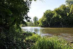 Nith River near Canning, Ontario | |
| Name origin: Named after the River Nith in Scotland | |
| Country | Canada |
|---|---|
| Province | Ontario |
| Region | Southwestern Ontario |
| Districts | Brant County, Oxford County, Perth County, Regional Municipality of Waterloo |
| Part of | Great Lakes Basin |
| Source | Woodland |
| - location | Wellesley, Regional Municipality of Waterloo |
| - elevation | 396 m (1,299 ft) |
| - coordinates | 43°33′18″N 80°45′41″W / 43.55500°N 80.76139°W |
| Mouth | Grand River |
| - location | Paris, County of Brant |
| - elevation | 221 m (725 ft) |
| - coordinates | 43°11′33″N 80°22′57″W / 43.19250°N 80.38250°WCoordinates: 43°11′33″N 80°22′57″W / 43.19250°N 80.38250°W |
 Location of the mouth of the Nith River in southern Ontario. | |
The Nith River is a river in Brant, Oxford and Perth Counties and the Regional Municipality of Waterloo in Southwestern Ontario, Canada. The Nith River empties into the Grand River at the town of Paris, and is named after the River Nith in Scotland.
Course
The Nith river begins in a woodland northwest of Crosshill and west of Waterloo Regional Road 5 in the township of Wellesley, Region of Waterloo. It heads north into Perth County, then turns sharply southwest and passes through the communities of Fernbank and Millbank in Perth East. It continues south, takes in the right tributary Smith Creek and arrives at the community of Nithburg. The river flows east back into Waterloo Region, takes in the right tributary Silver Creek, and then the left tributary Firella Creek south of the community of Wellesley in the township of Wellesley. The river turns south into the township of Wilmot, takes in the left tributary Bamberg Creek and passes through the communities of Phillipsburg and New Hamburg, Ontario. The Nith continues south, takes in the left tributaries Baden Creek and Hunsburger Creek, enters into Blandford-Blenheim, Oxford County and reaches the community of Plattsville. The river turns east, takes in the right tributary Black Creek, and left tributaries Hiller Creek, Alder Creek and Eden Creek, passes back into Waterloo Region, and reaches the community of Ayr in the township of North Dumfries, where it takes in the left tributary Cedar Creek. It then turns sharply west, flows back into Oxford County, then turns southeast passing through the communities of Wolverton and Canning. The Nith then flows into Brant County, takes in the right tributary Mud Creek and left tributary Charlie Creek, passing Barker's Bush and reaching its mouth at the Grand River in Paris.
Recreation
The Nith River is flat water with a few riffles, but rain can significantly increase the flow rate. In the early spring the water level has risen to nearly 1000 cm2/s, this causes major flooding in the flat regions upstream such as in and around New Hamburg. The Nith offers excellent paddling conditions in April, including a set of level 3 whitewater rapids as the Nith enters Paris, yet by May, the flow rate drops below 5cm2/s and becomes unsuitable for paddling.
The river is under the auspices of the Grand River Conservation Authority.
Tributaries
- Charlie Creek (left)
- Mud Creek (right)
- Cedar Creek (left)
- Eden Creek (left)
- Alder Creek (left)
- Hiller Creek (left)
- Black Creek (right)
- Hunsburger Creek (left)
- Baden Creek (left)
- Bamberg Creek (left)
- Firella Creek (left)
- Silver Creek (right)
- Smith Creek (right)
See also
References
- "The Grand River Watershed" (PDF). Grand River Conservation Authority. 2008. Retrieved 2010-07-03.
- "Nith River". Geographical Names Data Base. Natural Resources Canada. Retrieved 2010-07-03.
- "Toporama - Topographic Map Sheets 40P1, 40P2, 40P7, 40P8, 40P10". Atlas of Canada. Natural Resources Canada. Archived from the original on February 10, 2010. Retrieved 2010-07-03.