Newark Drawbridge
| Newark Drawbridge | |
|---|---|
 View with Stickel Bridge in the background | |
| Coordinates | 40°44′51″N 74°09′57″W / 40.7474°N 74.1659°WCoordinates: 40°44′51″N 74°09′57″W / 40.7474°N 74.1659°W |
| Carries | New Jersey Transit rail operations |
| Crosses | Passaic River |
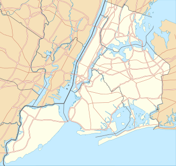
| Locale |
Newark and Harrison Northeastern New Jersey |
| Other name(s) | Morristown Line Bridge |
| Owner | New Jersey Transit |
| Maintained by | NJT |
| Characteristics | |
| Design | Swing bridge |
| Total length | 870.1 feet (265.2 m) |
| Width | 30.2 feet (9.2 m) |
| Longest span | 221.1 feet (67.4 m) |
| Clearance below | 20 feet (6.1 m) (low tide)[1] |
| History | |
| Opened | 1903 |
 Newark Drawbridge Location within New Jersey | |
The Newark Drawbridge, also known as the Morristown Line Bridge, is a railroad bridge on the Passaic River between Newark and Harrison, New Jersey. The swing bridge is the 11th bridge from the river's mouth at Newark Bay and is 5.85 miles (9.41 km) upstream from it.[1] Opened in 1903, it is owned and operated by New Jersey Transit.
History
Rail service across the river was generally oriented to bringing passengers and freight from the points west over the Hackensack Meadows to Bergen Hill, where tunnels and cuts provided access to terminals on the Hudson River.
In 1836, the Morris and Essex Railroad established a right-of-way from the west at Orange to Newark, from where it used the New Jersey Rail Road at Centre Street to cross the river and travel east to its terminal at Paulus Hook on the waterfront in Jersey City. By1855 it built its own bridge across the Passaic.[2][3] By the early 1860s, the railroad had established alignment across the Kearny Meadows and began using the Long Dock Tunnel to Hoboken.
In the early 1900s railroad elevated the line approaching the river which previously ran at grade along Division Street in Newark and built the current bridge. Completed in an earlier phase, the bridge was later shifted 35 feet (11 m) upstream on the new alignment.[4]
In 1945, the Morris and Essex Railroad officially merged into the Delaware, Lackawanna and Western Railroad. DL&W merged with the Erie Railroad in 1960 to form the Erie Lackawanna Railroad, which was absorbed by Conrail in 1976; New Jersey Transit has operated all passenger service since 1983.
Operations
The lower 17 miles (27 km) of the ninety mile (140 km) long Passaic River downstream of the Dundee Dam is tidally influenced and navigable, but due to the limited maritime traffic the bridge is infrequently required to open.[1] Since 1998 rules regulating drawbridge operations require a 24-hour notice.[5] The bridge is used exclusively by New Jersey Transit rail operations for the Montclair-Boonton Line and both branches of the Morris and Essex Lines, the Morristown Line and the Gladstone Branch. It is situated just east of Newark Broad Street Station, the first stop after the lines travelling west from Hoboken Terminal and Secaucus Junction converge. In 2004, NJT contracted a study to determine the condition of the bridge and to begin long-term planning for its future replacement.[6][7] In 2009-2010, the bridge underwent $23 million project for maintenance and repairs, funded by the agency.[8] and performed by Skanska[9]
See also
- Lower Hack Lift
- Timeline of Jersey City area railroads
- List of crossings of the Lower Passaic River
- List of bridges, tunnels, and cuts in Hudson County, New Jersey
- NJT movable bridges
References
- 1 2 3 "Lower Passaic River Restoration Project Commercial Navigation Analysis" (PDF). United States Army Corps of Engineers. July 2, 2010 (2nd Revision). Retrieved 2012-03-19. Check date values in:
|date=(help) - ↑ "The Morris and Essex", The New York Times, June 6, 1854, retrieved 2012-08-05
- ↑ "Fatal Railroad Accident", The New York Times, December 3, 1855, retrieved 2012-08-05
- ↑ "New Steel Bridge to Cross the Passaic". The New York Times. 1901-04-19.
- ↑ "Drawbridge Operation Regulations; Passaic River, NJ (Coast Guard 33 CFR Part 117 [CGD01–97–020] RIN 2115–AE47" (PDF). Rules and Regulations. Federal Register /Vol. 63, No. 120. June 23, 1998. Retrieved 2012-08-05.
- ↑ "Newark Drawbridge Engineering Study Approved" (Press release). New Jersey Transit. April 27, 2004. Retrieved 2012-08-05.
- ↑ "Transportation Capital Program Fiscal Year 2008". NJDOT. Retrieved 2012-08-05.
- ↑ http://www.njtransit.com/pdf/Jan%2017%202008.pdf
- ↑ http://www.usa.skanska.com/Global/brochure/coasttocoast/Finals/C2C_10_no2.pdf