New Lyme, Wisconsin
| New Lyme, Wisconsin | |
|---|---|
| Town | |
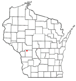 Location of New Lyme, Wisconsin | |
| Coordinates: 44°8′35″N 90°42′23″W / 44.14306°N 90.70639°WCoordinates: 44°8′35″N 90°42′23″W / 44.14306°N 90.70639°W | |
| Country | United States |
| State | Wisconsin |
| County | Monroe |
| Area | |
| • Total | 36.1 sq mi (93.4 km2) |
| • Land | 35.6 sq mi (92.1 km2) |
| • Water | 0.5 sq mi (1.3 km2) |
| Elevation[1] | 1,119 ft (341 m) |
| Population (2000) | |
| • Total | 141 |
| • Density | 4.0/sq mi (1.5/km2) |
| Time zone | Central (CST) (UTC-6) |
| • Summer (DST) | CDT (UTC-5) |
| Area code(s) | 608 |
| FIPS code | 55-56950[2] |
| GNIS feature ID | 1583814[1] |
New Lyme is a town in Monroe County, Wisconsin, United States. The population was 141 at the 2000 census.
Geography
According to the United States Census Bureau, the town has a total area of 36.1 square miles (93.4 km²), of which, 35.6 square miles (92.1 km²) of it is land and 0.5 square miles (1.3 km²) of it (1.36%) is water.
Demographics
As of the census[2] of 2000, there were 141 people, 57 households, and 42 families residing in the town. The population density was 4.0 people per square mile (1.5/km²). There were 80 housing units at an average density of 2.2 per square mile (0.9/km²). The racial makeup of the town was 100.00% White.
There were 57 households out of which 24.6% had children under the age of 18 living with them, 68.4% were married couples living together, 1.8% had a female householder with no husband present, and 26.3% were non-families. 17.5% of all households were made up of individuals and 3.5% had someone living alone who was 65 years of age or older. The average household size was 2.47 and the average family size was 2.74.
In the town the population was spread out with 21.3% under the age of 18, 5.7% from 18 to 24, 32.6% from 25 to 44, 24.1% from 45 to 64, and 16.3% who were 65 years of age or older. The median age was 40 years. For every 100 females there were 120.3 males. For every 100 females age 18 and over, there were 113.5 males.
The median income for a household in the town was $39,167, and the median income for a family was $39,792. Males had a median income of $20,000 versus $20,208 for females. The per capita income for the town was $20,306. There were 9.4% of families and 13.5% of the population living below the poverty line, including 25.9% of under eighteens and none of those over 64.
References
- 1 2 "US Board on Geographic Names". United States Geological Survey. 2007-10-25. Retrieved 2008-01-31.
- 1 2 "American FactFinder". United States Census Bureau. Retrieved 2008-01-31.
Municipalities and communities of Monroe County, Wisconsin, United States | ||
|---|---|---|
| Cities | 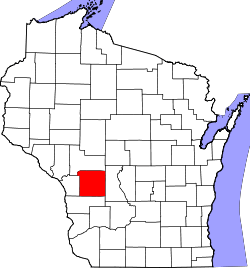 | |
| Villages | ||
| Towns | ||
| CDPs | ||
| Unincorporated communities | ||
| Indian reservation | ||
| Footnotes | ‡This populated place also has portions in an adjacent county or counties | |