New Florence, Missouri
| New Florence, Missouri | |
|---|---|
| City | |
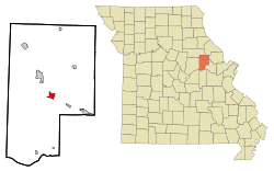 Location of New Florence, Missouri | |
| Coordinates: 38°54′40″N 91°26′56″W / 38.91111°N 91.44889°WCoordinates: 38°54′40″N 91°26′56″W / 38.91111°N 91.44889°W | |
| Country | United States |
| State | Missouri |
| County | Montgomery |
| Area[1] | |
| • Total | 2.94 sq mi (7.61 km2) |
| • Land | 2.92 sq mi (7.56 km2) |
| • Water | 0.02 sq mi (0.05 km2) |
| Elevation | 873 ft (266 m) |
| Population (2010)[2] | |
| • Total | 769 |
| • Estimate (2012[3]) | 751 |
| • Density | 263.4/sq mi (101.7/km2) |
| Time zone | Central (CST) (UTC-6) |
| • Summer (DST) | CDT (UTC-5) |
| ZIP code | 63363 |
| Area code(s) | 573 |
| FIPS code | 29-51770[4] |
| GNIS feature ID | 0729575[5] |
New Florence is a city in Montgomery County, Missouri, United States. The population was 769 at the 2010 census.
It includes a branch of Stone Hill Winery, based in Hermann, Missouri. From here to the St. Louis suburbs is the geographic area known as the Missouri Rhineland, first established as a center of vineyards by German immigrants in the mid-19th century.
New Florence lies at the junction of Interstate 70 and State Highway 19. Highway 19 is accessible from Interstate 70 via Exit 175.
History
New Florence was first named "Florence", and under the latter name was platted in 1858, and named after Florence Lewis, the daughter of a first settler.[6] A post office called New Florence has been in operation since 1858.[7]
Geography
New Florence is located at 38°54′40″N 91°26′56″W / 38.91111°N 91.44889°W (38.911079, -91.448827).[8]
According to the United States Census Bureau, the city has a total area of 2.94 square miles (7.61 km2), of which, 2.92 square miles (7.56 km2) is land and 0.02 square miles (0.05 km2) is water.[1]
Demographics
| Historical population | |||
|---|---|---|---|
| Census | Pop. | %± | |
| 1860 | 103 | — | |
| 1870 | 53 | −48.5% | |
| 1880 | 373 | 603.8% | |
| 1890 | 465 | 24.7% | |
| 1900 | 424 | −8.8% | |
| 1910 | 424 | 0.0% | |
| 1920 | 600 | 41.5% | |
| 1930 | 571 | −4.8% | |
| 1940 | 565 | −1.1% | |
| 1950 | 522 | −7.6% | |
| 1960 | 616 | 18.0% | |
| 1970 | 635 | 3.1% | |
| 1980 | 731 | 15.1% | |
| 1990 | 801 | 9.6% | |
| 2000 | 764 | −4.6% | |
| 2010 | 769 | 0.7% | |
| Est. 2015 | 728 | [9] | −5.3% |
2010 census
As of the census[2] of 2010, there were 769 people, 257 households, and 181 families residing in the city. The population density was 263.4 inhabitants per square mile (101.7/km2). There were 302 housing units at an average density of 103.4 per square mile (39.9/km2). The racial makeup of the city was 96.6% White, 0.9% African American, 0.1% Native American, 0.1% Asian, 0.4% from other races, and 1.8% from two or more races. Hispanic or Latino of any race were 0.8% of the population.
There were 257 households of which 35.4% had children under the age of 18 living with them, 51.4% were married couples living together, 12.1% had a female householder with no husband present, 7.0% had a male householder with no wife present, and 29.6% were non-families. 23.7% of all households were made up of individuals and 5.5% had someone living alone who was 65 years of age or older. The average household size was 2.67 and the average family size was 3.18.
The median age in the city was 41 years. 24.3% of residents were under the age of 18; 8.7% were between the ages of 18 and 24; 20.9% were from 25 to 44; 28% were from 45 to 64; and 18.2% were 65 years of age or older. The gender makeup of the city was 49.5% male and 50.5% female.
2000 census
As of the census[4] of 2000, there were 764 people, 248 households, and 176 families residing in the city. The population density was 471.3 people per square mile (182.1/km²). There were 288 housing units at an average density of 177.7 per square mile (68.6/km²). The racial makeup of the city was 97.12% White, 1.05% African American, 0.65% Native American, 0.13% Asian, 0.92% from other races, and 0.13% from two or more races. Hispanic or Latino of any race were 1.57% of the population.
There were 248 households out of which 37.9% had children under the age of 18 living with them, 53.2% were married couples living together, 10.5% had a female householder with no husband present, and 29.0% were non-families. 23.4% of all households were made up of individuals and 11.7% had someone living alone who was 65 years of age or older. The average household size was 2.70 and the average family size was 3.14.
In the city the population was spread out with 27.6% under the age of 18, 8.0% from 18 to 24, 24.6% from 25 to 44, 18.5% from 45 to 64, and 21.3% who were 65 years of age or older. The median age was 38 years. For every 100 females there were 87.7 males. For every 100 females age 18 and over, there were 78.4 males.
The median income for a household in the city was $30,156, and the median income for a family was $34,722. Males had a median income of $30,000 versus $18,864 for females. The per capita income for the city was $12,367. About 16.7% of families and 22.2% of the population were below the poverty line, including 27.8% of those under age 18 and 13.0% of those age 65 or over.
References
- 1 2 "US Gazetteer files 2010". United States Census Bureau. Retrieved 2012-07-08.
- 1 2 "American FactFinder". United States Census Bureau. Retrieved 2012-07-08.
- ↑ "Population Estimates". United States Census Bureau. Retrieved 2013-05-30.
- 1 2 "American FactFinder". United States Census Bureau. Retrieved 2008-01-31.
- ↑ "US Board on Geographic Names". United States Geological Survey. 2007-10-25. Retrieved 2008-01-31.
- ↑ "Montgomery County Place Names, 1928–1945". The State Historical Society of Missouri. Archived from the original on June 24, 2016. Retrieved November 11, 2016.
- ↑ "Post Offices". Jim Forte Postal History. Retrieved 11 November 2016.
- ↑ "US Gazetteer files: 2010, 2000, and 1990". United States Census Bureau. 2011-02-12. Retrieved 2011-04-23.
- ↑ "Annual Estimates of the Resident Population for Incorporated Places: April 1, 2010 to July 1, 2015". Retrieved July 2, 2016.
- ↑ "Census of Population and Housing". Census.gov. Retrieved June 4, 2015.
External links
- Historic maps of New Florence in the Sanborn Maps of Missouri Collection at the University of Missouri
Municipalities and communities of Montgomery County, Missouri, United States | ||
|---|---|---|
| Cities | 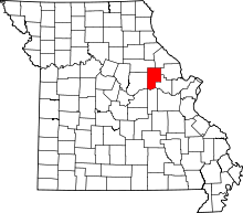 | |
| Village | ||
| Townships | ||
| CDPs | ||
| Other unincorporated communities | ||