Nassau Street (Princeton)
 | |||||||||||||||||
| Part of | New Jersey Route 27 | ||||||||||||||||
| Namesake | William III of England, Prince of Orange-Nassau (1724) | ||||||||||||||||
| Maintained by | NJDOT and Mercer County | ||||||||||||||||
| Length | 1.44 mi (2.32 km) | ||||||||||||||||
| Width | 6 rods (99 feet (30 m)) | ||||||||||||||||
| From |
| ||||||||||||||||
| Major junctions |
| ||||||||||||||||
| To | Snowden Lane / Riverside Drive | ||||||||||||||||
| Other | |||||||||||||||||
| Known for | Main street of Princeton, New Jersey, Princeton University, King's Highway Historic District, Princeton Historic District, Jugtown Historic District, Lincoln Highway | ||||||||||||||||
| |||||||||||||||||
Nassau Street is the main downtown thoroughfare of Princeton, New Jersey famous for its history, high-end stores, restaurants, and college town street life. It is the southernmost portion of Route 27 and has its western end at the intersection with Stockton and Bayard Streets, which form U.S. Route 206. The FitzRandolph Gate of Princeton University opens onto Nassau Street in front of Nassau Hall, at the intersection with Witherspoon Street, which serves as the iconic center of the town of Princeton. Nassau Street is lined with historic landmarks, including monuments, churches, mansions, university buildings, and offices. The street in its entirety is contained with the King's Highway Historic District (New Jersey), the western portion is part of the Princeton Historic District, and the stretch around the intersection with Harrison Street is part of the Jugtown Historic District. The eastern end of Nassau Street is at the intersection with Snowden Lane / Riverside Drive, where the old Princeton Borough ended. The street continues to the east as the Princeton-Kingston Road, leading to the Kingston Mill, Lake Carnegie, Delaware and Raritan Canal, and historic town of Kingston.
Nassau Street serves as a dividing line between Princeton University and the town, with the south side of the street, particularly in its western sections, lined with university buildings, and the northern side lined with shops, restaurants, offices, and apartments. The street is a major shopping destination with stores stretching nearly a mile between Bank Street and Murray Place, with a secondary shopping district around Harrison Street. Dining ranges from landmark college town eatery Hoagie Haven to some of New Jersey's finest restaurants in the blocks immediately north of Nassau along Witherspoon Street and Bayard Lane.[1] Other side streets such as Chambers and South Tulane host rows of stores including the famed Princeton Record Exchange.
Nassau Street is a major employment center with most of the former Borough's 2,126 companies, many only a P.O. Box for the prestigious address, and more than 20,000 jobs clustered along it. The university is the largest employer but provides only 1/6th of the town's employment which includes thousands occupied in financial and professional services.[2] Downtown Princeton office space, largely on Nassau Street, commands a significant premium over other regional office space and has lower vacancy rates.[3] The street is also at the center of a highly desirable and expensive residential area mixed in with stores and amenities in a vibrant, walkable core with walk scores that exceed 90 through much of its length.[4] Townhouses and homes on adjacent streets average sales prices in seven figures.[5]
History

Colonial
Before Princeton's first European settlers arrived in the 1690s along the Stony Brook and Millstone River, the route that is now Nassau Street was part of the Assunpink Trail of the Lenni Lenape tribe, making it one of the oldest continually used roads in the United States.[6] The trail became a part of the King's Highway, the colonial era road that connected Boston to Charleston, South Carolina, and in 1724 the portion in Princeton was named Nassau Street in honor of William III of England, Prince of Orange-Nassau. The College of New Jersey, renamed Princeton University in 1896, would adopt the name Nassau Hall for its original building when moving to Princeton in 1756.[7]
Modern
In August 2002, about 600 mailboxes that could have been used to mail the letters associated with the 2001 anthrax attacks were tested for anthrax. Just one was found to be positive for the spores, at 10 Nassau Street.[8]
Description
Stores
Kate Spade, Ralph Lauren, Design Within Reach, Urban Outfitters, Lululemon, Jack Wills, J. Crew, Brooks Brothers, Ann Taylor, Lilly Pulitzer, and Sperry Top-Sider.
See also
| Wikimedia Commons has media related to Nassau Street (Princeton, New Jersey). |
References
- ↑ Levin, Eric (July 14, 2015). "The 25 Best Restaurants of 2014". New Jersey Monthly.
- ↑ "Princeton Borough, New Jersey". American FactFinder. United States Census Bureau.
- ↑ Morgan, Scott (August 11, 2010). "Commercial Real Estate Is Hurting, But Healing". U.S. 1 Newspaper.
- ↑ "90 Nassau St, Princeton, NJ". Walk Score.
- ↑ "Culture, convenience attract home buyers to Princeton". NorthJersey.com. April 18, 2015.
- ↑ Smith, Richard D. (October 1, 1997). Princeton. Arcadia Publishing. p. 22. ISBN 978-0738550169.
- ↑ Bearse, Myrna (2005). Princeton: Still Making History. Indigo Custom Publishing. p. 7. ISBN 978-0976287575.
- ↑ "Anthrax: a Political Whodunit". abc.net.au. Retrieved March 30, 2008.
External links
Areas | 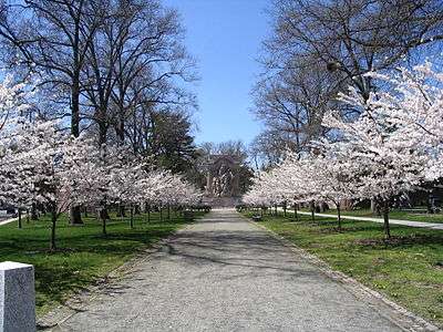 | |
| Historic Districts | ||
| Former municipalities | ||
Education | ||
| Public schools | ||
| Independent schools | ||
| Colleges and universities | ||
| Other education | ||
Other | ||
| Places of Worship | ||
| Parks and Recreation | ||
| Shopping, and Dining | ||
| Performing Arts | ||
| Media | ||
| Other landmarks | ||
| Princeton addressed landmarks outside the municipality | ||
See also: Princeton University and National Register of Historic Places listings in Mercer County, New Jersey | ||