Narrikup, Western Australia
| Narrikup Western Australia | |
|---|---|
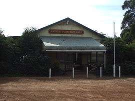 Narrikup District Hall | |
 Narrikup | |
| Coordinates | 34°46′26″S 117°42′07″E / 34.774°S 117.702°ECoordinates: 34°46′26″S 117°42′07″E / 34.774°S 117.702°E |
| Population | 515 (2006 census)[1] |
| Established | 1900s |
| Postcode(s) | 6326 |
| Location |
|
| LGA(s) | Shire of Plantagenet |
| State electorate(s) | Blackwood-Stirling |
| Federal Division(s) | O'Connor |
Narrikup is a small town between Albany and Mount Barker in the Great Southern region of Western Australia. At the 2006 census, Narrikup had a population of 515.[1]
The name Narrikup comes from the Aboriginal name of a nearby brook which is thought to mean "place of abundance".[2]
The area was visited by Thomas Wilson who travelled from Albany in 1829 when he camped on the banks of the stream west of the current townsite.[3]
The town is located on the Great Southern Railway line which was completed in this area in 1889, although initially the siding was named Hay River.[2]
A reserve for the townsite was put aside in 1901 and in 1905 20 lots were surveyed; the townsite was finally gazetted in 1907.
References
- 1 2 Australian Bureau of Statistics (25 October 2007). "Narrikup (State Suburb)". 2006 Census QuickStats. Retrieved 19 July 2011.
- 1 2 Western Australian Land Information Authority. "History of country town names – N". Retrieved 21 August 2008.
- ↑ "Albany Gateway - Narrikup History". 2008. Retrieved 21 April 2008.
External links
- Welcome to Narrikup (Albany Gateway)
This article is issued from Wikipedia - version of the 1/22/2016. The text is available under the Creative Commons Attribution/Share Alike but additional terms may apply for the media files.