Nang Rong District
| Nang Rong นางรอง | |
|---|---|
| Amphoe | |
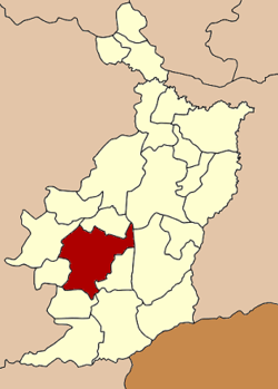 Amphoe location in Buriram Province | |
| Coordinates: 14°37′42″N 102°47′36″E / 14.62833°N 102.79333°ECoordinates: 14°37′42″N 102°47′36″E / 14.62833°N 102.79333°E | |
| Country | Thailand |
| Province | Buriram |
| Area | |
| • Total | 769.8 km2 (297.2 sq mi) |
| Population (2005) | |
| • Total | 108,143 |
| • Density | 151.6/km2 (393/sq mi) |
| Time zone | ICT (UTC+7) |
| Postal code | 31110 |
| Geocode | 3104 |
Nang Rong (Thai: นางรอง, pronounced [nāːŋ rɔ̄ːŋ]) is a district (amphoe) of Buriram Province, northeastern Thailand.
Geography
Neighboring districts are (from the northeast clockwise) Chamni, Mueang Buriram, Prakhon Chai, Chaloem Phra Kiat, Lahan Sai, Pakham, Non Suwan, and Nong Ki of Buriram Province.
It is the closest town to the Phanom Rung Historical Park, and 11th century religious site.
Climate
| Climate data for Nang Rong (1981–2010) | |||||||||||||
|---|---|---|---|---|---|---|---|---|---|---|---|---|---|
| Month | Jan | Feb | Mar | Apr | May | Jun | Jul | Aug | Sep | Oct | Nov | Dec | Year |
| Record high °C (°F) | 37.8 (100) |
40.4 (104.7) |
41.4 (106.5) |
41.8 (107.2) |
40.7 (105.3) |
39.3 (102.7) |
38.6 (101.5) |
36.8 (98.2) |
37.2 (99) |
37.2 (99) |
36.4 (97.5) |
36.0 (96.8) |
41.8 (107.2) |
| Average high °C (°F) | 31.2 (88.2) |
33.9 (93) |
35.7 (96.3) |
36.4 (97.5) |
34.8 (94.6) |
34.1 (93.4) |
33.5 (92.3) |
33.0 (91.4) |
32.1 (89.8) |
30.9 (87.6) |
30.2 (86.4) |
29.6 (85.3) |
33.0 (91.4) |
| Daily mean °C (°F) | 24.3 (75.7) |
26.4 (79.5) |
28.4 (83.1) |
29.5 (85.1) |
28.8 (83.8) |
28.6 (83.5) |
28.1 (82.6) |
27.8 (82) |
27.2 (81) |
26.5 (79.7) |
25.0 (77) |
23.6 (74.5) |
27.0 (80.6) |
| Average low °C (°F) | 17.5 (63.5) |
20.1 (68.2) |
22.4 (72.3) |
24.1 (75.4) |
24.5 (76.1) |
24.5 (76.1) |
24.2 (75.6) |
24.0 (75.2) |
23.7 (74.7) |
23.0 (73.4) |
20.5 (68.9) |
17.6 (63.7) |
22.2 (72) |
| Record low °C (°F) | 9.4 (48.9) |
10.7 (51.3) |
11.6 (52.9) |
18.8 (65.8) |
19.8 (67.6) |
21.6 (70.9) |
21.2 (70.2) |
21.1 (70) |
20.0 (68) |
16.3 (61.3) |
12.2 (54) |
7.8 (46) |
7.8 (46) |
| Average rainfall mm (inches) | 4.7 (0.185) |
19.6 (0.772) |
47.9 (1.886) |
81.6 (3.213) |
166.6 (6.559) |
129.7 (5.106) |
148.0 (5.827) |
181.7 (7.154) |
239.6 (9.433) |
133.9 (5.272) |
37.2 (1.465) |
3.4 (0.134) |
1,193.9 (47.004) |
| Average rainy days | 0.9 | 2.6 | 5.1 | 8.5 | 15.6 | 14.3 | 16.2 | 16.9 | 18.8 | 12.0 | 4.1 | 0.8 | 115.8 |
| Average relative humidity (%) | 69 | 66 | 67 | 70 | 77 | 77 | 79 | 80 | 84 | 82 | 75 | 71 | 75 |
| Mean monthly sunshine hours | 279.0 | 245.8 | 275.9 | 240.0 | 195.3 | 153.0 | 158.1 | 117.8 | 144.0 | 198.4 | 255.0 | 260.4 | 2,522.7 |
| Mean daily sunshine hours | 9.0 | 8.7 | 8.9 | 8.0 | 6.3 | 5.1 | 5.1 | 3.8 | 4.8 | 6.4 | 8.5 | 8.4 | 6.9 |
| Source #1: Thai Meteorological Department[1] | |||||||||||||
| Source #2: Office of Water Management and Hydrology, Royal Irrigation Department (sun and humidity)[2] | |||||||||||||
Administration
The district is divided into 15 sub-districts (tambon), which are further subdivided into 204 villages (muban). Nang Rong is a township (thesaban tambon) which covers parts of tambon Nang Rong and Thanon Hak. There are also 15 tambon administrative organizations (TAO).
| No. | Name | Thai name | Villages | Pop. | |
|---|---|---|---|---|---|
| 1. | Nang Rong | นางรอง | 30 | 22,934 | |
| 3. | Sadao | สะเดา | 17 | 9,624 | |
| 5. | Chum Saeng | ชุมแสง | 14 | 5,418 | |
| 6. | Nong Bot | หนองโบสถ์ | 14 | 7,196 | |
| 8. | Nong Kong | หนองกง | 11 | 6,199 | |
| 13. | Thanon Hak | ถนนหัก | 13 | 10,073 | |
| 14. | Nong Sai | หนองไทร | 14 | 6,494 | |
| 15. | Kan Lueang | ก้านเหลือง | 10 | 4,573 | |
| 16. | Ban Sing | บ้านสิงห์ | 14 | 5,503 | |
| 17. | Lam Sai Yong | ลำไทรโยง | 14 | 5,525 | |
| 18. | Sap Phraya | ทรัพย์พระยา | 13 | 6,924 | |
| 24. | Nong Yai Phim | หนองยายพิมพ์ | 10 | 4,568 | |
| 25. | Hua Thanon | หัวถนน | 11 | 4,613 | |
| 26. | Thung Saeng Thong | ทุ่งแสงทอง | 7 | 3,099 | |
| 27. | Nong Sano | หนองโสน | 12 | 5,400 |
Missing numbers are tambon which now form the districts Non Suwan and Chamni, as well as parts of Chaloem Phra Kiat.
References
- ↑ "Climatological Data for the Period 1981–2010". Thai Meteorological Department. p. 14. Retrieved 2 August 2016.
- ↑ "ปริมาณการใช้น้ำของพืชอ้างอิงโดยวิธีของ Penman Monteith (Reference Crop Evapotranspiration by Penman Monteith)" (PDF) (in Thai). Office of Water Management and Hydrology, Royal Irrigation Department. p. 66. Retrieved 2 August 2016.