Nandu River
| Nandu River | |
|---|---|
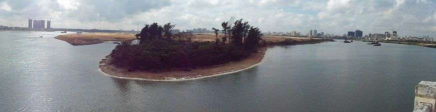
 Nandu River at Longtang just north of the town and south of the dam, on the west side, facing southeast | |
| Native name | 南渡江 |
| Country | People's Republic of China |
| Basin | |
| River mouth | Qiongzhou Strait |
| Basin size | 150×106 m3 (5.3×10⁹ cu ft) Fengtan Reservoir, Forge Reservoir, East Lake[1] |
| Physical characteristics | |
| Length | 314 km (195 mi) |
| Discharge |
|
The Nandu River (Chinese: 南渡江) is the longest river in Hainan Province, China.[1] Its tributary is the Xinwu River. The river discharges into the Nandu River estuary at Haikou city, and then into Qiongzhou Strait.[2]
The river is 314 km long, with a discharge of 6.099 billion cubic metres. It passes the major settlements of Chengmai Zhen in Chengmai County then Dingcheng in Ding'an County. The river then turns north, goes over the dam at Longtang, a somewhat smaller town than Chengmai and Ding'an. The Nandu then goes under several bridges, such as the Nandu River Iron Bridge and Qiongzhou Bridge. Once passed the Qiongzhou Bridge, at the southern tip of Xinbu Island, the Nandu flows north along the east side of Xinbu Island and out into the sea. At the southern tip of Xinbu Island, two distributaries branch off. One is the Henggouhe Channel which runs along the west side of Xinbu Island. The other is the smaller Haidian River which flows westward, under the Haikou Century Bridge, and out into Haikou Bay.
Bridges

From Chengmai Zhen in Chengmai County at the west to its mouth at Haikou there are numerous bridges crossing the Nandu River. Some are semi-permanent and get washed out during times of high water, while other, major bridges are currently under construction. The following is a fairly comprehensive list of landmarks and bridges between Chengmai Zhen and Haikou City.
|
|
Gallery
 Map
Map
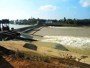 Nandu River Dam located by Longtang
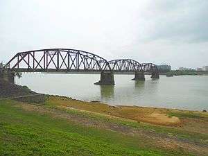
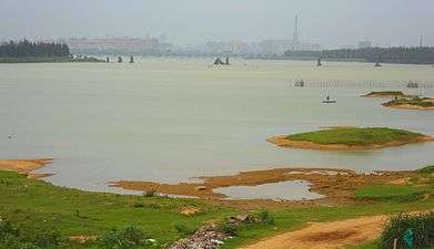 Near Haikou
See also
References
- 1 2 "无标题文档". Haikou.gov.cn. Retrieved 2010-07-30.
- ↑ "Haikou - CNSeeker". China-map.cnseeker.com. 2010-01-12. Retrieved 2010-07-30.
External links
| Wikimedia Commons has media related to Nandu River. |
- Table of rivers in China with Chinese names and useful data
Coordinates: 19°59′52″N 110°23′08″E / 19.9979°N 110.3856°E
Hainan topics | |
|---|---|
| General | |
| Geography | |
| Flora and fauna | |
| Media | |
| Transportation | |
| Education | |
| Demographics | |
| Buildings and structures | |
| Cuisine | |
| Visitor attractions | |
| |