National Highway 79 (India)
| ||||
|---|---|---|---|---|
|
Road map of India with National Highway 79 highlighted in solid blue color | ||||
| Route information | ||||
| Length: | 134 km (83 mi) | |||
| Major junctions | ||||
| East end: | Ulundurpettai, Villupuram district, Tamil Nadu | |||
| West end: | Salem, Tamil Nadu | |||
| Location | ||||
| States: | Tamil Nadu | |||
| Primary destinations: | Ulundrupet - Kallakkurichchi - Chinnasalem - Attur - Pethanaickenpalayam - Vazhapadi - Salem | |||
| Highway system | ||||
| ||||

.png)
National Highway 79 (NH 79) is a National Highway in India entirely within the state of Tamil Nadu. It runs between Ulundurpettai and Salem in the Indian state of Tamil Nadu for a total of 134 km (83 mi).[1] It connects with NH 44 and NH 544 at Salem. NH 79 connects NH 68 and SH 69 at Ulundurpettai. It was upgraded to a dual carriageway road in two phases on a Build-operate-transfer basis by Reliance Infrastructure and Maytas.[2]
Traffic
NH 79is an important connecting road for vehicles travelling from the two major cities Coimbatore and Kochi. NH 79 connects Salem, in directly Coimbatore, Erode, Tirupur and the cities around these areas with Chennai.
Route
Ulundurpettai - Elavanasur - ThiyagaDurgam - Kallakurichi - Chinnasalem, Thalaivasal - Kattukottai - Attur - Pethanaickenpalayam - Vazhapadi - Salem
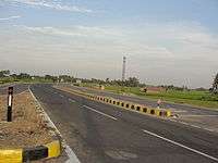
Gallery
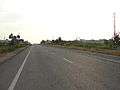
 NH 79 near Kallakurichi, Villupuram district, Tamil Nadu
See also
References
| Wikimedia Commons has media related to National Highway 79 (India). |
- ↑ "National Highways Starting and Terminal Stations". Ministry of Road Transport & Highways. Retrieved 2012-12-02.
- ↑ R, Ilangovan (2009-03-19). "Satyam fiasco affects NH-79works". Salem: The Hindu. Retrieved 13 May 2012.
