Nödinge-Nol
| Nödinge-Nol | |
|---|---|
|
| |
 Nödinge-Nol 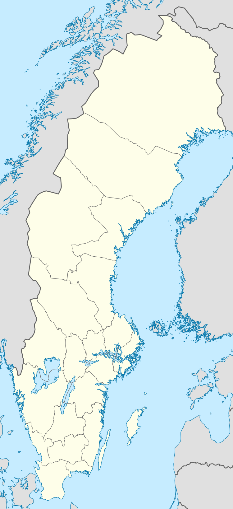 Nödinge-Nol | |
| Coordinates: 57°54′N 12°04′E / 57.900°N 12.067°ECoordinates: 57°54′N 12°04′E / 57.900°N 12.067°E | |
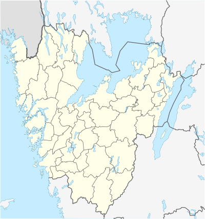
| Country | Sweden |
| Province | Västergötland |
| County | Västra Götaland County |
| Municipality | Ale Municipality |
| Area[1] | |
| • Total | 5.99 km2 (2.31 sq mi) |
| Population (31 December 2010)[1] | |
| • Total | 9,822 |
| • Density | 1,641/km2 (4,250/sq mi) |
| Time zone | CET (UTC+1) |
| • Summer (DST) | CEST (UTC+2) |

Nödinge-Nol is a locality and the seat of Ale Municipality in Västra Götaland County, Sweden. It had 9,822 inhabitants in 2010.[1]
Overview
The town Nödinge-Nol was once three villages: Alafors, Nol and Nödinge. They have grown together into one locality. It is situated approximately 20 kilometers northeast of Gothenburg next to the euro highway E45, east of the river Göta Älv. Nödinge community was originally called Kyrkby and has been the site of a church since medieval times. The current church was built in 1727 and has excellent murals.
Nödinge-Nol has solely been defined by the Central Bureau of Statistics, who has no authority to decide in these things. The Land Survey Place Name Unit still lists Nödinge, Nol and Alafors as three individual places. Therefore, it is incorrect to claim that Nödinge-Nol even exist. The only reason that Geonames.org does not list it this way is because the database at the Land Survey is not accessible in the way they wish. It is however possible to search in the database online.[2] This database has no entry, what so ever, of the name Nödinge-Nol.
The downtown area is dominated by apartment complexes and is surrounded by extensive countryside intermixed with villas. Downtown is Ale Torg, a shopping center with a diverse selection of stores. There is a junior high school, middle school, emergency room, library, a sports arena, a nine-hole golf course and a small boat harbor. The main public transport is Gothenburg commuter rail, which has two stations here, Nödinge and Nol and takes you to Gothenburg in about 15min.
The surrounding countryside includes very steep hills around the river Göta Älv. In the southeast is the nature reserve Vättlefjäll, which has numerous hiking trails and lakes in various sizes that are spread out over 2,567 hectares. The Göta Älv ridge to the east. Inside the town itself there are a large number of steep hills intermixed with flat valleys that today is fertile farmland, but which once was the sea bottom. The hills used to be islets of the old archipelago.
Ale is known for many things, best found on Ale Municipality page. Alafors for its brewery Ahlafors Bryggerier, Nol for the former industrial factories.
Nödinge in Ale was founded when a king called Inge. When fleeing from his enemies he swam with his horse over Göta Älv where he was helped. In gratitude, Inge founded Kirkby (kyrkby = church village) but when it started to form itself to a town it changed Its name to Nödinge. (Distress = Nöd, Inge = Inge, that becomes Nödinge (Inge was in need of help). This is based on folk etymology and is not the real meaning of the name.
References
- 1 2 3 "Tätorternas landareal, folkmängd och invånare per km2 2005 och 2010" (in Swedish). Statistics Sweden. 14 December 2011. Archived from the original on 10 January 2012. Retrieved 10 January 2012.
- ↑ https://kso.etjanster.lantmateriet.se/