Musquodoboit Valley
| Musqudoboit Valley | |
|---|---|
| Valley | |
|
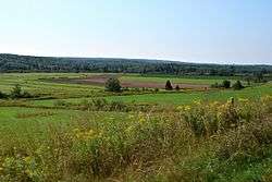
Musquodoboit Valley at Greenwood | |
 Musqudoboit Valley Location within Nova Scotia | |
| Coordinates: 45°02′35″N 63°09′06″W / 45.04306°N 63.15167°WCoordinates: 45°02′35″N 63°09′06″W / 45.04306°N 63.15167°W | |
| Country |
|
| Province |
|
| Municipality | Halifax Regional Municipality |
| Area[1] | |
| • Total | 714 km2 (276 sq mi) |
| Time zone | AST (UTC-4) |
| • Summer (DST) | ADT (UTC-3) |
| Communities | Caribou Mines, Chaplin, Dean, Pleasant Valley, Sheet Harbour Road, Upper Musquodoboit, Fraser Settlement, Kent, Centre Musquodoboit, Reid, Newcomb Corner, Lindsay Lake, Elmsvale, Higginsville, Brookvale, Glenmore, Middle Musquodoboit, South Section, Murchyville, Mooseland, Chaswood, Cooks Brook, Carrolls Corner, Elderbank, Lake Egmont, Meaghers Grant, Meagher, Lower Meaghers Grant, Musquodoboit Harbour, Greenwood |
| Highways |
|
| Website |
www |
The Musquodoboit Valley (pronunciation: /ˌmʌskəˈdɑːbᵻt/ MUSS-kə-DAH-bit) is a valley and region in the Halifax Regional Municipality, Nova Scotia, Canada.
The word "Musquodoboit" is derived from the mi'kmaq language and means "rolling out in foam".[1]
It is administratively located in the Halifax Regional Municipality's Musquodoboit Valley & Dutch Settlement planning area and the western edge of the valley includes communities that are considered part of the commutershed for the urban area of the Halifax Regional Municipality.

The picturesque Musquodoboit River flows through majority of the valley, passing by most of the communities in the valley. The river is approximately 97 kilometres (60 mi) long and originates in the extreme northeastern area of the valley. The three major communities in the valley are Upper Musquodoboit, Middle Musquodoboit and Musquodoboit Harbour.
Amenities and economy
The upper part of the Musquodoboit Valley comprises the largest farming district in the Halifax Regional Municipality. The farms have adapted over time from family-run farms to large commercial scale farms, to adapt to the changing market.[3]
Commerce
Most of the non-farming businesses are concentrated in Upper Musquodoboit and Middle Musquodoboit.
Middle Musquodoboit has a Co-op store,[4] a bakery/restaurant, a fire station,[5] a police station,[6] a natural resources station,[7] a post office,[8] and an RBC bank.[9] The annual Halifax County Exhibition is held each August in the valley farming community of Middle Musquodoboit.[1]
Upper Musquodoboit has a convenience store,[10] an auto-body shop [11] and a limestone mine, named Mosher Limestone.[12]
Schools
There are three schools in the Musquodoboit Valley: Musquodoboit Rural High School (MRHS), Musquodoboit Valley Education Centre (MVEC), both located in Middle Musquodoboit and Upper Musquodoboit Consolidated Elementary School (UMES), located in Upper Musquodoboit.
Musquodoboit Rural High School (MRHS) is the only high school in the Musquodoboit Valley. It has two feeder schools, MVEC and UMES. The school teaches grades 7-12. The school offers Intensive French. The school was constructed in 2008. In 2014, there were 262 students enrolled in the school.[13] Musquodoboit Valley Education Centre (MVEC) is a feeder school of MRHS. It is located in Middle Musquodoboit. The school teaches grades primary through six. The school was constructed in 2001. In 2014, there were 133 students enrolled in the school.[14]
Upper Musquodoboit Consolidated Elementary School (UMES) is a feeder school of MRHS. The school is located in Upper Musquodoboit. The school teaches grades primary through six. It was constructed in 1962. In 2014, there were 41 students enrolled in the school.[15]
Healthcare
There is one hospital in the Musquodoboit Valley: Musquodoboit Valley Memorial Hospital (MVMH).
MVMH is the only hospital in the Musquodoboit Valley. It is located in Middle Musquodoboit and is on the opposite side of the river. It is connected to Braeside Nursing home, which adjacent to the hospital.[16][17]
Climate
| Climate data for Middle Musquodoboit, 1981–2010 normals, extremes 1961–present | |||||||||||||
|---|---|---|---|---|---|---|---|---|---|---|---|---|---|
| Month | Jan | Feb | Mar | Apr | May | Jun | Jul | Aug | Sep | Oct | Nov | Dec | Year |
| Record high °C (°F) | 16.5 (61.7) |
17.0 (62.6) |
28.0 (82.4) |
30.5 (86.9) |
33.3 (91.9) |
33.9 (93) |
34.5 (94.1) |
35.6 (96.1) |
33.0 (91.4) |
26.7 (80.1) |
23.5 (74.3) |
16.0 (60.8) |
35.6 (96.1) |
| Average high °C (°F) | −0.9 (30.4) |
0.2 (32.4) |
3.9 (39) |
9.6 (49.3) |
16.1 (61) |
21.3 (70.3) |
24.7 (76.5) |
24.6 (76.3) |
20.3 (68.5) |
14.0 (57.2) |
7.8 (46) |
2.2 (36) |
12.0 (53.6) |
| Daily mean °C (°F) | −6.2 (20.8) |
−5.2 (22.6) |
−1.3 (29.7) |
4.4 (39.9) |
9.9 (49.8) |
14.8 (58.6) |
18.5 (65.3) |
18.4 (65.1) |
14.2 (57.6) |
8.5 (47.3) |
3.5 (38.3) |
−2.4 (27.7) |
6.4 (43.5) |
| Average low °C (°F) | −11.4 (11.5) |
−10.6 (12.9) |
−6.4 (20.5) |
−0.9 (30.4) |
3.7 (38.7) |
8.3 (46.9) |
12.2 (54) |
12.2 (54) |
7.9 (46.2) |
2.9 (37.2) |
−1.0 (30.2) |
−7.1 (19.2) |
0.8 (33.4) |
| Record low °C (°F) | −34.0 (−29.2) |
−33.0 (−27.4) |
−31.0 (−23.8) |
−15.0 (5) |
−7.8 (18) |
−3.0 (26.6) |
1.1 (34) |
−1.5 (29.3) |
−4.5 (23.9) |
−10.6 (12.9) |
−21.0 (−5.8) |
−34.0 (−29.2) |
−34.0 (−29.2) |
| Average precipitation mm (inches) | 129.8 (5.11) |
100.5 (3.957) |
124.2 (4.89) |
109.0 (4.291) |
105.4 (4.15) |
99.8 (3.929) |
103.8 (4.087) |
91.9 (3.618) |
110.7 (4.358) |
116.7 (4.594) |
136.8 (5.386) |
129.1 (5.083) |
1,357.6 (53.449) |
| Average rainfall mm (inches) | 80.4 (3.165) |
62.1 (2.445) |
92.8 (3.654) |
99.5 (3.917) |
104.9 (4.13) |
99.8 (3.929) |
103.8 (4.087) |
91.9 (3.618) |
110.7 (4.358) |
116.7 (4.594) |
128.6 (5.063) |
97.2 (3.827) |
1,188.3 (46.783) |
| Average snowfall cm (inches) | 49.4 (19.45) |
41.3 (16.26) |
31.4 (12.36) |
9.5 (3.74) |
0.5 (0.2) |
0.0 (0) |
0.0 (0) |
0.0 (0) |
0.0 (0) |
0.0 (0) |
8.2 (3.23) |
31.9 (12.56) |
172.2 (67.8) |
| Average precipitation days (≥ 0.2 mm) | 14.8 | 12.1 | 13.7 | 15.0 | 14.9 | 14.0 | 12.7 | 12.7 | 12.3 | 14.7 | 15.8 | 14.5 | 167.1 |
| Average rainy days (≥ 0.2 mm) | 7.5 | 6.0 | 9.4 | 14.0 | 14.8 | 14.0 | 12.7 | 12.7 | 12.3 | 14.7 | 14.8 | 10.1 | 143.1 |
| Average snowy days (≥ 0.2 cm) | 9.0 | 7.5 | 5.4 | 1.8 | 0.08 | 0.0 | 0.0 | 0.0 | 0.0 | 0.0 | 1.9 | 6.2 | 31.8 |
| Source: Environment Canada[18][19][20][21] | |||||||||||||
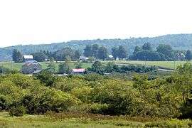
Gallery
- Musquodoboit Valley


References
- 1 2 3 "Experience Musquodoboit Valley!". TownCryer News. Retrieved 23 October 2015.
- ↑ "Settlement Areas". Halifax Regional Municipality. Retrieved 2 October 2015.
- ↑ "Agriculture & Industry". TownCryer News. Retrieved 23 October 2015.
- ↑ "Community Directory". TownCryer News. Retrieved 23 October 2015.
- ↑ "Fire Stations". Halifax Regional Municipality. Retrieved 23 October 2015.
- ↑ "About Halifax District RCMP". Royal Canadian Mounted Police. Retrieved 23 October 2015.
- ↑ "NREC - Our Facilities". Nova Scotia Government. Retrieved 23 October 2015.
- ↑ "CanadaPost - Post Office: MIDDLE MUSQUODOBOIT PO, Nova Scotia (mail, package delivery, courier) - Location & Hours". MyStore411.com. Retrieved 23 October 2015.
- ↑ "RBC Branch and ATM Locator". Royal Bank of Canada. Retrieved 23 October 2015.
- ↑ "Upper Musquodoboit Mini Mart". Yellow Pages Digital & Media Solutions Limited. Retrieved 23 October 2015.
- ↑ "Atwood's Autobody & Garage". Yellow Pages Digital & Media Solutions Limited. Retrieved 23 October 2015.
- ↑ "Mosher Limestone". Mosher Limestone Co. Ltd. Retrieved 23 October 2015.
- ↑ "Musquodoboit Rural High". Halifax Regional School Board. Retrieved 23 October 2015.
- ↑ "Musquodoboit Valley Education Centre". Halifax Regional School Board. Retrieved 23 October 2015.
- ↑ "Upper Musquodoboit Consolidated Elem.". Halifax Regional School Board. Retrieved 23 October 2015.
- ↑ "Musquodoboit Valley Memorial Hospital". Nova Scotia Health Authority. Retrieved 23 October 2015.
- ↑ "Braeside Nursing Home". 411 Local Search Corp. Retrieved 23 October 2015.
- ↑ "Middle Musquodoboit, Nova Scotia". Canadian Climate Normals 1981–2010. Environment Canada. Retrieved 12 May 2015.
- ↑ "Daily Data Report for December 2008". Canadian Climate Data. Environment Canada. Retrieved 3 October 2016.
- ↑ "Daily Data Report for April 2009". Canadian Climate Data. Environment Canada. Retrieved 3 October 2016.
- ↑ "Daily Data Report for March 2012". Canadian Climate Data. Environment Canada. Retrieved 3 October 2016.