Murdo, South Dakota
| Murdo, South Dakota | |
|---|---|
| City | |
|
| |
 Location in Jones County and the state of South Dakota | |
| Coordinates: 43°53′17″N 100°42′40″W / 43.88806°N 100.71111°WCoordinates: 43°53′17″N 100°42′40″W / 43.88806°N 100.71111°W | |
| Country | United States |
| State | South Dakota |
| County | Jones |
| Incorporated | 1908[1] |
| Area[2] | |
| • Total | 0.63 sq mi (1.63 km2) |
| • Land | 0.63 sq mi (1.63 km2) |
| • Water | 0 sq mi (0 km2) |
| Elevation | 2,313 ft (705 m) |
| Population (2010)[3] | |
| • Total | 488 |
| • Estimate (2014)[4] | 482 |
| • Density | 774.6/sq mi (299.1/km2) |
| Time zone | Central (CST) (UTC-6) |
| • Summer (DST) | CDT (UTC-5) |
| ZIP code | 57559 |
| Area code(s) | 605 |
| FIPS code | 46-44260 |
| GNIS feature ID | 1256622[5] |
| Website | http://www.murdosd.com/ |

Murdo is a city in Jones County, South Dakota, United States. The population was 488 at the 2010 census. It is the county seat of Jones County.[6]
History
Murdo was founded about 1907 on the Chicago, Milwaukee, St. Paul and Pacific Railroad.[7] The town was named in honor of Murdo MacKenzie.[8]
Geography
Murdo is located at 43°53′17″N 100°42′40″W / 43.88806°N 100.71111°W (43.888173, -100.711109).[9]
According to the United States Census Bureau, the city has a total area of 0.63 square miles (1.63 km2), all of it land.[2]
Murdo has been assigned the ZIP code 57559 and the FIPS place code 44260.
Demographics
| Historical population | |||
|---|---|---|---|
| Census | Pop. | %± | |
| 1910 | 372 | — | |
| 1920 | 500 | 34.4% | |
| 1930 | 619 | 23.8% | |
| 1940 | 680 | 9.9% | |
| 1950 | 739 | 8.7% | |
| 1960 | 783 | 6.0% | |
| 1970 | 865 | 10.5% | |
| 1980 | 723 | −16.4% | |
| 1990 | 679 | −6.1% | |
| 2000 | 612 | −9.9% | |
| 2010 | 488 | −20.3% | |
| Est. 2015 | 458 | [10] | −6.1% |
| U.S. Decennial Census[11] 2014 Estimate[4] | |||
2010 census
As of the census[3] of 2010, there were 488 people, 237 households, and 128 families residing in the city. The population density was 774.6 inhabitants per square mile (299.1/km2). There were 291 housing units at an average density of 461.9 per square mile (178.3/km2). The racial makeup of the city was 93.9% White, 0.2% African American, 3.5% Native American, and 2.5% from two or more races. Hispanic or Latino of any race were 0.8% of the population.
There were 237 households of which 26.6% had children under the age of 18 living with them, 43.0% were married couples living together, 7.6% had a female householder with no husband present, 3.4% had a male householder with no wife present, and 46.0% were non-families. 43.0% of all households were made up of individuals and 21.5% had someone living alone who was 65 years of age or older. The average household size was 2.06 and the average family size was 2.84.
The median age in the city was 45.1 years. 21.9% of residents were under the age of 18; 6.7% were between the ages of 18 and 24; 21.1% were from 25 to 44; 29.4% were from 45 to 64; and 20.7% were 65 years of age or older. The gender makeup of the city was 47.1% male and 52.9% female.
2000 census
At the 2000 census, there were 612 people, 271 households and 160 families residing in the city. The population density was 964.5 per square mile (375.1/km²). There were 315 housing units at an average density of 496.4 per square mile (193.1/km²). The racial makeup of the city was 95.92% White, 2.94% Native American, and 1.14% from two or more races. Hispanic or Latino of any race were 0.49% of the population.
There were 271 households of which 28.0% had children under the age of 18 living with them, 44.6% were married couples living together, 11.4% had a female householder with no husband present, and 40.6% were non-families. 37.6% of all households were made up of individuals and 19.2% had someone living alone who was 65 years of age or older. The average household size was 2.26 and the average family size was 2.99.
Age distribution was 26.8% under the age of 18, 6.9% from 18 to 24, 25.2% from 25 to 44, 21.9% from 45 to 64, and 19.3% who were 65 years of age or older. The median age was 40 years. For every 100 females there were 94.9 males. For every 100 females age 18 and over, there were 85.9 males.
The median household income was $30,104, and the median family income was $40,000. Males had a median income of $24,196 versus $17,917 for females. The per capita income for the city was $16,008. About 10.5% of families and 12.1% of the population were below the poverty line, including 15.3% of those under age 18 and 11.1% of those age 65 or over.
References
- ↑ "SD Towns" (PDF). South Dakota State Historical Society. Retrieved 2010-02-14.
- 1 2 "US Gazetteer files 2010". United States Census Bureau. Retrieved 2012-06-21.
- 1 2 "American FactFinder". United States Census Bureau. Retrieved 2012-06-21.
- 1 2 "Population Estimates". United States Census Bureau. Retrieved June 11, 2015.
- ↑ "US Board on Geographic Names". United States Geological Survey. 2007-10-25. Retrieved 2008-01-31.
- ↑ "Find a County". National Association of Counties. Retrieved 2011-06-07.
- ↑ Hellmann, Paul T. (May 13, 2013). Historical Gazetteer of the United States. Routledge. p. 993. Retrieved 30 November 2013.
- ↑ Federal Writers' Project (1940). South Dakota place-names, v.1-3. University of South Dakota. p. 52.
- ↑ "US Gazetteer files: 2010, 2000, and 1990". United States Census Bureau. 2011-02-12. Retrieved 2011-04-23.
- ↑ "Annual Estimates of the Resident Population for Incorporated Places: April 1, 2010 to July 1, 2015". Retrieved July 2, 2016.
- ↑ United States Census Bureau. "Census of Population and Housing". Retrieved September 21, 2013.
Municipalities and communities of Jones County, South Dakota, United States | ||
|---|---|---|
| City | 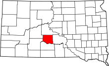 | |
| Town | ||
| CDP | ||
| Unincorporated communities | ||
| Township | ||