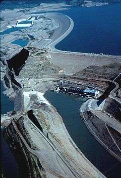
Munda Dam
| Munda Dam | |
|---|---|
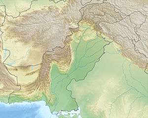 Location of Munda Dam in Pakistan | |
| Official name | Munda Dam |
| Location | Mohmand Agency, Federally Administered Tribal Areas, Pakistan |
| Coordinates | 34°21′11.49″N 071°31′58.72″E / 34.3531917°N 71.5329778°ECoordinates: 34°21′11.49″N 071°31′58.72″E / 34.3531917°N 71.5329778°E |
| Status | Proposed |
| Construction cost | US$ 1.401 Billion (2010 estimate) |
| Owner(s) | Government of Pakistan |
| Operator(s) | Water and Power Development Authority (WAPDA) |
| Dam and spillways | |
| Type of dam | Concrete-faced rock-filled |
| Impounds | Swat River |
| Height | 698.82 ft (213.00 m) |
| Length | 2,500 ft (760 m) |
| Reservoir | |
| Creates | Munda Reservoir |
| Power station | |
| Installed capacity | 740 MW |
| Annual generation | 2407 GWh |
Munda Dam is a proposed multi-purpose concrete-faced rock-filled dam located on the Swat River approximately 37 km north of Peshawar and 5 km upstream of Munda Headworks in the Mohmand Agency of Pakistan's Federally Administered Tribal Areas (FATA).[1][2]
Once completed, the dam will generate 740 MW of hydroelectricity, irrigate 15,100 acres of land and control floods downstream.[3] It is expected to provide numerous estimated annual benefits including Rs. 4.98 billion in annual water storage benefits, Rs. 19.6 billion in power generation benefits by generating 2.4 billion units of electricity annually and Rs. 79 million in annual flood mitigation benefits.[4][5]
Munda Dam is also expected to protect Nowshera and Charsadda districts from seasonal floods by storing peak flood water in its reservoir and releasing it in dry seasons.[6] In December 2010, in the aftermath of the July 2010 floods in Pakistan, the Pakistan Supreme Court had constituted a flood inquiry commission to investigate the damage caused by the July floods that engulfed the country and caused unprecedented damage to life and property. In its report, the commission noted that if the Munda Dam had been constructed, there would have been minimal damage downstream in Charsadda, Peshawar and Nowshera districts and Munda Headworks.[7][8]
The reservoir that will be created behind the dam would also provide recreational facilities and promote fisheries.[9]
Planning and Financing
The initial feasibility study of the Munda Dam Project was completed in March 2000. Subsequently, Pakistan's Ministry of Water & Power awarded a review of the initial feasibility study to an American firm, AMZO LLC, which submitted a revised feasibility study to the Private Power Infrastructure Board (PPIB). The Ministry of Water & Power reassigned the project to Pakistan's Water and Power Development Authority (WAPDA) for carrying out detailed engineering design and construction of the project. Revised Project Cost (PC-II) amounting to Rs. 648.324 million was approved by CDWP subject to availability of foreign funding. Expression of Interest (EOI) for shortlisting of consultants for detailed engineering design and preparation of tender documents were received on 23 November 2010. Nine firms/joint ventures (JVs) submitted EOI documents out of which five firms/JVs were shortlisted and RFP issued to shortlisted firms. Technical and financial proposals from shortlisted firms for detailed engineering design and preparation of tender documents were invited on 6 July 2011.[10] A consortium of consulting firms comprising (i) SMEC(Australia), (ii) NK (Japan) and (iii) NESPAK-ACE-BAK (Pakistan) were finalized as the detailed engineering design consultants for the project in August 2011.[11] Currently, the dam is in final detailed design.
France has granted Euro 61 million (Rs. 8.5 Billion) funding for two hydropower projects in Pakistan. The two projects were Munda hydropower project (740 MW) located in Mohmand Agency, KPK and Harpo hydropower project (35 mW) in the Gilgit-Baltistan, Skardu region.[12]
Salient features
Dam:
Type: Concrete-Faced Rock-Filled
Length: 2,500 ft (760 m)[13]
Height: 698.82 ft (213.00 m)
Width: N/A
Reservoir Capacity:
Gross: 1.290 Million acre-feet (MAF)
Live: 0.676 MAF
Dead: 0.314 MAF
Flood: 0.081 MAF
Power Generation:
Maximum Capacity: 740 MW
Command Area:
Total: 15,100 Acres
Construction:
Construction Period: 7 years
See also
References
- ↑ http://www.wapda.gov.pk/vision2025/htmls_vision2025/munda.htm
- ↑ http://tribune.com.pk/story/46322/munda-dam-to-be-constructed-on-priority-basis/
- ↑ http://www.wapda.gov.pk/vision2025/htmls_vision2025/munda.htm
- ↑ WAPDA advertisement appearing in The Nation, 20 August 2011
- ↑ http://tribune.com.pk/story/46322/munda-dam-to-be-constructed-on-priority-basis/
- ↑ http://tribune.com.pk/story/46322/munda-dam-to-be-constructed-on-priority-basis/
- ↑ http://www.dawn.com/2011/06/16/munda-dam-should-be-a-priority.html
- ↑ http://www.allvoices.com/contributed-news/9311032-munda-dam-could-have-avoided-flood-devastation-report
- ↑ http://pakistantimes.net/pt/detail.php?newsId=14521
- ↑ http://www.wapda.gov.pk/vision2025/htmls_vision2025/munda.htm
- ↑ WAPDA advertisement appearing in The Nation, 20 August 2011
- ↑ http://www.brecorder.com/top-news/109-world-top-news/165627-france-provides-61mn-euros-to-pakistan-for-two-hydropower-projects.html
- ↑ http://pakistantimes.net/pt/detail.php?newsId=14521
External links
- WAPDA Project Details
- The Impact of Munda Dam on the Farm Sector in the Dam Command Area (NWFP-Pakistan)
- Hydro Potential in Pakistan (WAPDA Report)