Katima Mulilo Airport
| Katima Mulilo Airport Mpacha Airport | |||||||||||
|---|---|---|---|---|---|---|---|---|---|---|---|
|
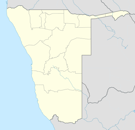 MPA Location of airport in Namibia | |||||||||||
| IATA: MPA – ICAO: FYKM | |||||||||||
| Summary | |||||||||||
| Airport type | Public | ||||||||||
| Owner/Operator | Namibia Airports Co.[1] | ||||||||||
| Serves | Katima Mulilo, Namibia | ||||||||||
| Elevation AMSL | 3,144 ft / 958 m | ||||||||||
| Coordinates | 17°38′00″S 24°10′50″E / 17.63333°S 24.18056°E | ||||||||||
| Runways | |||||||||||
| |||||||||||
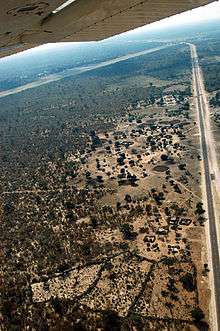
Crossing the Caprivi Highway on approach to Katima's Mpacha Airport.
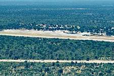
Katima Mulilo Airport (IATA: MPA, ICAO: FYKM, formerly FYMP), also known as Mpacha Airport, serves Katima Mulilo, the capital of the Zambezi Region in Namibia. The airport is on the B8 road, about 18 km (11 mi) southwest of Katima Mulilo.[5]
The Katima Mulilo non-directional beacon (Ident: KL) is located on the field.[6][7]
Airlines and destinations
| Airlines | Destinations |
|---|---|
| Air Namibia | Rundu,[8] Windhoek-Eros |
See also
 Aviation portal
 Namibia portal
- List of airports in Namibia
- Transport in Namibia
References
- ↑ Namibia Airports Company: Airport Information
- ↑ Airport information for FYKM from DAFIF (effective October 2006)
- ↑ Airport information for MPA at Great Circle Mapper.
- ↑ Google Maps - Katima
- ↑ "Distance from Katima Mulilo to airport". WikiMapia. Retrieved 18 Feb 2010.
- ↑ KL NDB
- ↑ Katima Mulilo NDB
- ↑ Air Namibia schedule
External links
This article is issued from Wikipedia - version of the 7/12/2016. The text is available under the Creative Commons Attribution/Share Alike but additional terms may apply for the media files.