Mount Albert Edward, Papua New Guinea
| Mount Albert Edward | |
|---|---|
 The cross on top of Mount Albert Edward | |
| Highest point | |
| Elevation | 3,990 m (13,090 ft) |
| Coordinates | 8°24′40″S 147°24′14″E / 8.411°S 147.404°ECoordinates: 8°24′40″S 147°24′14″E / 8.411°S 147.404°E |
| Geography | |
 Mount Albert Edward | |
| Parent range | Wharton Range |
| Climbing | |
| First ascent | 1906 by C A W Monckton |
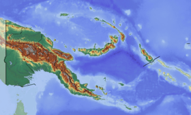
Mount Albert Edward is a 3,990-metre-high (13,091 ft) mountain in the Wharton Range in Central Province, Papua New Guinea. The mountain consists of two peaks about 400 metres apart, a cross marks the top of the slightly higher western peak and a trig station marks the eastern peak. The mountain lies approximately 120 km north of Port Moresby.
The first recorded ascent was in 1906 by C A W Monckton. There were further ascents in the early 20th century, but the first detailed account was made in 1935 following an ascent by Richard Archbold and Austin L. Rand in 1933.
References
- Nolan, Riall W. (1983). Bushwalking in Papua New Guinea (1 ed.). Lonely Planet. pp. 87–97. ISBN 0-908086-41-5.
Further reading
- Archbold, R.; Rand, A.L. (1935). Summary of the 1933-1934 Papuan Expedition. Results of the Archbold Expeditions. No.7. (68(8): 527-579 ed.). Bulletin of the American Museum of Natural History.
- Monckton, C.A.W. (1922). Last Days in New Guinea: Being Further Experiences of a New Guinea Resident Magistrate. Newnes.
Highest Mountains of Papua New Guinea | ||
|---|---|---|
| ||
This article is issued from Wikipedia - version of the 4/30/2016. The text is available under the Creative Commons Attribution/Share Alike but additional terms may apply for the media files.