Albert Mountain (North Carolina)
| Albert Mountain | |
|---|---|
 Albert Mountain viewed from Georgia State Route 246 | |
| Highest point | |
| Elevation | 5,200 ft (1,600 m) [1] |
| Prominence | 200 ft (61 m) [1] |
| Coordinates | 35°03′08″N 83°28′38″W / 35.0523147°N 83.4771007°WCoordinates: 35°03′08″N 83°28′38″W / 35.0523147°N 83.4771007°W [2] |
| Geography | |
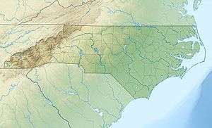 Albert Mountain North Carolina, U.S. | |
| Location | Macon County, North Carolina, United States |
| Parent range | Appalachian Mountains |
| Topo map | USGS Prentiss [3] |
| Climbing | |
| Easiest route | Hike |
Albert Mountain[2] is a mountain in North Carolina's Nantahala Range of the Appalachian Mountains.[3] The Appalachian Trail goes along its summit, which is around 5,200 feet (1,600 m) high.[1][4][5] A fire tower offers views of the Blue Ridge and the Little Tennessee River valley.[6]
Name
Albert Mountain is named after Albert Siler (1829-1904), a local resident. Nearby geographic features are also named after Siler's family, such as Siler Bald (not to be confused with Silers Bald), named after Albert's father William Siler and Rufus Morgan Falls, named after Siler's grandson Rufus Morgan.[7]
Geography
Albert Mountain is located inside the Nantahala National Forest in Macon County.[3][5] The mountain has an elevation of around 5,200 feet (1,600 m).[1] Standing Indian Mountain is located about 3.5 miles (5.6 km) to the south, while the town of Franklin is located about 10 miles (16 km) northeast of the mountain. The summit is also located about 4 miles (6.4 km) north of the Georgia border.[3]
Fire tower
A log lookout cabin has existed on Albert's Mountain since as early as 1942. In 1951, a steel tower was built on Albert Mountain's summit to supplant the abandoned lookout towers on Big Pinnacle Mountain and Standing Indian Mountain and to provide fire detection for the Coweeta Hydrologic Laboratory. The steel tower has a height of 55 feet (17 m). The tower offers views of the Nantahala Mountains and the Little Tennessee River valley. The Great Smoky Mountains and the Great Balsam Mountains are also visible from the fire tower.[7]
Hiking
The Appalachian Trail passes over Albert Mountain's summit. From Bearpen Gap, the hike is about 0.5 miles (0.80 km) up to the summit.[5]
See also
References
- 1 2 3 4 "Albert Mountain, North Carolina". Peakbagger.com. Retrieved 2016-10-29.
- 1 2 U.S. Geological Survey Geographic Names Information System: Albert Mountain (North Carolina)
- 1 2 3 4 United States Geological Survey (29 October 2016). "United States Geological Survey Topographic Map: Prentiss, NC quadrangle" (Map). TopoQuest. Sunset Dynamics. Retrieved 29 October 2016.
- ↑ Sorrell, Robert. Blue Ridge Fire Towers (2015). pp. 95. Arcadia Publishing. ISBN 1626198179.
- 1 2 3 "Albert Mountain". SummitPost.org. Retrieved 2016-10-29.
- ↑ Appalachian Trail: Albert Mountain fire tower to Mooney Gap. ashevilletrails.com. Retrieved 29 October 2016.
- 1 2 Barr, Peter. Hiking North Carolina's Lookout Towers (2008). John F Blair Pub. pp. 43-52. ISBN 0895874334.