Mortágua
| Mortágua | |||
|---|---|---|---|
| Municipality | |||
|
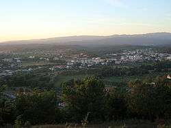
View of Mortágua valley | |||
| |||
 | |||
| Coordinates: 40°26′N 8°14′W / 40.433°N 8.233°WCoordinates: 40°26′N 8°14′W / 40.433°N 8.233°W | |||
| Country |
| ||
| Region | Centro | ||
| Subregion | Dão-Lafões | ||
| Intermunic. comm. | Região de Coimbra | ||
| District | Viseu | ||
| Parishes | 7 | ||
| Government | |||
| • President | José Júlio Norte (PPD-PSD) | ||
| Area | |||
| • Total | 251.18 km2 (96.98 sq mi) | ||
| Population (2011) | |||
| • Total | 9,607 | ||
| • Density | 38/km2 (99/sq mi) | ||
| Time zone | WET/WEST (UTC+0/+1) | ||
| Website | http://www.cm-mortagua.pt/ | ||


Mortágua (Portuguese pronunciation: [muɾˈtaɣwɐ] or [mɔɾˈtaɣwɐ]) is a municipality in the district of Viseu, Portugal. The population in 2011 was 9,607,[1] in an area of 251.18 km².[2]
The present mayor is José Júlio Norte, elected in 2013 by the Social Democratic Party.
History
Legend suggests that that village was formed on a lake; settlers recalled that Água Morta (dead water) existed here, but no physiological evidence remains of the body of water.[3] But, the name overtime stayed and evolved, becoming the variant today of the local municipality.
About 1 kilometre (0.62 mi) from the main village is a hill, covered in vegetation, but whose lateral flank was occupied by a Moorish settlement known as Crasto.[3] Over a cliff archeologists discovered several homes including a building that was defined as a kitchen, on its edge.[3]
By 1895, several chapels were situated on this hilltop, which had become known as Cabeça da Senhora do Mundo (owing to the existence of an image to that invocation).[3]
Geography
Administratively, the municipality is divided into 7 civil parishes (freguesias):[4]
- Cercosa
- Espinho
- Marmeleira
- Mortágua, Vale de Remígio, Cortegaça e Almaça
- Pala
- Sobral
- Trezói
References
Notes
- ↑ Instituto Nacional de Estatística
- ↑ Direção-Geral do Território
- 1 2 3 4 J.L. de V. (1895), p.10
- ↑ Diário da República. "Law nr. 11-A/2013, page 552 78" (pdf) (in Portuguese). Retrieved 28 July 2014.
Sources
- J.L. de V., "Antiguidades de Mortágua", O Arqueólogo Português (PDF) (in Portuguese) (Série 1 ed.), Lisbon, Portugal: DGPC, p. 10