Clarence Moreton Basin
| Clarence Moreton Basin | |
|---|---|
|
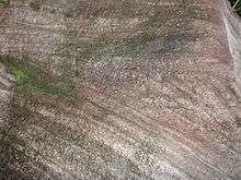
Walloon Coal Measures exposed in quarry at Bexhill | |
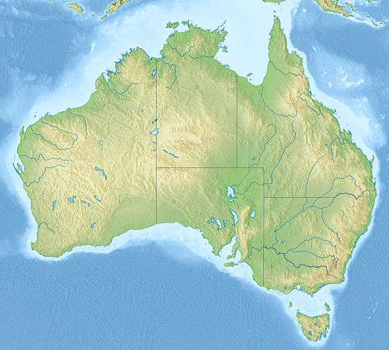 Location in Australia | |
| Location | Northern Rivers region in New South Wales and South East region of Queensland |
| Coordinates | 30°00′N 152°30′E / 30°N 152.5°ECoordinates: 30°00′N 152°30′E / 30°N 152.5°E |
| Range | Tweed, Border, Lamington, McPherson |
| Geology | Sedimentary basin |
| Age | Late Triassic to late Jurassic |
| Website | Geoscience Australia |

The Clarence Moreton Basin is a Mesozoic sedimentary basin on the easternmost part of the Australian continent. It is located in the far north east of the state of New South Wales around Lismore and Grafton and in the south east corner of Queensland. It formed by oblique extension of the underlying Paleozoic New England Orogen basement. It consists of continental deposits, starting with a small amount of Triassic coal beds, and then mostly Jurassic and Cretaceous sedimentary rocks.[1] The basin covers 16,000 square kilometres (6,200 sq mi).[2] The basin was named when the Clarence Basin (named after the Clarence River) and Moreton Basin in Queensland were proved to be one structure.[1]
Location and features
The oldest rocks in the Clarence Moreton Basin of New South Wales are the Chillingham Volcanics. These are from some time in the Triassic period, and outcrop in a band north and south of Chillingham. They consist of conglomerate at the base, Rhyolite, lithic rhyolitic tuff, and shale.[3] The Nymboida Coal measures extend from Nymboida to Kangaroo Creek. They consist of lithic sandstones (wackes, minor arenites), siltstone, polymictic conglomerate, coal, rhyolitic tuff, and basalt. The total thickness is over 1,000 metres (3,300 ft). The outcrop is 90 square kilometres (35 sq mi), and it forms a north west trending band 29 kilometres (18 mi) long on the southwest tip of the basin.[3] Fossils reveal a date of middle Triassic. A lower part is called Cloughers Creek Formation.[1][4] The Basin Creek Formation[5] includes the coal mined at Nymboida. The Bardool Conglomerate forming a 180 m thick layer,[6] is also a unit in the coal measures. The conglomerate includes a 15-metre (49 ft) thick layer of basalt exposed at Copes Creek.[1]
The Red Cliff Coal Measures are from late Triassic. It forms an outcropping belt 2.5 kilometres (1.6 mi) wide and 19 kilometres (12 mi) long from Buchanans Head trough Red Cliff.[7] The Evans Head Coal measure are correlated with these, but are further up the north coast at Evans Head.[8]
The basin was next uplifted and eroded and then deepened considerably and Bundamba group rocks form a complete V shape on both sides of the basin. In the northern parts the rock is mostly friable sandstone, but in the south it is divided into conglomerate below and siltstone above. The Laytons Range Conglomerate[9] rests on the basin floor and extends from Baryulgil, to Nymboida. The conglomerate often appears as a cliff. The Corindi Conglomerate is a local name for a hailstone sized gravel near Corindi. The Mill Creek Siltstone.[10] are often olive green or yellow-brown with bright red joint planes.[1]
The Marburg subgroup[11] extends for 225 kilometres (140 mi) along the western side of the basin into Queensland from Corindi. It is mostly clay cemented cross bedded quartz sandstone, but this is interbedded with claystone and shale. At the base is the Blaxland Fossil Wood Conglomerate Member at Blaxlands Creek. The fossil wood is in the form of horizontal tree trunks up to 18 metres (59 ft) long and 600 millimetres (24 in) in diameter. The fossilization process replaced the wood with limonite and hematite.[1] The Towallum Basalt is a 15-metre (49 ft) thick layer near Nymboida, Glenreagh and Moleton trig station overlying the Marburg formation.[1] The Walloon Coal Measures[12] forms a U shape around the east, south and west sides of the basin. It consists of claystone, shale, siltstone, arenites, and coal seams and the plant fossils in it show a Jurassic age.[12]
The next layer of rocks in the basin forming a nested U shape in its exposure is the Kangaroo Creek Sandstone.[13] This sandstone has saccharoidal texture, and glistens white and cream. This is not due to angular sand grains, but results from silica crystallization. It is up to 150 metres (490 ft) thick.[1]
The Grafton Formation[14] is the sedimentary unit in the core of the basin. It is the youngest of the beds being between Late Jurassic and early Cretaceous. It occurs from Grafton to Casino consisting of soft sandstone, siltstone and claystone. Dolerite has intruded this at Glenugie Peak, and near Banyabba.[1]
Rifting along the east coast of Australia commenced and uplifted the eastern side of the Clarence Moreton Basin.[2] This resulted in the splitting off of the Lord Howe Rise and the opening of the ocean floor.[15]
References
- 1 2 3 4 5 6 7 8 9 McElroy, C. T. (November 1969). "The Clarence-Moreton Basin in New South Wales". In Packham, G. H. The Geology of New South Wales. Sydney: Geological Society of Australia. pp. 457–479.
- 1 2 "Clarence-Moreton Basin - Geological Overview". Trade & Investment: Resources and Energy. Government of New South Wales. Retrieved 14 May 2015.
- 1 2 "Chillingham Volcanics". Australian Stratigraphic Names Database. Geoscience Australia. 24 September 2008.
- ↑ "Cloughers Creek Formation". Australian Stratigraphic Names Database. Geoscience Australia. 13 December 2007.
- ↑ "Basin Creek Formation". Australian Stratigraphic Names Database. Geoscience Australia. 25 August 2008.
- ↑ "Bardool Conglomerate". Australian Stratigraphic Names Database. Geoscience Australia. 13 December 2007.
- ↑ "Red Cliff Coal Measures". Australian Stratigraphic Names Database. Geoscience Australia. 19 February 2008.
- ↑ "Evans Head Coal Measures". Australian Stratigraphic Names Database. Geoscience Australia. 24 September 2008.
- ↑ "Laytons Range Conglomerate". Australian Stratigraphic Names Database. Geoscience Australia. 22 May 2008.
- ↑ "Mill Creek Siltstone". Australian Stratigraphic Names Database. Geoscience Australia. 22 May 2008.
- ↑ "Marburg Subgroup". Australian Stratigraphic Names Database. Geoscience Australia. 16 April 2009.
- 1 2 "Walloon Coal Measures". Australian Stratigraphic Names Database. Geoscience Australia. 27 August 2008.
- ↑ "Kangaroo Creek Sandstone". Australian Stratigraphic Names Database. Geoscience Australia. 4 December 2008.
- ↑ "Grafton Formation". Australian Stratigraphic Names Database. Geoscience Australia. 27 August 2008.
- ↑ Geological Survey of New South Wales. "Offshore Clarence-Moreton Basin - Geological Overview".