Brevort Township, Michigan
| Brevort Township, Michigan | |
|---|---|
| Township | |
 Brevort Township, Michigan Location within the state of Michigan | |
| Coordinates: 46°2′46″N 84°50′35″W / 46.04611°N 84.84306°WCoordinates: 46°2′46″N 84°50′35″W / 46.04611°N 84.84306°W | |
| Country | United States |
| State | Michigan |
| County | Mackinac |
| Area | |
| • Total | 98.8 sq mi (256.0 km2) |
| • Land | 92.5 sq mi (239.5 km2) |
| • Water | 6.4 sq mi (16.5 km2) |
| Elevation | 686 ft (209 m) |
| Population (2000) | |
| • Total | 649 |
| • Density | 7.0/sq mi (2.7/km2) |
| Time zone | Eastern (EST) (UTC-5) |
| • Summer (DST) | EDT (UTC-4) |
| FIPS code | 26-10360[1] |
| GNIS feature ID | 1625975[2] |
Brevort Township is a civil township of Mackinac County in the U.S. state of Michigan. As of the 2000 census, the township population was 649. Most of the township land is within the eastern portion of the Hiawatha National Forest. The township includes part of the Mackinac Wilderness, a listed Wilderness Area.
The township was named after Henry Brevort (or Brevoort), a surveyor assigned to subdivide the area in 1845.[3]
Communities
- Allenville was a station on the Detroit, Mackinac and Marquette Railroad less than one mile southeast of Moran at 45°59′05″N 84°49′14″W / 45.98472°N 84.82056°W.[4] It was founded by J. Alley, head of the Alley Lumber Company in 1873. A post office operated from December 1873 until October 1891. Also known as "Alley Town", the community was almost destroyed by fire in 1882.[3]
- Moran is an unincorporated community on M-123 at 45°59′39″N 84°49′51″W / 45.99417°N 84.83083°W[5] approximately 13 miles northwest of St. Ignace. Confusingly, the community is not a part of Moran Township, which is adjacent to Brevort Township on the south and west. It was initially called "Jacob City", after the president of the German Land Company of Detroit, which sold land to members in 1881-83. In 1883, Jacob was accused of fraud and ousted from the organization. Another member of the group, William B. Moran, loaned the group funds to buy additional land and the settlement was renamed after him in 1883. A post office named Jacob City was established in February 1882 and renamed Moran in January 1883. The office was transferred to and renamed Allenville in April 1898, but a Moran post office was re-established in May 1910. The name of Moran Township and other nearby places named Moran such as East Moran Bay in St. Ignace, West Moran Bay on Lake Michigan, and the Moran River all have a different origin, and instead derive from the French Morin.[3]
Geography
According to the United States Census Bureau, the township has a total area of 98.8 square miles (256 km2), of which 92.5 square miles (240 km2) is land and 6.4 square miles (17 km2) (6.44%) is water.
Demographics

As of the census[1] of 2000, there were 649 people, 264 households, and 184 families residing in the township. The population density was 7.0 per square mile (2.7/km²). There were 561 housing units at an average density of 6.1 per square mile (2.3/km²). The racial makeup of the township was 79.51% White, 15.10% Native American, 0.15% Asian, and 5.24% from two or more races. Hispanic or Latino of any race were 0.92% of the population.
There were 264 households out of which 30.7% had children under the age of 18 living with them, 55.7% were married couples living together, 7.2% had a female householder with no husband present, and 30.3% were non-families. 23.9% of all households were made up of individuals and 10.2% had someone living alone who was 65 years of age or older. The average household size was 2.46 and the average family size was 2.86.
In the township the population was spread out with 23.3% under the age of 18, 8.8% from 18 to 24, 25.6% from 25 to 44, 29.0% from 45 to 64, and 13.4% who were 65 years of age or older. The median age was 40 years. For every 100 females there were 102.8 males. For every 100 females age 18 and over, there were 101.6 males.
The median income for a household in the township was $33,611, and the median income for a family was $36,591. Males had a median income of $30,156 versus $21,250 for females. The per capita income for the township was $19,878. About 6.6% of families and 9.5% of the population were below the poverty line, including 12.9% of those under age 18 and 7.1% of those age 65 or over.
References
- 1 2 "American FactFinder". United States Census Bureau. Archived from the original on 2013-09-11. Retrieved 2008-01-31.
- ↑ U.S. Geological Survey Geographic Names Information System: Brevort Township, Michigan
- 1 2 3 Romig, Walter (1986) [1973]. Michigan Place Names. Detroit, Michigan: Wayne State University Press. ISBN 0-8143-1838-X.
- ↑ U.S. Geological Survey Geographic Names Information System: Allenville, Michigan
- ↑ U.S. Geological Survey Geographic Names Information System: Moran, Michigan
Municipalities and communities of Mackinac County, Michigan, United States | ||
|---|---|---|
| Cities | 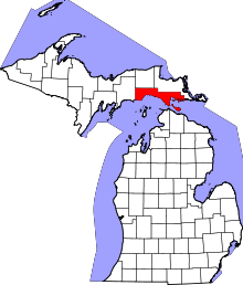 | |
| Townships | ||
| Unincorporated communities | ||