Monseñor Nouel Province
| Monseñor Nouel | |
| Province | |
| Country | |
|---|---|
| Capital | Bonao |
| - elevation | 173 m (568 ft) |
| - coordinates | 18°57′0″N 70°24′36″W / 18.95000°N 70.41000°WCoordinates: 18°57′0″N 70°24′36″W / 18.95000°N 70.41000°W |
| Area | 992.39 km2 (383 sq mi) |
| Population | 203,183 (2014) [1] |
| Density | 205/km2 (531/sq mi) |
| Province since | 1991 |
| Subdivisions | 3 municipalities 7 municipal districts |
| Congresspersons | 1 Senator 3 Deputies |
| Timezone | EST (UTC-4) |
| Area code | 1-809 1-829 1-849 |
| ISO 3166-2 | DO-28 |
| Postal Code | 42000 |
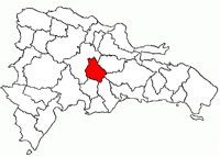 Location of the Monseñor Nouel Province | |
Monseñor Nouel (Spanish pronunciation: [monseˈɲor nuˈwel]) is a province of the Dominican Republic. It was split from La Vega in 1982.
It is named for Monseñor Dr. Adolfo Alejandro Nouel y Bobadilla (1862-1937), Archbishop of Santo Domingo and briefly President of the Republic in 1912-3.
Municipalities and municipal districts
The province as of June 20, 2006 is divided into the following municipalities (municipios) and municipal districts (distrito municipal - D.M.) within them:[2]
- Bonao
- Arroyo Toro-Masipedro (D.M.)
- Jayaco (D.M.)
- Juma Bejucal (D.M.)
- La Salvia-Los Quemados
- Sabana del Puerto (D.M.)
- Maimón
- Piedra Blanca
- Juan Adrián (D.M.)
- Villa Sonador (D.M.)
The following is a sortable table of the municipalities and municipal districts with population figures as of the 2012 census. Urban population are those living in the seats (cabeceras literally heads) of municipalities or of municipal districts. Rural population are those living in the districts (Secciones literally sections) and neighborhoods (Parajes literally places) outside of them.[3]
For comparison with the municipalities and municipal districts of other provinces see the list of municipalities and municipal districts of the Dominican Republic.
| Name | Total population | Urban population | Rural population |
|---|---|---|---|
| Bonao | 158,034 | 97,990 | 60,044 |
| Maimón | 18,655 | 14,069 | 4,586 |
| Piedra Blanca | 24,785 | 16,090 | 8,695 |
| Monseñor Nouel province | 201,474 | 120,754 | 80,720 |
References
- ↑ Consejo Nacional de Población y Familia. "Estamaciones y Proyecciones de la Población Dominicana por Regiones, Provincias, Municipios y Distritos Municipales, 2014" (PDF) (in Spanish). Retrieved 2014-02-02.
- ↑ Oficina Nacional de Estadistica, Departamento de Cartografia, Division de Limites y Linderos. "Listado de Codigos de Provincias, Municipio y Distritos Municipales, Actualizada a Junio 20 del 2006" (in Spanish). Retrieved 2007-01-24.
- ↑ Consejo Nacional de Población y Familia. "Censos y Proyecciones de la Población Dominicana por Regiones, Provincias, Municipios y Distritos Municipales, 2012" (PDF) (in Spanish). Retrieved 2012-01-11.
External links
- (Spanish) Oficina Nacional de Estadística, Statistics Portal of the Dominican Republic
- (Spanish) Oficina Nacional de Estadística, Maps with administrative division of the provinces of the Dominican Republic, downloadable in PDF format