Shafter Airport
| Shafter Airport Minter Field | |||||||||||||||
|---|---|---|---|---|---|---|---|---|---|---|---|---|---|---|---|
|
USGS 2006 orthophoto | |||||||||||||||
| IATA: MIT – ICAO: KMIT – FAA LID: MIT | |||||||||||||||
| Summary | |||||||||||||||
| Airport type | Public | ||||||||||||||
| Owner | Minter Field Airport District | ||||||||||||||
| Serves | Shafter, California | ||||||||||||||
| Elevation AMSL | 424 ft / 129 m | ||||||||||||||
| Coordinates | 35°30′21″N 119°11′30″W / 35.50583°N 119.19167°WCoordinates: 35°30′21″N 119°11′30″W / 35.50583°N 119.19167°W | ||||||||||||||
| Website | www.MinterField.com | ||||||||||||||
| Map | |||||||||||||||
 MIT Location of airport in California | |||||||||||||||
| Runways | |||||||||||||||
| |||||||||||||||
| Statistics (2011) | |||||||||||||||
| |||||||||||||||

Shafter Airport (IATA: MIT, ICAO: KMIT, FAA LID: MIT), also known as Minter Field, is a public use airport located four nautical miles (5 mi, 7 km) east of the central business district of Shafter, a city in Kern County, California, United States. It is owned by the Minter Field Airport District.[1] This airport is included in the National Plan of Integrated Airport Systems for 2011–2015, which categorized it as a general aviation facility.[2]
History
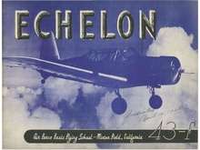
Lerdo Field, as the airport was initially known during World War II was first opened in June 1941 when the United States Army Air Corps (USAAC) dispatched a small garrison of airmen to open an airfield at Shafter.[3]
The name was derived from close proximity to the highway of the same name. The airfield commander utilized Bakersfield College as his headquarters, while airmen were quartered in temporary facilities from Bakersfield to Wasco while barracks and other structures were being built. As construction proceeded though the rest of the year, the Minter Sub-Depot was established as a branch of the Sacramento Air Depot.
In August, the first operational training units (OTU)s began arriving at Minter, the airfields mission being advanced pilot training of USAAC bomber, attack, transport and pursuit pilots. In April 1942, contracts for the construction of more than 65 on-base buildings were let while the constantly increasing numbers of cadets were housed in a large tent city erected as temporary shelter.
With the relative completion of construction in July 1942, the airfield was renamed Minter Field Army Airfield a member of the locally prominent Minter family. The Lieutenant, a World War I veteran, was killed in a mid-air collision over March Field in July, 1932. The airfield was placed under the overall command of the United States Army Air Forces West Coast Training Center. Known sub-bases and auxiliaries of Minter Field were:
- Wasco Auxiliary Airfield (No.1) – 35°37′12″N 119°21′14″W / 35.62000°N 119.35389°W
- Bakersfield Auxiliary Airfield (No.2) – Location undetermined
- Famoso Bakersfield Auxiliary Airfield (No.3) – 35°38′28″N 119°12′43″W / 35.64111°N 119.21194°W
- Dunlap Auxiliary Airfield (No.4) (AKA Jasmin Landing Field) – 35°44′37″N 119°08′37″W / 35.74361°N 119.14361°W
- Semi-tropic Auxiliary Airfield (No.5) – 35°45′25″N 119°30′45″W / 35.75694°N 119.51250°W
- Poso Auxiliary Airfield (No.6) – 35°35′48″N 119°08′01″W / 35.59667°N 119.13361°W
- Lost Hills Auxiliary Airfield (No.7) – 35°37′27″N 119°41′15″W / 35.62417°N 119.68750°W
- Coalinga Municipal Airport (Old) (Closed) – 36°09′27″N 120°21′35″W / 36.15750°N 120.35972°W
The primary aircraft flown at Minter Field was the Vultee BT-13 Valiant, which was used for basic flight training. Other training aircraft included the Cessna UC-78 Bobcat, as well as the AT-6 Texan advanced trainer, North American B-25 Mitchell twin-engine medium bomber, and Lockheed P-38 Lightning, as well as other widely used fighter, bomber and observation craft.
With the end of the war in 1945, airfield was determined to be excess by the military and turned over to the local government for civil use in March 1948.[4]
The Gossamer Condor piloted by Bryan Allen won the first Kremer prize on August 23, 1977 by completing a figure '8' course specified by the Royal Aeronautical Society at Minter Field. A California State Monument is located at the Field for this event.
Facilities and aircraft
Shafter-Minter Field covers an area of 1,206 acres (488 ha) at an elevation of 424 feet (129 m) above mean sea level. It has two runways: 12/30 is 4,501 by 100 feet (1,372 x 30 m) with an asphalt surface; 17/35 is 2,970 by 100 feet (905 x 30 m) with a concrete surface.[1]
For the 12-month period ending November 1, 2011, the airport had 45,000 general aviation aircraft operations, an average of 123 per day. At that time there were 114 aircraft based at this airport: 77% single-engine, 8% helicopter, 7% ultralight, 4% jet, and 4% multi-engine.[1]
See also
- California World War II Army Airfields
- 35th Flying Training Wing (World War II)
- List of airports in Kern County, California
References
- 1 2 3 4 FAA Airport Master Record for MIT (Form 5010 PDF). Federal Aviation Administration. Effective May 31, 2012.
- ↑ "2011–2015 NPIAS Report, Appendix A" (PDF, 2.03 MB). National Plan of Integrated Airport Systems. Federal Aviation Administration. October 4, 2010. External link in
|work=(help) - ↑ Thole, Lou (1999), Forgotten Fields of America : World War II Bases and Training, Then and Now - Vol. 2. Publisher: Pictorial Histories Pub, ISBN 1-57510-051-7
- ↑ "Minter Army Airfield History". Minter Field Air Museum. Retrieved April 20, 2008.
| Wikimedia Commons has media related to Minter Field. |
Other sources
-
 This article incorporates public domain material from the Air Force Historical Research Agency website http://www.afhra.af.mil/.
 - Shaw, Frederick J. (2004), Locating Air Force Base Sites History’s Legacy, Air Force History and Museums Program, United States Air Force, Washington DC, 2004.
- Manning, Thomas A. (2005), History of Air Education and Training Command, 1942–2002. Office of History and Research, Headquarters, AETC, Randolph AFB, Texas ASIN: B000NYX3PC
External links
- Shafter Airport/Minter Field, official site
- Minter Field Air Museum
- Aerial image as of September 1994 from USGS The National Map
- FAA Terminal Procedures for MIT, effective December 8, 2016
- Resources for this airport:
- FAA airport information for MIT
- AirNav airport information for KMIT
- ASN accident history for MIT
- FlightAware airport information and live flight tracker
- SkyVector aeronautical chart for KMIT
| Flying Training |
|  | ||||||
|---|---|---|---|---|---|---|---|---|
| Technical Training |
| |||||||