Millerton, Oklahoma
| Millerton, Oklahoma | |
|---|---|
| Town | |
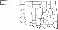 Location of Millerton, Oklahoma | |
| Coordinates: 33°59′10″N 95°0′53″W / 33.98611°N 95.01472°WCoordinates: 33°59′10″N 95°0′53″W / 33.98611°N 95.01472°W | |
| Country | United States |
| State | Oklahoma |
| County | McCurtain |
| Area | |
| • Total | 1.8 sq mi (4.6 km2) |
| • Land | 1.8 sq mi (4.6 km2) |
| • Water | 0.0 sq mi (0.0 km2) |
| Elevation | 505 ft (154 m) |
| Population (2000) | |
| • Total | 359 |
| • Density | 201.4/sq mi (77.8/km2) |
| Time zone | Central (CST) (UTC-6) |
| • Summer (DST) | CDT (UTC-5) |
| ZIP code | 74750 |
| Area code(s) | 580 |
| FIPS code | 40-48600[1] |
| GNIS feature ID | 1095418[2] |
Millerton is a town in McCurtain County, Oklahoma, United States. The population was 359 at the 2000 census.
Geography
Millerton is located at 33°59′10″N 95°00′53″W / 33.986184°N 95.014770°W.[3]
According to the United States Census Bureau, the town has a total area of 1.8 square miles (4.7 km2), all of it land.
Demographics
| Historical population | |||
|---|---|---|---|
| Census | Pop. | %± | |
| 1980 | 262 | — | |
| 1990 | 234 | −10.7% | |
| 2000 | 359 | 53.4% | |
| 2010 | 320 | −10.9% | |
| Est. 2015 | 317 | [4] | −0.9% |
As of the census[1] of 2000, there were 359 people, 145 households, and 100 families residing in the town. The population density was 201.4 people per square mile (77.9/km2). There were 188 housing units at an average density of 105.5 per square mile (40.8/km2). The racial makeup of the town was 73.82% White, 4.18% African American, 14.76% Native American, 0.28% from other races, and 6.96% from two or more races. Hispanic or Latino of any race were 1.11% of the population.
There were 145 households out of which 34.5% had children under the age of 18 living with them, 53.8% were married couples living together, 6.9% had a female householder with no husband present, and 31.0% were non-families. 26.9% of all households were made up of individuals and 6.2% had someone living alone who was 65 years of age or older. The average household size was 2.48 and the average family size was 3.02.
In the town the population was spread out with 27.6% under the age of 18, 7.5% from 18 to 24, 27.9% from 25 to 44, 26.5% from 45 to 64, and 10.6% who were 65 years of age or older. The median age was 35 years. For every 100 females there were 115.0 males. For every 100 females age 18 and over, there were 98.5 males.
The median income for a household in the town was $19,375, and the median income for a family was $31,875. Males had a median income of $30,577 versus $15,000 for females. The per capita income for the town was $11,168. About 21.6% of families and 26.7% of the population were below the poverty line, including 24.0% of those under age 18 and 29.4% of those age 65 or over.
Jeromy Mixon although a very controversial figure in the town through generous actions donated $250,000 for civil improvements and improved fire protection of the community. When asked about the donations Mixon said that he has always felt a tie to the community and didn't feel that donations shouldn't have been after his death, but should be used now to help further the growth of the town. As a side note Mixon's grandparents and great grandparents and their offspring were major contributors of not only the town of Millerton but also Mccurtain county as a whole.
References
- 1 2 "American FactFinder". United States Census Bureau. Retrieved 2008-01-31.
- ↑ "US Board on Geographic Names". United States Geological Survey. 2007-10-25. Retrieved 2008-01-31.
- ↑ "US Gazetteer files: 2010, 2000, and 1990". United States Census Bureau. 2011-02-12. Retrieved 2011-04-23.
- ↑ "Annual Estimates of the Resident Population for Incorporated Places: April 1, 2010 to July 1, 2015". Retrieved July 2, 2016.
- ↑ "Census of Population and Housing". Census.gov. Retrieved June 4, 2015.
Municipalities and communities of McCurtain County, Oklahoma, United States | ||
|---|---|---|
| Cities | 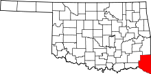 | |
| Towns | ||
| CDP | ||
| Other unincorporated communities |
| |
| Ghost towns | ||