Migré
| Migré | |
|---|---|
 | |
 Migré | |
|
Location within Nouvelle-Aquitaine region  Migré | |
| Coordinates: 46°04′31″N 0°33′23″W / 46.0753°N 0.5564°WCoordinates: 46°04′31″N 0°33′23″W / 46.0753°N 0.5564°W | |
| Country | France |
| Region | Nouvelle-Aquitaine |
| Department | Charente-Maritime |
| Arrondissement | Saint-Jean-d'Angély |
| Canton | Loulay |
| Intercommunality | Canton de Loulay |
| Government | |
| • Mayor (2008–2014) | Jean-Yves Grolleau |
| Area1 | 14.3 km2 (5.5 sq mi) |
| Population (2008)2 | 337 |
| • Density | 24/km2 (61/sq mi) |
| Time zone | CET (UTC+1) |
| • Summer (DST) | CEST (UTC+2) |
| INSEE/Postal code | 17234 / 17330 |
| Elevation |
26–88 m (85–289 ft) (avg. 30 m or 98 ft) |
|
1 French Land Register data, which excludes lakes, ponds, glaciers > 1 km² (0.386 sq mi or 247 acres) and river estuaries. 2 Population without double counting: residents of multiple communes (e.g., students and military personnel) only counted once. | |
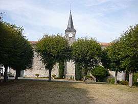
Migré is a commune in the Charente-Maritime department in southwestern France.
Population
| Historical population | ||
|---|---|---|
| Year | Pop. | ±% |
| 1793 | 562 | — |
| 1800 | 529 | −5.9% |
| 1806 | 533 | +0.8% |
| 1821 | 605 | +13.5% |
| 1831 | 674 | +11.4% |
| 1836 | 727 | +7.9% |
| 1841 | 795 | +9.4% |
| 1846 | 781 | −1.8% |
| 1851 | 774 | −0.9% |
| 1856 | 746 | −3.6% |
| 1861 | 772 | +3.5% |
| 1866 | 789 | +2.2% |
| 1872 | 767 | −2.8% |
| 1876 | 783 | +2.1% |
| 1881 | 721 | −7.9% |
| 1886 | 658 | −8.7% |
| 1891 | 585 | −11.1% |
| 1896 | 619 | +5.8% |
| 1901 | 606 | −2.1% |
| 1906 | 630 | +4.0% |
| 1911 | 613 | −2.7% |
| 1921 | 566 | −7.7% |
| 1926 | 571 | +0.9% |
| 1931 | 562 | −1.6% |
| 1936 | 555 | −1.2% |
| 1946 | 633 | +14.1% |
| 1954 | 504 | −20.4% |
| 1962 | 479 | −5.0% |
| 1968 | 480 | +0.2% |
| 1975 | 406 | −15.4% |
| 1982 | 338 | −16.7% |
| 1990 | 329 | −2.7% |
| 1999 | 320 | −2.7% |
| 2008 | 337 | +5.3% |
See also
References
| Wikimedia Commons has media related to Migré. |
This article is issued from Wikipedia - version of the 3/4/2013. The text is available under the Creative Commons Attribution/Share Alike but additional terms may apply for the media files.