Miangas
| Native name: <span class="nickname" ">Pulau Miangas | |
|---|---|
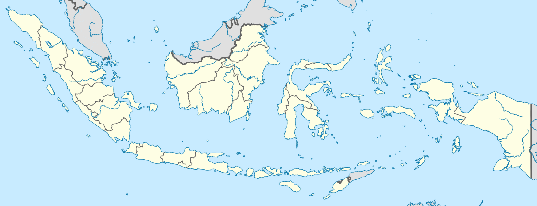 Miangas Location of Miangas in Indonesia | |
| Geography | |
| Coordinates | 5°34′02″N 126°34′54″E / 5.5672°N 126.5817°ECoordinates: 5°34′02″N 126°34′54″E / 5.5672°N 126.5817°E |
| Archipelago | Talaud Islands |
| Administration | |
|
Indonesia | |
Miangas or Palmas is North Sulawesi's northernmost island, and one of the 92 officially listed outlying islands of Indonesia.
Etymology
According to Ganesan and Amer, the word miangas means "open for the sea pirates", because the pirates from Mindanao used to visit the island.[1] In the 16th century, the island was named Isla de las Palmas in Spanish, while in Portuguese it was named Ilha de Palmeiras.[2] In the Sasahara language,[lower-alpha 1] The island is called Tinonda or Poilaten, which mean "people who live separated from the main archipelago" and "our island" respectively.[3]
History
According to local tradition, there were a number of kingdoms in the area. Sangir, Talaud and Sitaro belonged to two kingdoms, Tabukan and Kalongan. To justify their sovereignty over Miangas, the Dutch argued that the island had been under the domination of the princes of Sangir.[4]
First Europeans
In October 1526, Garcia de Loaisa, Spanish sailor and researcher, was the first European to visit the island.[5]
The island had been used as a defense site by Talaud people while Sulu Sultanate attacked them.[6]
The island was affected by the outbreak of cholera in 1885, causing hundreds of the inhabitants to move to Karakelang Island.[7]
In 1895, E. J. Jellesma, a Manado resident, visited Miangas to praise Miangas residents and kapiten laut after rejecting the Spanish flag. Jellesma gave them a medal and Dutch flag. Along with Jellesma, were Pastor Kroll. 254 residents were baptized by Kroll into Protestant. After Jellesma's visit, a Tahuna assistant resident and Pastor Pannings visited the island in April and October 1909.[8]
The Island of Palmas Case
According to Treaty of Paris, the Philippines area was all areas inside a large geographic box. Miangas lay inside the southern boundary of the box. On 21 January 1906, General Leonard Wood, Governor General of Moro, officially visited the island for the first time.[9][10] He found the Dutch flag already flew there and that the island was claimed as part of the Dutch East Indies.[11] When Wood returned to Zamboanga, he reported it to the United States Military Secretary, on 26 January 1906. The United States government referred the matter to the Netherlands through their embassy in The Hague on 31 March 1906. On 17 October 1906 the Netherlands Foreign Ministry responded with reasons why the island was included in the Dutch East Indies.[12] On 23 January 1925 the Netherlands and the United States brought the case to the Permanent Court of Arbitration, under a sole arbitrator Max Huber of Switzerland.[10][13] On 4 April 1928 Huber decided that the island "forms in its entirety a part of Netherlands territory".[14][15][16]
Post Indonesian independence
On 4 July 1956, Indonesia, represented by Ambassador Soehardjo Wirjopranoto, and the Philippines, represented by Ambassador Jose T. Fuentebella, signed Agreement on Immigration Between the Republic of the Philippines and the Republic of Indonesia, which allowed border residents in Sangihe, Talaud, Nunukan, Balut, and Sarangani, who had passing card to cross the border to trade, visit family, worship, and travel. On 16 September 1965, Jusuf Ronodipuro of Indonesia and Leon T. Garcia of the Philippines signed a Directives and Guidelines on the Implementation of the Immigration Agreement on Repatriation and Border Crossing Arrangement Between Republic of Indonesia and the Republic of the Philippines, which clarify the first agreement, making Marore, Miangas, Mabila, and Balut as the checkpoints.[17]
In 1972, the island was hit by a tsunami, 90 householders were moved by government to Bolaang-Mongondow Regency as a result.[7]
In 2005, however, Indonesia government forbade a shipping line from Miangas to Davao (part of the Philippines). The same year, Miangas inhabitants waved the Philippines' flag as a protest to officers who killed a local resident.[6]
In February 2009, Philippine Tourism Authority published a map which included Miangas as the Philippines' territory. According to Indonesian Foreign Ministry's spokesman, the map was probably made by private company, not by the Philippine government.[18]
A monument, named Monumen Patung Santiago (Monument of Santiago Statue), has been built on the island in 2010 to recall Santiago who defended the island from the Dutch colonials.[6][19] In 2011, the island could be reached by ship operated by Pelni.[20]
Geography
Miangas is located 324 miles from Manado, the capital of North Sulawesi and 78 miles from Davao City.[21] It also lays 50 miles southeast of Mindanao.[11]> Its length and width are 2 miles and 0.75 miles respectively,[22] which make the island covering 3.15 km2.[18] Miangas belongs to Nanusa district, Talaud Islands Regency.[20][23] The island mostly is lowland, which is about 1.5 meters above the sea level. The highest point is 111 meters called Gunung Batu, located in northeast part of the island. This area is covered with coconut palm. In the northeast corner of the island, there is a cliff 46 meters high. Northeast shore is surrounded by 0.2 mile reef.[24]
Transportation
In transportation, Miangas inhabitants used to be relying on their homemade sailboats. During the New Order, however, they started using motorboats. Though these are the main sources of transportation they are not the only forms of transportation in Miangas[25]
Economy
Miangas inhabitants derive their main income from fishing. For the women, they weave mats from pandan leaves.[26]
Demography
As at the 2010 Census, the island's population was 728 people.[18] Some of Miangas inhabitants speak Indonesian, Bisaya, and English; the elder usually speak Tagalog.[1][6]
Notes
- ↑ Sasahara language or sea language is a language that is used by Sangi people while sailing.
References
- Notes
- 1 2 Ganesan & Amer 2010, p. 297
- ↑ Ulaen, Wulandari & Tangkilisan 2012, pp. 10–11
- ↑ Ulaen, Wulandari & Tangkilisan 2012, pp. 14–15
- ↑ M. P. H. Roessingh, "Dutch relations with the Philippines:a survey of sources in the General States Archives, The Hague, Netherlands", Asian Studies 5, No. 2, pp. 377-407
- ↑ Ulaen, Wulandari & Tangkilisan 2012, p. 10
- 1 2 3 4 Raharjo, Sandy Nur Ikfal (17 January 2012). "Menilik Perbatasan Indonesia-Filipina: Pulau Miangas". LIPI. Retrieved 16 June 2012.
- 1 2 Ulaen, Wulandari & Tangkilisan 2012, p. 139
- ↑ Ulaen, Wulandari & Tangkilisan 2012, pp. 61–62
- ↑ Ulaen, Wulandari & Tangkilisan 2012, p. 84
- 1 2 Hong & van Dyke 2009, p. 139
- 1 2 Rothwell et al. 2010, p. 272
- ↑ Ulaen, Wulandari & Tangkilisan 2012, pp. 84–85
- ↑ Ulaen, Wulandari & Tangkilisan 2012, p. 85
- ↑ Huber, Max (4 April 1928). "Island of Palmas (or Miangas) (The United States of America v. The Netherlands)". PCA Case Repository. The Hague: Permanent Court of Arbitration. Retrieved 8 October 2016.
- ↑ "Island of Palmas Case" (pdf). Reports of International Arbitral Awards. II: 829–871. 4 April 1928.
- ↑ Ulaen, Wulandari & Tangkilisan 2012, p. 86
- ↑ Ulaen, Wulandari & Tangkilisan 2012, pp. 121–123
- 1 2 3 "Private mapmaker suspected in border blunder". The Jakarta Post. 14 February 2009. Retrieved 15 June 2012.
- ↑ Agus Setiawan, ed. (23 April 2010). "Patung Santiago : Simbol NKRI di Pulau Miangas". Antara News. Retrieved 16 June 2012.
- 1 2 Harsaputra, Indra (28 June 2011). "Two ports to become world-class harbors". The Jakarta Post. Retrieved 15 June 2012.
- ↑ Ganesan & Amer 2010, p. 293
- ↑ Hong & van Dyke 2009, p. 94
- ↑ "KM Sangiang-Berlayar Hingga Tapal Batas Miangas KM Sangiang-Berlayar Hingga Tapal Batas Miangas". Pelni. 19 May 2011. Retrieved 15 June 2012.
- ↑ National Geospatial-intelligence Agency 2004, p. 3
- ↑ Ulaen, Wulandari & Tangkilisan 2012, pp. 137–138
- ↑ Ulaen, Wulandari & Tangkilisan 2012, pp. 136–137
- Bibliography
- Ganesan, N.; Amer, Ramses (2010). International Relations in Southeast Asia: Between Bilateralism and Multilateralism. Singapore: ISEAS Publishing. ISBN 9789814279574.
- Hong, Seoung-Yong; van Dyke, Jon M. (2009). Maritime Boundary Disputes, Settlement Processes, and the Law of the Sea. Publications on Ocean Development. 65. Martinus Nijhoff Publishers. ISBN 9789004173439.
- National Geospatial-intelligence Agency (2004). Prostar Sailing Directions 2004 New Guinea Enroute (9th ed.). ProStar Publications. ISBN 9781577855699.
- Rothwell, Donald R.; Kaye, Stuart; Akhtarkhavari, Afshin; Davis, Ruth (2010). International Law: Cases and Materials With Australian Perspectives. Melbourne, Victoria: Cambridge University Press. ISBN 9780521609111.
- Ulaen, Alex J.; Wulandari, Triana; Tangkilisan, Yuda B. (2012). Sejarah Wilayah Perbatasan: Miangas - Filipina 1928 - 2010 Dua Nama Satu Juragan. Jakarta: Gramata Publishing. ISBN 9786028986496.